Champagnac-la-Prune
| Champagnac-la-Prune | ||
|---|---|---|
|
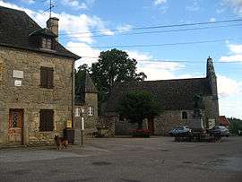
The church and surrounding buildings in Champagnac-la-Prune | ||
| ||
 Champagnac-la-Prune | ||
|
Location within Nouvelle-Aquitaine region  Champagnac-la-Prune | ||
| Coordinates: 45°11′11″N 1°57′06″E / 45.1864°N 1.9517°ECoordinates: 45°11′11″N 1°57′06″E / 45.1864°N 1.9517°E | ||
| Country | France | |
| Region | Nouvelle-Aquitaine | |
| Department | Corrèze | |
| Arrondissement | Tulle | |
| Canton | Roche-Canillac | |
| Intercommunality | Doustre et du Plateau des Étangs | |
| Government | ||
| • Mayor (2008–2014) | Jacquy Senut | |
| Area1 | 13.27 km2 (5.12 sq mi) | |
| Population (2008)2 | 168 | |
| • Density | 13/km2 (33/sq mi) | |
| Time zone | CET (UTC+1) | |
| • Summer (DST) | CEST (UTC+2) | |
| INSEE/Postal code | 19040 / 19320 | |
| Elevation |
246–546 m (807–1,791 ft) (avg. 400 m or 1,300 ft) | |
|
1 French Land Register data, which excludes lakes, ponds, glaciers > 1 km² (0.386 sq mi or 247 acres) and river estuaries. 2 Population without double counting: residents of multiple communes (e.g., students and military personnel) only counted once. | ||
.svg.png)
Champagnac-la-Prune is a commune in the Corrèze department in central France.
Population
| Historical population | ||
|---|---|---|
| Year | Pop. | ±% |
| 1962 | 275 | — |
| 1968 | 282 | +2.5% |
| 1975 | 263 | −6.7% |
| 1982 | 219 | −16.7% |
| 1990 | 167 | −23.7% |
| 1999 | 160 | −4.2% |
| 2008 | 168 | +5.0% |
See also
References
| Wikimedia Commons has media related to Champagnac-la-Prune. |
This article is issued from Wikipedia - version of the 3/15/2016. The text is available under the Creative Commons Attribution/Share Alike but additional terms may apply for the media files.