Saint-Fréjoux
| Saint-Fréjoux | ||
|---|---|---|
|
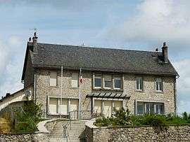
The town hall in Saint-Fréjoux | ||
| ||
 Saint-Fréjoux | ||
|
Location within Nouvelle-Aquitaine region  Saint-Fréjoux | ||
| Coordinates: 45°32′50″N 2°22′25″E / 45.5472°N 2.3736°ECoordinates: 45°32′50″N 2°22′25″E / 45.5472°N 2.3736°E | ||
| Country | France | |
| Region | Nouvelle-Aquitaine | |
| Department | Corrèze | |
| Arrondissement | Ussel | |
| Canton | Ussel-Est | |
| Government | ||
| • Mayor (2008–2014) | Paul Gratadour | |
| Area1 | 24.93 km2 (9.63 sq mi) | |
| Population (2008)2 | 275 | |
| • Density | 11/km2 (29/sq mi) | |
| Time zone | CET (UTC+1) | |
| • Summer (DST) | CEST (UTC+2) | |
| INSEE/Postal code | 19204 / 19200 | |
| Elevation |
637–829 m (2,090–2,720 ft) (avg. 695 m or 2,280 ft) | |
|
1 French Land Register data, which excludes lakes, ponds, glaciers > 1 km² (0.386 sq mi or 247 acres) and river estuaries. 2 Population without double counting: residents of multiple communes (e.g., students and military personnel) only counted once. | ||
.svg.png)
Saint-Fréjoux is a commune in the Corrèze department in central France.
Population
| Historical population | ||
|---|---|---|
| Year | Pop. | ±% |
| 1962 | 224 | — |
| 1968 | 264 | +17.9% |
| 1975 | 252 | −4.5% |
| 1982 | 253 | +0.4% |
| 1990 | 283 | +11.9% |
| 1999 | 248 | −12.4% |
| 2008 | 275 | +10.9% |
See also
References
| Wikimedia Commons has media related to Saint-Fréjoux. |
This article is issued from Wikipedia - version of the 2/26/2015. The text is available under the Creative Commons Attribution/Share Alike but additional terms may apply for the media files.