Marcillac-la-Croisille
| Marcillac-la-Croisille | ||
|---|---|---|
|
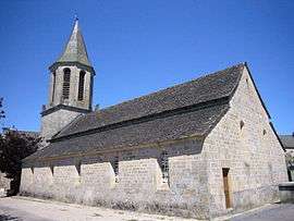
The church in Marcillac-la-Croisille | ||
| ||
 Marcillac-la-Croisille | ||
|
Location within Nouvelle-Aquitaine region  Marcillac-la-Croisille | ||
| Coordinates: 45°16′24″N 2°01′49″E / 45.2733°N 2.0303°ECoordinates: 45°16′24″N 2°01′49″E / 45.2733°N 2.0303°E | ||
| Country | France | |
| Region | Nouvelle-Aquitaine | |
| Department | Corrèze | |
| Arrondissement | Tulle | |
| Canton | Roche-Canillac | |
| Government | ||
| • Mayor (2008–2014) | Jean-Louis Bachellerie | |
| Area1 | 38.69 km2 (14.94 sq mi) | |
| Population (2008)2 | 834 | |
| • Density | 22/km2 (56/sq mi) | |
| Time zone | CET (UTC+1) | |
| • Summer (DST) | CEST (UTC+2) | |
| INSEE/Postal code | 19125 / 19320 | |
| Elevation |
247–642 m (810–2,106 ft) (avg. 530 m or 1,740 ft) | |
|
1 French Land Register data, which excludes lakes, ponds, glaciers > 1 km² (0.386 sq mi or 247 acres) and river estuaries. 2 Population without double counting: residents of multiple communes (e.g., students and military personnel) only counted once. | ||
.svg.png)
Marcillac-la-Croisille is a commune in the Corrèze department in central France.
Population
| Historical population | ||
|---|---|---|
| Year | Pop. | ±% |
| 1962 | 825 | — |
| 1968 | 907 | +9.9% |
| 1975 | 801 | −11.7% |
| 1982 | 777 | −3.0% |
| 1990 | 787 | +1.3% |
| 1999 | 779 | −1.0% |
| 2008 | 834 | +7.1% |
See also
References
| Wikimedia Commons has media related to Marcillac-la-Croisille. |
This article is issued from Wikipedia - version of the 2/11/2016. The text is available under the Creative Commons Attribution/Share Alike but additional terms may apply for the media files.