Saint-Bonnet-près-Bort
| Saint-Bonnet-près-Bort | ||
|---|---|---|
|
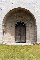
Church door | ||
| ||
 Saint-Bonnet-près-Bort | ||
|
Location within Nouvelle-Aquitaine region  Saint-Bonnet-près-Bort | ||
| Coordinates: 45°30′16″N 2°25′02″E / 45.5044°N 2.4172°ECoordinates: 45°30′16″N 2°25′02″E / 45.5044°N 2.4172°E | ||
| Country | France | |
| Region | Nouvelle-Aquitaine | |
| Department | Corrèze | |
| Arrondissement | Ussel | |
| Canton | Bort-les-Orgues | |
| Intercommunality | Plateau Bortois | |
| Government | ||
| • Mayor (2008–2014) | Bernard Chabanne | |
| Area1 | 17.14 km2 (6.62 sq mi) | |
| Population (2008)2 | 182 | |
| • Density | 11/km2 (28/sq mi) | |
| Time zone | CET (UTC+1) | |
| • Summer (DST) | CEST (UTC+2) | |
| INSEE/Postal code | 19190 / 19200 | |
| Elevation |
637–743 m (2,090–2,438 ft) (avg. 700 m or 2,300 ft) | |
|
1 French Land Register data, which excludes lakes, ponds, glaciers > 1 km² (0.386 sq mi or 247 acres) and river estuaries. 2 Population without double counting: residents of multiple communes (e.g., students and military personnel) only counted once. | ||
.svg.png)
Saint-Bonnet-près-Bort is a commune in the Corrèze department in central France.
Population
| Historical population | ||
|---|---|---|
| Year | Pop. | ±% |
| 1962 | 201 | — |
| 1968 | 202 | +0.5% |
| 1975 | 168 | −16.8% |
| 1982 | 162 | −3.6% |
| 1990 | 176 | +8.6% |
| 1999 | 165 | −6.2% |
| 2008 | 182 | +10.3% |
See also
References
| Wikimedia Commons has media related to Saint-Bonnet-près-Bort. |
This article is issued from Wikipedia - version of the 3/15/2016. The text is available under the Creative Commons Attribution/Share Alike but additional terms may apply for the media files.