Saint-Geniez-ô-Merle
| Saint-Geniez-ô-Merle | ||
|---|---|---|
|
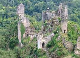
Tours de Merle | ||
| ||
 Saint-Geniez-ô-Merle | ||
|
Location within Nouvelle-Aquitaine region  Saint-Geniez-ô-Merle | ||
| Coordinates: 45°05′03″N 2°03′54″E / 45.0842°N 2.065°ECoordinates: 45°05′03″N 2°03′54″E / 45.0842°N 2.065°E | ||
| Country | France | |
| Region | Nouvelle-Aquitaine | |
| Department | Corrèze | |
| Arrondissement | Tulle | |
| Canton | Saint-Privat | |
| Government | ||
| • Mayor (2008–2014) | Yves Faur | |
| Area1 | 15.83 km2 (6.11 sq mi) | |
| Population (2008)2 | 107 | |
| • Density | 6.8/km2 (18/sq mi) | |
| Time zone | CET (UTC+1) | |
| • Summer (DST) | CEST (UTC+2) | |
| INSEE/Postal code | 19205 / 19220 | |
| Elevation |
243–563 m (797–1,847 ft) (avg. 500 m or 1,600 ft) | |
|
1 French Land Register data, which excludes lakes, ponds, glaciers > 1 km² (0.386 sq mi or 247 acres) and river estuaries. 2 Population without double counting: residents of multiple communes (e.g., students and military personnel) only counted once. | ||
.svg.png)
Saint-Geniez-ô-Merle is a commune in the Corrèze department in central France.
Geography
The Maronne river forms the commune's southern boundary.
Population
| Historical population | ||
|---|---|---|
| Year | Pop. | ±% |
| 1962 | 133 | — |
| 1968 | 187 | +40.6% |
| 1975 | 169 | −9.6% |
| 1982 | 180 | +6.5% |
| 1990 | 135 | −25.0% |
| 1999 | 116 | −14.1% |
| 2008 | 107 | −7.8% |
See also
References
| Wikimedia Commons has media related to Saint-Geniez-ô-Merle. |
This article is issued from Wikipedia - version of the 3/19/2013. The text is available under the Creative Commons Attribution/Share Alike but additional terms may apply for the media files.