Des Lacs, North Dakota
| Des Lacs, North Dakota | |
|---|---|
| City | |
|
Des Lacs, North Dakota | |
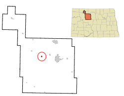 Location of Des Lacs, North Dakota | |
| Coordinates: 48°15′25″N 101°33′49″W / 48.25694°N 101.56361°WCoordinates: 48°15′25″N 101°33′49″W / 48.25694°N 101.56361°W | |
| Country | United States |
| State | North Dakota |
| County | Ward |
| Area[1] | |
| • Total | 0.56 sq mi (1.45 km2) |
| • Land | 0.53 sq mi (1.37 km2) |
| • Water | 0.03 sq mi (0.08 km2) |
| Elevation | 1,932 ft (589 m) |
| Population (2010)[2] | |
| • Total | 204 |
| • Estimate (2014)[3] | 203 |
| • Density | 384.9/sq mi (148.6/km2) |
| Time zone | Central (CST) (UTC-6) |
| • Summer (DST) | CDT (UTC-5) |
| ZIP code | 58733 |
| Area code(s) | 701 |
| FIPS code | 38-19300 |
| GNIS feature ID | 1028663[4] |
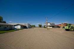
Des Lacs is a city in Ward County, North Dakota, United States. The population was 204 at the 2010 census.[5] It is part of the Minot Micropolitan Statistical Area. Des Lacs was founded in 1888, named after the Riviere de Lacs (now Des Lacs River), from the French for "River [of] The Lakes."
Geography
Des Lacs is located at 48°15′25″N 101°33′49″W / 48.256862°N 101.563599°W.[6] According to the United States Census Bureau, the city has a total area of 0.56 square miles (1.45 km2), of which, 0.53 square miles (1.37 km2) is land and 0.03 square miles (0.08 km2) is water.[1]
Demographics
| Historical population | |||
|---|---|---|---|
| Census | Pop. | %± | |
| 1920 | 188 | — | |
| 1930 | 205 | 9.0% | |
| 1940 | 197 | −3.9% | |
| 1950 | 180 | −8.6% | |
| 1960 | 185 | 2.8% | |
| 1970 | 197 | 6.5% | |
| 1980 | 212 | 7.6% | |
| 1990 | 216 | 1.9% | |
| 2000 | 209 | −3.2% | |
| 2010 | 204 | −2.4% | |
| Est. 2015 | 204 | [7] | 0.0% |
| U.S. Decennial Census[8] 2014 Estimate[3] | |||
2010 census
As of the census[2] of 2010, there were 204 people, 78 households, and 62 families residing in the city. The population density was 384.9 inhabitants per square mile (148.6/km2). There were 78 housing units at an average density of 147.2 per square mile (56.8/km2). The racial makeup of the city was 96.6% White, 2.0% Native American, and 1.5% from two or more races. Hispanic or Latino of any race were 0.5% of the population.
There were 78 households of which 32.1% had children under the age of 18 living with them, 69.2% were married couples living together, 2.6% had a female householder with no husband present, 7.7% had a male householder with no wife present, and 20.5% were non-families. 15.4% of all households were made up of individuals and 5.1% had someone living alone who was 65 years of age or older. The average household size was 2.62 and the average family size was 2.92.
The median age in the city was 40 years. 25.5% of residents were under the age of 18; 4.4% were between the ages of 18 and 24; 23.5% were from 25 to 44; 32.4% were from 45 to 64; and 14.2% were 65 years of age or older. The gender makeup of the city was 50.5% male and 49.5% female.
2000 census
As of the census of 2000, there were 209 people, 75 households, and 63 families residing in the city. The population density was 390.1 people per square mile (149.4/km2). There were 76 housing units at an average density of 141.9 per square mile (54.3/km2). The racial makeup of the city was 99.04% White, 0.48% Native American, and 0.48% from two or more races. Hispanic or Latino of any race were 0.96% of the population.
There were 75 households out of which 36.0% had children under the age of 18 living with them, 72.0% were married couples living together, 6.7% had a female householder with no husband present, and 16.0% were non-families. 14.7% of all households were made up of individuals and 6.7% had someone living alone who was 65 years of age or older. The average household size was 2.79 and the average family size was 3.06.
In the city the population was spread out with 27.3% under the age of 18, 7.7% from 18 to 24, 30.6% from 25 to 44, 24.9% from 45 to 64, and 9.6% who were 65 years of age or older. The median age was 37 years. For every 100 females there were 109.0 males. For every 100 females age 18 and over, there were 114.1 males.
The median income for a household in the city was $36,250, and the median income for a family was $36,875. Males had a median income of $22,125 versus $15,000 for females. The per capita income for the city was $12,369. About 6.2% of families and 8.4% of the population were below the poverty line, including 12.5% of those under the age of eighteen and none of those sixty five or over.
Education
Des Lacs shares its school system with Burlington. Students in grades kindergarten through eight attend school in Burlington, where the elementary school is located, while those in grades nine through twelve attend in Des Lacs. The district is known as "United Public School District 7". The Des Lacs students meet at the high school to ride their buses to school. The Burlington students meet at the elementary school to ride their buses to school. thumb|Some of the countryside surrounding Des Lacs
References
- 1 2 "US Gazetteer files 2010". United States Census Bureau. Retrieved 2012-06-14.
- 1 2 "American FactFinder". United States Census Bureau. Retrieved 2012-06-14.
- 1 2 "Population Estimates". United States Census Bureau. Retrieved June 2, 2015.
- ↑ "US Board on Geographic Names". United States Geological Survey. 2007-10-25. Retrieved 2008-01-31.
- ↑ "2010 Census Redistricting Data (Public Law 94-171) Summary File". American FactFinder. United States Census Bureau. Retrieved 2 May 2011.
- ↑ "US Gazetteer files: 2010, 2000, and 1990". United States Census Bureau. 2011-02-12. Retrieved 2011-04-23.
- ↑ "Annual Estimates of the Resident Population for Incorporated Places: April 1, 2010 to July 1, 2015". Retrieved July 2, 2016.
- ↑ United States Census Bureau. "Census of Population and Housing". Retrieved October 23, 2013.
Municipalities and communities of Ward County, North Dakota, United States | ||
|---|---|---|
| Cities | 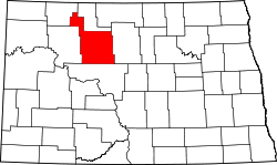 | |
| Townships |
| |
| CDPs | ||
| Unincorporated communities |
| |