Surrey, North Dakota
| Surrey, North Dakota | |
|---|---|
| City | |
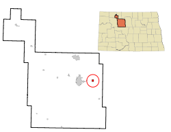 Location of Surrey, North Dakota | |
| Coordinates: 48°14′13″N 101°7′59″W / 48.23694°N 101.13306°WCoordinates: 48°14′13″N 101°7′59″W / 48.23694°N 101.13306°W | |
| Country | United States |
| State | North Dakota |
| County | Ward |
| Area[1] | |
| • Total | 0.99 sq mi (2.56 km2) |
| • Land | 0.98 sq mi (2.54 km2) |
| • Water | 0.01 sq mi (0.03 km2) |
| Elevation | 1,634 ft (498 m) |
| Population (2010)[2] | |
| • Total | 934 |
| • Estimate (2015)[3] | 1,358 |
| • Density | 953.1/sq mi (368.0/km2) |
| Time zone | Central (CST) (UTC-6) |
| • Summer (DST) | CDT (UTC-5) |
| ZIP code | 58785 |
| Area code(s) | 701 |
| FIPS code | 38-77180 |
| GNIS feature ID | 1032399[4] |
| Website | http://www.surreynd.org/ |
Surrey is a city in Ward County, North Dakota, United States. The population was 934 at the 2010 census.[5] Official incorporation of Surrey occurred in 1951. The city is part of the Minot Micropolitan Statistical Area.
History
Surrey was founded on June 18, 1900, and named after Surrey, England, by Great Northern Railway officials.[6] It was one of several sites along the Great Northern's transcontinental route between Devils Lake and Minot that were named after places in England (the others were Berwick, Leeds, Norwich, Penn, Rugby, Tunbridge, and York).
In 1910, Surrey gained notoriety as being the point where construction began on a shortening of the Great Northern transcontinental route. This construction progressed eastward and was completed in 1912.[7] The new line, which proceeded diagonally from Fargo to Surrey and reduced the distance required to travel between those two cities by 44 miles (71 km),[8] came to be popularly known as the Surrey Cutoff.[6] Both the cutoff and the original line are still in place today, with the cutoff forming a part of the BNSF Railway's northernmost transcontinental route.
Geography
Surrey is located at 48°14′13″N 101°7′59″W / 48.23694°N 101.13306°W (48.237055, -101.133035).[9] According to the United States Census Bureau, the city has a total area of 0.99 square miles (2.56 km2), of which, 0.98 square miles (2.54 km2) is land and 0.01 square miles (0.03 km2) is water.[1]
Demographics
| Historical population | |||
|---|---|---|---|
| Census | Pop. | %± | |
| 1960 | 309 | — | |
| 1970 | 361 | 16.8% | |
| 1980 | 999 | 176.7% | |
| 1990 | 856 | −14.3% | |
| 2000 | 917 | 7.1% | |
| 2010 | 934 | 1.9% | |
| Est. 2015 | 1,358 | [10] | 45.4% |
| U.S. Decennial Census[11] 2015 Estimate[3] | |||
2010 census
As of the census[2] of 2010, there were 934 people, 334 households, and 264 families residing in the city. The population density was 953.1 inhabitants per square mile (368.0/km2). There were 335 housing units at an average density of 341.8 per square mile (132.0/km2). The racial makeup of the city was 95.3% White, 0.6% African American, 1.3% Native American, 0.3% Asian, 0.2% Pacific Islander, 0.2% from other races, and 2.0% from two or more races. Hispanic or Latino of any race were 1.4% of the population.
There were 334 households of which 39.2% had children under the age of 18 living with them, 65.6% were married couples living together, 7.8% had a female householder with no husband present, 5.7% had a male householder with no wife present, and 21.0% were non-families. 16.2% of all households were made up of individuals and 3.3% had someone living alone who was 65 years of age or older. The average household size was 2.80 and the average family size was 3.09.
The median age in the city was 32.5 years. 28.2% of residents were under the age of 18; 8.2% were between the ages of 18 and 24; 29.9% were from 25 to 44; 25.8% were from 45 to 64; and 7.8% were 65 years of age or older. The gender makeup of the city was 51.2% male and 48.8% female.
2000 census
As of the census of 2000, there were 917 people, 307 households, and 260 families residing in the city. The population density was 943.1 people per square mile (365.0/km²). There were 313 housing units at an average density of 321.9 per square mile (124.6/km²). The racial makeup of the city was 97.27% White, 1.85% Native American, 0.33% Asian, and 0.55% from two or more races. Hispanic or Latino of any race were 0.87% of the population.
There were 307 households out of which 53.4% had children under the age of 18 living with them, 66.4% were married couples living together, 13.0% had a female householder with no husband present, and 15.0% were non-families. 12.4% of all households were made up of individuals and 2.6% had someone living alone who was 65 years of age or older. The average household size was 2.99 and the average family size was 3.24.
In the city the population was spread out with 34.5% under the age of 18, 6.8% from 18 to 24, 34.5% from 25 to 44, 19.3% from 45 to 64, and 5.0% who were 65 years of age or older. The median age was 32 years. For every 100 females there were 102.4 males. For every 100 females age 18 and over, there were 99.7 males.
The median income for a household in the city was $43,403, and the median income for a family was $46,250. Males had a median income of $29,688 versus $19,375 for females. The per capita income for the city was $14,679. About 5.5% of families and 5.9% of the population were below the poverty line, including 8.6% of those under age 18 and 11.8% of those age 65 or over.
Climate
This climatic region is typified by large seasonal temperature differences, with warm to hot (and often humid) summers and cold (sometimes severely cold) winters. According to the Köppen Climate Classification system, Surrey has a humid continental climate, abbreviated "Dfb" on climate maps.[12]
References
- 1 2 "US Gazetteer files 2010". United States Census Bureau. Retrieved 2012-06-14.
- 1 2 "American FactFinder". United States Census Bureau. Retrieved 2012-06-14.
- 1 2 "Population Estimates". United States Census Bureau. Retrieved June 8, 2016.
- ↑ "US Board on Geographic Names". United States Geological Survey. 2007-10-25. Retrieved 2008-01-31.
- ↑ "2010 Census Redistricting Data (Public Law 94-171) Summary File". American FactFinder. United States Census Bureau. Retrieved 2 May 2011.
- 1 2 Wick, Douglas A. "Surrey (Ward County)". North Dakota Place Names. Retrieved 7 May 2011.
- ↑ Eisenberg, Alan (2005). BNSF Railway Track Segment Listings (PDF) (9 ed.). p. 47.
Segment 34
- ↑ Eisenberg, Alan (2005). BNSF Railway Station Listings by Segments (PDF) (3 ed.). pp. 58–59,126.
Segments 33, 34, 220
- ↑ "US Gazetteer files: 2010, 2000, and 1990". United States Census Bureau. 2011-02-12. Retrieved 2011-04-23.
- ↑ "Annual Estimates of the Resident Population for Incorporated Places: April 1, 2010 to July 1, 2015". Retrieved July 2, 2016.
- ↑ United States Census Bureau. "Census of Population and Housing". Retrieved October 23, 2013.
- ↑ Climate Summary for Surrey, North Dakota
Municipalities and communities of Ward County, North Dakota, United States | ||
|---|---|---|
| Cities | 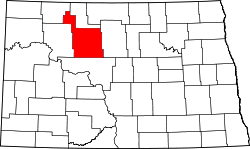 | |
| Townships |
| |
| CDPs | ||
| Unincorporated communities |
| |