Fayette County, Indiana
| Fayette County, Indiana | |
|---|---|
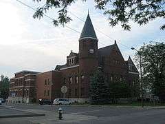 Fayette County Courthouse in Connersville | |
 Location in the U.S. state of Indiana | |
 Indiana's location in the U.S. | |
| Founded | 1819 |
| Named for | Marquis de la Fayette |
| Seat | Connersville |
| Largest city | Connersville |
| Area | |
| • Total | 215.16 sq mi (557 km2) |
| • Land | 215.01 sq mi (557 km2) |
| • Water | 0.15 sq mi (0 km2), 0.07% |
| Population | |
| • (2010) | 24,277 |
| • Density | 113/sq mi (43.61/km²) |
| Congressional district | 6th |
| Time zone | Eastern: UTC-5/-4 |
| Website | Fayette County/ Connersville Website |
| Footnotes: Indiana county number 21 | |
Fayette County is one of 92 counties in U.S. state of Indiana located in the east central portion of the state. As of 2010, the population was 24,277.[1] The county seat and only incorporated town is Connersville which holds a majority of the county's population.[2]
The county is a severely economically depressed area with high unemployment. Though the county was historically significant early in the 19th century as a conduit for settlement of the Northwest Territory, and again in the early 20th century as an automotive manufacturing center, there is little of historical, economic, cultural or political significance in the county today. The county lacks a commercial airport, rail (freight) and bus service, and has no major (U.S. or Interstate) highways.
History
Predecessor counties
At the organization of the Indiana Territory from the Northwest Territory in 1800, present day Indiana was divided between Knox county (seat Vincinnes) in the south, and Wayne county including northern Ohio (seat Detroit) north of Fort Wayne in the north. By the Ohio Enabling Act of 1802 settlers in the Whitewater valley became citizens of Indiana Territory and residents of Clark county, which had been organized from the eastern part of Knox in 1801, with the county seat at Falls of the Ohio, later called Clarksville.[3]
On Sept. 30, 1809, the United States, on behalf of the Northwest Territory and Governor William Henry Harrison, concluded the Treaty of Fort Wayne, part of whose terms included the purchase from the Indians of a strip of land locally called "The 12 Mile Purchase" enclosing the White Water Valley and comprising the largest portion of the future county. Conclusion of the Treaty essentially ended Indian occupation of the county and cleared the way for settlement.
In the territory of Indiana, Wayne and Franklin counties were carved from Dearborn (est. 1803) and Clark counties in 1811. At that time much of southeastern Indiana was divided between the two latter counties.[4]
The County
Fayette County was created by act of the Indiana General Assembly in Dec. 1818 from portions of Wayne and Franklin counties and unincorporated ("New Purchase") territory in the northern portion of the county. It was named for the Marquis de la Fayette, a French hero of the Revolutionary War.[5][6] Connersville, then a small village of less than a hundred inhabitants, was designated the county seat. The county was divided into 5 townships (Harrison, Connersville, Jennings, Columbia and Brownsville) in Feb. 1819, "Connersville" containing the namesake town. In 1821, the organization of Waterloo Township subsumed the portion of Brownsville Township remaining in Fayette County, along with a portion of Harrison Township west of the Whitewater River.
The far eastern part of Fayette lying between the Treaty of Greenville treaty line of 1795 and the present eastern boundary line of Waterloo and Jennings townships remained a part of Fayette county until it was split off into the newly created Union county in 1821. In 1826, a small part in the southeastern portion of Jackson township not included in the limits of the county in 1818, being left a part of Franklin county was attached to Fayette County.
In 1841, Connersville became the first, and remains the only, incorporated town (chartered as a city in 1869) in the county.[7]
Settlement, growth and decline
The county and its seat Connersville rose from unincorporated territory surrounding an isolated trading post on the Whitewater River to the principal conduit for settlement of northern and central Indiana, Michigan, Wisconsin and Illinois during the early 19th century, to an automotive manufacturing powerhouse in the first half of the 20th century, before declining to one of the poorest counties in Indiana and the central midwest. After early settlement, during industrial growth, the county's population concentrated in the town of Connersville.
At the time of its organization in 1819, the county had approximately 3000 residents.
Geography
According to the 2010 census, the county has a total area of 215.16 square miles (557.3 km2), of which 215.01 square miles (556.9 km2) (or 99.93%) is land and 0.15 square miles (0.39 km2) (or 0.07%) is water.[8] The county is located in the northern portion of the Whitewater River Valley running south and southeasterly from Wayne County to Cincinnati on the Ohio River. The only major waterway in the county is the West Fork of the Whitewater River running north to south through the center of the county. There is only a single tiny lake in the county, Manlove's lake in Posey Township. The county is mostly flat with low, rolling hills. The county (and all of Indiana) is part of the Eastern (U.S.) Broadleaf Forest biome dominated by deciduous trees including over 175 native species of oak. Most of the land use is farms (>80%), vacant woodland and pasture. The most common crops are corn and soybeans.
Adjacent counties
- Henry County (north)
- Wayne County (northeast)
- Union County (east)
- Franklin County (south)
- Rush County (west)
Political subdivisions
Townships
Cities and towns
Unincorporated towns
- Alquina
- Alpine
- Bentonville
- Columbia
- Everton
- Glenwood
- Falmouth
- Harrisburg
- Huber
- Longwood Crossing
- Lyonsville
- Nulltown
- Orange
- Springersville
- Tyner Crossing
- Waterloo
Transportation
The county is distant from major cities/markets. The nearest large cities are Cincinnati 58 miles to the southeast, Indianapolis 66 miles to the west, Louisville 127 miles to the south, and Columbus, Ohio 135 miles to the northeast.
Major highways
The accessible state roads are all narrow 2-lane roads subject to closure during winter snowstorms and ice-overs. The nearest major highways are U.S. 40 12 miles to the north, and Interstate 70 14 miles to the north, both in Henry and Wayne Counties.
Airport, rail and bus
There is no commercial airport, rail (freight) or bus service in the county. Amtrak passenger trains serve Connersville.
Waterways
While the Whitewater River is navigable, it's not commercially significant because it doesn't intersect any major cities, nor is it large enough to support shipping.[9]
Economy
In 2010, the county ranked 92nd out of 92 Indiana counties in median household income. Most of the economic activity is local manufacturing, retail trade and healthcare services, concentrated in Connersville. Commercial and economic development remains constrained due to lack of commercial airport, freight rail service, and major (Interstate and U.S. highway) access.
Climate and weather
| Connersville, Indiana | ||||||||||||||||||||||||||||||||||||||||||||||||||||||||||||
|---|---|---|---|---|---|---|---|---|---|---|---|---|---|---|---|---|---|---|---|---|---|---|---|---|---|---|---|---|---|---|---|---|---|---|---|---|---|---|---|---|---|---|---|---|---|---|---|---|---|---|---|---|---|---|---|---|---|---|---|---|
| Climate chart (explanation) | ||||||||||||||||||||||||||||||||||||||||||||||||||||||||||||
| ||||||||||||||||||||||||||||||||||||||||||||||||||||||||||||
| ||||||||||||||||||||||||||||||||||||||||||||||||||||||||||||
In recent years, average temperatures in Connersville have ranged from a low of 15 °F (−9 °C) in January to a high of 83 °F (28 °C) in July, although a record low of −31 °F (−35 °C) was recorded in January 1994 and a record high of 102 °F (39 °C) was recorded in July 1952. Average monthly precipitation ranged from 2.33 inches (59 mm) in February to 4.89 inches (124 mm) in May.[10]
Schools and Colleges
The county is served by the Fayette County School system including elementary, middle and high schools. There are also a few parochial elementary schools in Connersville. Both Ivy Tech Community College of Indiana and Indiana University East offer classes in Connersville
Government
The county government is a constitutional body, and is granted specific powers by the Constitution of Indiana, and by the Indiana Code.
County Council: The county council is the legislative branch of the county government and controls all the spending and revenue collection in the county. Representatives are elected from county districts. The council members serve four-year terms. They are responsible for setting salaries, the annual budget, and special spending. The council also has limited authority to impose local taxes, in the form of an income and property tax that is subject to state level approval, excise taxes, and service taxes.[11][12]
Board of Commissioners: The executive body of the county is made of a board of commissioners. The commissioners are elected county-wide, in staggered terms, and each serves a four-year term. One of the commissioners, typically the most senior, serves as president. The commissioners are charged with executing the acts legislated by the council, collecting revenue, and managing the day-to-day functions of the county government.[11][12]
Court: The county maintains a small claims court that can handle some civil cases. The judge on the court is elected to a term of four years and must be a member of the Indiana Bar Association. The judge is assisted by a constable who is also elected to a four-year term. In some cases, court decisions can be appealed to the state level circuit court.[12]
County Officials: The county has several other elected offices, including sheriff, coroner, auditor, treasurer, recorder, surveyor, and circuit court clerk. Each of these elected officers serves a term of four years and oversees a different part of county government. Members elected to county government positions are required to declare party affiliations and to be residents of the county.[12]
Fayette County is part of Indiana's 6th congressional district; Indiana Senate district 42;[13] and Indiana House of Representatives district 55.[14]
Demographics
| Historical population | |||
|---|---|---|---|
| Census | Pop. | %± | |
| 1820 | 5,950 | — | |
| 1830 | 9,112 | 53.1% | |
| 1840 | 9,837 | 8.0% | |
| 1850 | 10,217 | 3.9% | |
| 1860 | 10,225 | 0.1% | |
| 1870 | 10,476 | 2.5% | |
| 1880 | 11,394 | 8.8% | |
| 1890 | 12,630 | 10.8% | |
| 1900 | 13,495 | 6.8% | |
| 1910 | 14,415 | 6.8% | |
| 1920 | 17,142 | 18.9% | |
| 1930 | 19,243 | 12.3% | |
| 1940 | 19,411 | 0.9% | |
| 1950 | 23,391 | 20.5% | |
| 1960 | 24,454 | 4.5% | |
| 1970 | 26,216 | 7.2% | |
| 1980 | 28,272 | 7.8% | |
| 1990 | 26,015 | −8.0% | |
| 2000 | 25,588 | −1.6% | |
| 2010 | 24,277 | −5.1% | |
| Est. 2015 | 23,434 | [15] | −3.5% |
| U.S. Decennial Census[16] 1790-1960[17] 1900-1990[18] 1990-2000[19] 2010-2013[1] | |||
2010 Census Data
As of the 2010 United States Census, there were 24,277 people, 9,719 households, and 6,669 families residing in the county.[20] The population density was 112.9 inhabitants per square mile (43.6/km2). There were 10,898 housing units at an average density of 50.7 per square mile (19.6/km2).[8] The racial makeup of the county was 96.9% white, 1.3% black or African American, 0.3% Asian, 0.1% American Indian, 0.3% from other races, and 1.0% from two or more races. Those of Hispanic or Latino origin made up 0.9% of the population.[20] In terms of ancestry, 20.4% were German, 15.2% were American, 11.8% were Irish, and 8.2% were English.[21]
Of the 9,719 households, 31.9% had children under the age of 18 living with them, 50.6% were married couples living together, 12.4% had a female householder with no husband present, 31.4% were non-families, and 26.6% of all households were made up of individuals. The average household size was 2.46 and the average family size was 2.93. The median age was 40.8 years.[20]
The median income for a household in the county was $47,697 and the median income for a family was $46,601. Males had a median income of $41,211 versus $29,388 for females. The per capita income for the county was $18,928. About 11.9% of families and 19.4% of the population were below the poverty line, including 26.0% of those under age 18 and 9.9% of those age 65 or over.[22]
2000 Census Data
As of the census[23] of 2000, there were 25,588 people, 10,199 households, and 7,149 families residing in the county. The population density was 119 people per square mile (46/km²). There were 10,981 housing units at an average density of 51 per square mile (20/km²). The racial makeup of the county was 97.16% White, 1.67% Black or African American, 0.09% Native American, 0.27% Asian, 0.02% Pacific Islander, 0.13% from other races, and 0.66% from two or more races. 0.52% of the population were Hispanic or Latino of any race. 39.2% were of American, 18.9% German, 10.6% English and 9.7% Irish ancestry according to Census 2000.
There were 10,199 households out of which 30.80% had children under the age of 18 living with them, 55.60% were married couples living together, 10.20% had a female householder with no husband present, and 29.90% were non-families. 25.80% of all households were made up of individuals and 12.30% had someone living alone who was 65 years of age or older. The average household size was 2.46 and the average family size was 2.94.
In the county the population was spread out with 24.30% under the age of 18, 8.60% from 18 to 24, 27.10% from 25 to 44, 24.50% from 45 to 64, and 15.50% who were 65 years of age or older. The median age was 38 years. For every 100 females there were 94.00 males. For every 100 females age 18 and over, there were 90.70 males.
The median income for a household in the county was $38,840, and the median income for a family was $46,111. Males had a median income of $34,493 versus $23,082 for females. The per capita income for the county was $18,624. About 6.00% of families and 7.90% of the population were below the poverty line, including 8.40% of those under age 18 and 7.70% of those age 65 or over.
Notable people
- Howard Garns, born in Connersville in 1905 and known as the inventor of Number Place, which would become later known as Sudoku.
- William Grose, Civil War general and Indiana State Senator grew up here.
- George Washington Steele, First Governor of Oklahoma Territory.[24]
- Robert Wise, president of the Directors Guild of America from 1971 to 1975 and the president of the Academy of Motion Picture Arts and Sciences from 1984 through 1987.
See also
- McFarlan Automobile
- National Register of Historic Places listings in Fayette County, Indiana
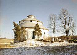
- Thomas Ranck Round Barn
- Edward E. Moore, Indiana state senator and Los Angeles City Council member
Further reading
- History of Fayette County, Indiana, Warner, Beers & Co. 1885
References
- 1 2 "Fayette County QuickFacts". United States Census Bureau. Retrieved 2011-09-17.
- ↑ "Find a County". National Association of Counties. Archived from the original on May 10, 2015. Retrieved 2011-06-07.
- ↑ Barrows, Frederick (1917). History of Fayette County. Bowen & Co. pp. 42–43.
- ↑ Barrows, Frederick (1917). History of Fayette County. Bowen & Co. p. 56.
- ↑ De Witt Clinton Goodrich & Charles Richard Tuttle (1875). An Illustrated History of the State of Indiana. Indiana: R. S. Peale & co. p. 557.
- ↑ Gannett, Henry (1905). The Origin of Certain Place Names in the United States. Govt. Print. Off. p. 124.
- ↑ Connersville Charter, Ind. Local Laws, Indiana General Assembly, 25th Session, 1840-1 p.171-177
- 1 2 "Population, Housing Units, Area, and Density: 2010 - County". United States Census Bureau. Retrieved 2015-07-10.
- ↑ http://www.in.gov/dnr/outdoor/4473.htm
- 1 2 "Monthly Averages for Connersville, Indiana". The Weather Channel. Retrieved 2011-01-27.
- 1 2 Indiana Code. "Title 36, Article 2, Section 3". IN.gov. Retrieved 2008-09-16.
- 1 2 3 4 Indiana Code. "Title 2, Article 10, Section 2" (PDF). IN.gov. Retrieved 2008-09-16.
- ↑ "Indiana Senate Districts". State of Indiana. Retrieved 2011-01-23.
- ↑ "Indiana House Districts". State of Indiana. Retrieved 2011-01-23.
- ↑ "County Totals Dataset: Population, Population Change and Estimated Components of Population Change: April 1, 2010 to July 1, 2015". Retrieved July 2, 2016.
- ↑ "U.S. Decennial Census". United States Census Bureau. Archived from the original on May 11, 2015. Retrieved July 10, 2014.
- ↑ "Historical Census Browser". University of Virginia Library. Retrieved July 10, 2014.
- ↑ "Population of Counties by Decennial Census: 1900 to 1990". United States Census Bureau. Retrieved July 10, 2014.
- ↑ "Census 2000 PHC-T-4. Ranking Tables for Counties: 1990 and 2000" (PDF). United States Census Bureau. Retrieved July 10, 2014.
- 1 2 3 "DP-1 Profile of General Population and Housing Characteristics: 2010 Demographic Profile Data". United States Census Bureau. Retrieved 2015-07-10.
- ↑ "DP02 SELECTED SOCIAL CHARACTERISTICS IN THE UNITED STATES – 2006-2010 American Community Survey 5-Year Estimates". United States Census Bureau. Retrieved 2015-07-10.
- ↑ "DP03 SELECTED ECONOMIC CHARACTERISTICS – 2006-2010 American Community Survey 5-Year Estimates". United States Census Bureau. Retrieved 2015-07-10.
- ↑ "American FactFinder". United States Census Bureau. Retrieved 2008-01-31.
- ↑ "George Washington Steele". Ancestry.com. Retrieved October 10, 2012.
 |
Henry County | Wayne County | | |
| Rush County | |
Union County | ||
| ||||
| | ||||
| Franklin County |
Municipalities and communities of Fayette County, Indiana, United States | ||
|---|---|---|
| City | ||
| Town | ||
| Townships | ||
| Unincorporated communities | ||
| Footnotes | ‡This populated place also has portions in an adjacent county or counties | |

Coordinates: 39°38′N 85°11′W / 39.64°N 85.18°W