Greenwood, Indiana
| City of Greenwood, Indiana | |
|---|---|
| City | |
|
The Commercial Historic District | |
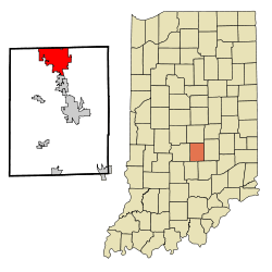 Location in the state of Indiana | |
| Coordinates: 39°36′41″N 86°07′05″W / 39.61139°N 86.11806°WCoordinates: 39°36′41″N 86°07′05″W / 39.61139°N 86.11806°W | |
| Country | United States |
| State | Indiana |
| County | Johnson |
| Government | |
| • Mayor | Mark W. Myers (R) |
| Area[1] | |
| • Total | 21.23 sq mi (54.99 km2) |
| • Land | 21.23 sq mi (54.99 km2) |
| • Water | 0 sq mi (0 km2) |
| Elevation | 804 ft (245 m) |
| Population (2010)[2] | |
| • Total | 49,791 |
| • Estimate (2014[3]) | 54,491 |
| • Density | 2,345.3/sq mi (905.5/km2) |
| Time zone | EST (UTC-5) |
| • Summer (DST) | EDT (UTC-4) |
| ZIP codes | 46142-46143 |
| Area code(s) | 317 |
| FIPS code | 18-29898[4] |
| GNIS feature ID | 0435464[5] |
| Website | www.greenwood.in.gov |
Greenwood is a city in Johnson County, Indiana, United States. The population was 49,791 at the 2010 Census, and increased to 55,586 in the Census 2015 estimates.[6] Greenwood is located between Indiana State Road 37 and Interstate 65. The city shares a border with Indianapolis and is the most populous suburb in the southern portion of the Indianapolis Metropolitan Area.
History
Early history and founding
The first inhabitants of the area currently known as Greenwood were the Delaware Indians (Lenape). In 1818, the Treaty of St. Mary's opened central Indiana to European American settlement, and by 1823 the first cabin in northern Johnson County was erected by settlers John B. and Isaac Smock on land currently occupied by Greenwood Park Mall.[7] Greenwood was first known as "Smocktown" or "Smock's Settlement" in honor of the Smock brothers, and became "Greenfield" in 1825. Since this clashed with another Greenfield located in Hancock County, the name of the settlement was changed to Greenwood. Some claim the town's name was in honor of Samuel Greenwood, who platted the community in 1872.
J.T. Polk Canning Company
The Polk Canning Company was essential to Greenwood's early growth. The cannery was a major employer and canned a variety of vegetables grown in Indiana. Later, the company expanded into the dairy market and provided milk delivery to customers. At one point the cannery was the largest canning operation west of Baltimore.[8] The cannery was eventually purchased by the Stokely-Van Camp company and retained operations in Greenwood until the 1950s. Portions of the cannery are still standing on Main Street and have been repurposed for professional office space.[9]
Indianapolis Interurban
Greenwood was an early and key cog in the Electric Indianapolis Interurban Railway System. In 1895, Henry L. Smith proposed and organized the Indianapolis, Greenwood & Franklin Company and graded the line to Greenwood. The Indianapolis, Greenwood & Franklin Railway was opened between Indianapolis and Greenwood on January 1, 1900 and, according to Indianapolis historian Jacob Piatt Dunn, was the Hoosier capital's first real interurban electric railway.[10] The railway followed what is now Madison Avenue.
Incorporation
Greenwood was incorporated as a town under Indiana law in 1864[11] and became a fifth-class city in 1960.[12] In 2010, the Greenwood City Council approved a measure to change the official status of Greenwood to second class city in accordance with Indiana Code Title 36, Article 4, Chapter 1.[13]
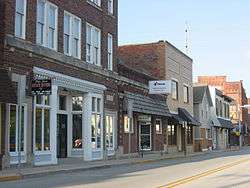
Historic District
Greenwood Commercial Historic District was listed on the National Register of Historic Places in 1991. This district encompasses 25 buildings and 32 acres (13 hectares).[14]
Geography and transportation
According to the 2010 census, Greenwood has a total area of 21.231 square miles (54.99 km2), of which 21.23 square miles (54.99 km2) (or 100%) is land and 0.001 square miles (0.00 km2) (or 0%) is water.[1]
Bodies of water
There are no navigable bodies of water within city limits. However, the White River and its tributaries sit just outside the western boundaries of Greenwood. Several creeks run through the area and influence local drainage patterns, topography, and storm water management systems. Pleasant Run Creek flows from east to west across the northern half of the county. Several municipal parks occupy the lowlands next to the creek. Grassy Creek and Tracy Ditch flow south from the city connecting Greenwood to the towns of New Whiteland, Whiteland, and Franklin. Honey Creek originates in the southwest section of the city and after flowing through White River Township eventually joins with the White River near the intersection of Smith Valley Road and U.S. 37.[15]
Transportation
According to Greenwood's most recent Comprehensive Annual Financial Report, there were 209.6 miles of public streets within the city limits as of 2015[16]
Major east-west corrirodors in Greenwood are not numbered and include: County Line Road, Fry Road, Main Street, Smith Valley Road, Stop 18 Road, and Worthsville Road. Greenwood's system of east-west streets link residents and businesses in White River Township with the business and neighborhoods adjacent to Interstate 65.
Most major north-south corridors in Greenwood are numbered and are not property of the city. U.S. 31, State Road 135, and Interstate 65 serve as the major north-south corridors in the city. The city does own and maintain three secondary corridors east of U.S. 31. Madison Avenue connects the Greenwood Park Mall to the Old Town Historic District. Emerson Avenue serves as a major commercial and business corridor and connects St. Francis Hospital in Indianapolis to Smith Valley Road. Graham Road, located east of Interstate 65 connects County Line Road to Worthsville Road and serves several large distribution centers.
Interstate access
As of 2015, three interstate exits connected Greenwood to Interstate 65. The most recent interchange, the Worthsville Road Exit, features a diverging diamond traffic design, The diverging diamond at Worthsville Road is one of two such installations in Indiana.[17] The remaining two interchanges, Main Street and County Line Road, follow conventional design standards and serve major commercial and industrial zones.
Airport
- KHFY – Greenwood Municipal Airport
Demographics
| Historical population | |||
|---|---|---|---|
| Census | Pop. | %± | |
| 1880 | 448 | — | |
| 1890 | 862 | 92.4% | |
| 1900 | 1,503 | 74.4% | |
| 1910 | 1,608 | 7.0% | |
| 1920 | 1,907 | 18.6% | |
| 1930 | 2,377 | 24.6% | |
| 1940 | 2,499 | 5.1% | |
| 1950 | 3,066 | 22.7% | |
| 1960 | 7,169 | 133.8% | |
| 1970 | 11,869 | 65.6% | |
| 1980 | 19,327 | 62.8% | |
| 1990 | 26,265 | 35.9% | |
| 2000 | 36,037 | 37.2% | |
| 2010 | 49,791 | 38.2% | |
| Est. 2015 | 55,586 | [18] | 11.6% |
2010 Census
As of the census[2] of 2010, there were 49,791 people, 19,615 households, and 12,845 families residing in the city. The population density was 2,345.3 inhabitants per square mile (905.5/km2). There were 21,339 housing units at an average density of 1,005.1 per square mile (388.1/km2). The racial makeup of the city was 91.1% White, 1.7% African American, 0.3% Native American, 3.7% Asian, 0.1% Pacific Islander, 2.1% from other races, and 2.1% from two or more races. Hispanic or Latino of any race were 4.0% of the population.
There were 19,615 households of which 35.7% had children under the age of 18 living with them, 49.2% were married couples living together, 11.6% had a female householder with no husband present, 4.8% had a male householder with no wife present, and 34.5% were non-families. 27.8% of all households were made up of individuals and 8.9% had someone living alone who was 65 years of age or older. The average household size was 2.51 and the average family size was 3.09.
The median age in the city was 34 years. 26.6% of residents were under the age of 18; 9% were between the ages of 18 and 24; 29.8% were from 25 to 44; 23.1% were from 45 to 64; and 11.6% were 65 years of age or older. The gender makeup of the city was 48.4% male and 51.6% female.
2000 Census
As of the census[4] of 2000, there were 36,037 people, 14,931 households, and 9,600 families residing in the city. The population density was 2,524.8 people per square mile (975.0/km²). There were 16,042 housing units at an average density of 1,123.9 per square mile (434.0/km²). The racial makeup of the city was 96.54% White, 0.44% African American, 0.19% Native American, 1.36% Asian, 0.04% Pacific Islander, 0.69% from other races, and 0.74% from two or more races. Hispanic or Latino of any race were 1.91% of the population.
There were 14,931 households out of which 32.4% had children under the age of 18 living with them, 51.0% were married couples living together, 9.9% had a female householder with no husband present, and 35.7% were non-families. 29.9% of all households were made up of individuals and 9.9% had someone living alone who was 65 years of age or older. The average household size was 2.37 and the average family size was 2.97.
In the city the population was spread out with 25.3% under the age of 18, 9.6% from 18 to 24, 32.1% from 25 to 44, 20.7% from 45 to 64, and 12.3% who were 65 years of age or older. The median age was 34 years. For every 100 females there were 91.9 males. For every 100 females age 18 and over, there were 87.6 males.
The median income for a household in the city was $46,176, and the median income for a family was $57,298. Males had a median income of $40,291 versus $28,936 for females. The per capita income for the city was $23,003. About 4.6% of families and 7.0% of the population were below the poverty line, including 8.5% of those under age 18 and 9.4% of those age 65 or over
Economic environment
Indianapolis suburb
As a bedroom community for Indianapolis, Greenwood is a popular destination for families seeking homes in the Central Indiana Region. In 2013, Greenwood ranked fifth in a list of the top ten most affordable suburbs in the U.S. by real estate blog Movoto.com. In 2014, Johnson County was one of eight counties across the country profiled by CNN Money in their "Where the Middle Class Thrives" series.[20]
Large employers
Greenwood is home to the U.S. headquarters of Endress+Hauser, a Swiss company that specializes in process automation and instrumentation products. The city is also home to Indiana American Water, a publicly traded utility that serves about 1.2 million Hoosiers in 126 communities. Other major employers in Greenwood include the corporate headquarters for machine tools manufacturer Nachi America and metal fabrication firm Poynter Sheet Metal. Greenwood is also home to distribution centers for Ulta, ALDI, United Natural Foods, and Nestle Waters North America; and a medical services complex for Ortho Indy.
Greenwood Park Mall, the only regional shopping mall in the southern part of the Indianapolis Metropolitan Area, is located at the confluence of US Highway 31, Madison Avenue, and County Line Road in Greenwood.[21] As of 2016, the center was home to 148 tenants and had a 98% occupancy rate.[22] Anchor stores at the mall include: J. C. Penney, Von Maur, Macy's, and Sears.[23]
Craft breweries
Three craft breweries are located within Greenwood. Oaken Barrel Brewing Co. has called Greenwood home since its opening in 1994. Oaken Barrel is the second oldest brewpub in the State[24] Planetary Brewing establshed a production center and tasting room for Greenwood customers in 2013[25] The city is also home to Mashcraft Brewing Company. Mashcraft operates a taproom on State Road 135.[26]
Education
Educational attainment
91.1% of Greenwood residents are high school graduates or higher. 26.1% of residents have attained a bachelor's degree or higher.[27]
Public schools
Three public school corporations serve Greenwood residents:[28] Greenwood Community School Corporation,[29] Clark Pleasant Community School Corporation,[30] and Center Grove Community School Corporation.[31]
Greenwood Community School Corporation
High School: Greenwood Community High School
Middle School: Greenwood Community Middle School
Elementary Schools:
- Southwest Elementary School
- Northeast Elementary School
- V.O. Isom Elementary School
- Westwood Elementary School
Center Grove Community School Corporation
High School: Center Grove High School
Middle Schools:
- Center Grove Middle School Central
- Center Grove Middle School North
Elementary Schools:
- Center Grove Elementary School
- North Grove Elementary School
- Pleasant Grove Elementary School
- Sugar Grove Elementary School
- Maple Grove Elementary School
Private schools
- Our Lady of Greenwood – Preschool – 8th grade[32]
- St. Francis and Clare Catholic School – Preschool – 8th grade[33]
- Greenwood Christian Academy – K-12[34]
- Suburban Christian School – Preschool – 12th grade[35]
City parks

City Center Park
Located at 415 Lincoln Street, City Center Park sits on 5 acres just east of the City Center Building. City Center Park was formerly known as Pool Park. After redevelopment in 2013, the park was renamed after its proximity to the Greenwood City Center Building.[36] The park contains the only splash pad in Greenwood. City Center Park also features handicap accessible playgrounds, a basketball court, and a shelter.[37]
Community Garden
The Greenwood Community Garden is located on the north side of Fry Road. For a fee, residents can rent a 20 x 20-foot plot to grow plants, flowers, fruits, and vegetables.[38]
Craig Park
Located at 10 East Smith Valley Road, Craig Park is the largest park in Old Town Greenwood. The park spans 27 acres and is located between Smith Valley Road and Main Street. Craig Park has two shelters and one gazebo. Major amenities include playgrounds, tennis courts, pathways, and three nature themed play pockets. Craig Park is home to WAMM Fest and Freedom Festival.[39]
Freedom Park
Located at 850 West Stop 18 Road, Freedom Park covers 79 acres and offers multiple amenities to patrons. Freedom Park is the largest park in Greenwood. Key attractions include: soccer fields, football fields, tennis courts, basketball courts, walking trails, a sledding hill, playgrounds, and Freedom Springs Aquatic Center.[40]
Northeast Park
Located at 100 Crestview Drive, Northeast Park covers 19 acres and sits adjacent to Northeast Elementary School. Key attractions include: soccer fields, a softball diamond, a basketball court, two picnic shelters, and the only skateboarding park in the city.[41]
Old City Park
Located at 304 South Meridian Street, Old City Park follows Pleasant Creek from Meridian Street to Madison Avenue. The park spans 5 acres. Major amenities include a playground, a football field, and a shelter.[42] The Greenwood Public Library is directly south of the park and overlooks the football field.
University Park
Located at 200 Legacy Blvd., University Park covers 40 acres of land on the eastside of the city. University Park is interegrated into the design of Homecoming at University Park- a large residential development east of Interstate 65. Major features of the park include: a picnic shelter, a playground, a basketball court, walking trails, Four Paws Dog park, and Reflections Plaza Pavilion.[43]
Westside Park
Located at 820 West Main Street, Westside Park covers 27 acres of land. Pleasant Run Creek runs through the park and is the defining feature of the landscape. Other major features include:a softball diamond, a picnic shelter, tennis courts, playgrounds, and walking trails.[44]
See also
References
- 1 2 "G001 – Geographic Identifiers – 2010 Census Summary File 1". United States Census Bureau. Retrieved 2015-07-28.
- 1 2 "American FactFinder". United States Census Bureau. Retrieved 2012-12-11.
- ↑ "Annual Estimates of the Resident Population for Incorporated Places: April 1, 2010 to July 1, 2014". Retrieved June 4, 2015.
- 1 2 "American FactFinder". United States Census Bureau. Retrieved 2008-01-31.
- ↑ "US Board on Geographic Names". United States Geological Survey. October 25, 2007. Retrieved 2008-01-31.
- ↑ "Population estimates, July 1, 2015, (V2015)". www.census.gov. Retrieved 2016-07-15.
- ↑ "Story Map Tour". Retrieved 2016-10-24.
- ↑ "Story Map Tour". Retrieved 2016-10-24.
- ↑ "Greenwood". The Polis Center. Indiana University Purdue University Indianapolis. Retrieved September 8, 2016.
- ↑ "The Economic and Social Impact of the Electric Interurban Railways on Indianapolis: A Sketch for a Portrait" (PDF). www.indianahistory.org.
- ↑ Branigin, Elba L. (1913). History of Johnson County, Indiana. B. F. Bowen & Company. p. 531.
- ↑ "GREATER SOUTHEAST". http://www.polis.iupui.edu/. IUPUI. Retrieved January 27, 2015. External link in
|website=(help) - ↑ "Growing central Indiana suburbs mull class status". www.ibj.com. Retrieved 2016-08-03.
- ↑ National Park Service (2010-07-09). "National Register Information System". National Register of Historic Places. National Park Service.
- ↑ "Greenwood City Maps". City of Greenwood.
- ↑ "2015 Comprehensive Annual Financial Report" (PDF). City of Greenwood.
- ↑ "Diverging diamond interchange in Greenwood is only the second in Indiana". Retrieved 2016-08-05.
- ↑ "Annual Estimates of the Resident Population for Incorporated Places: April 1, 2010 to July 1, 2015". Retrieved July 2, 2016.
- ↑ "Census of Population and Housing". Census.gov. Retrieved June 4, 2015.
- ↑ Hargreaves, Steve. "Where the middle class thrives". Retrieved 2016-07-15.
- ↑ "Greenwood Park Mall Leasing Fact Sheet" (PDF). Retrieved 2016-07-30.
- ↑ Trares, Ryan. "Varied options key to shopping centers' success". Daily Journal. Retrieved 2016-08-10.
- ↑ Reserved., Simon Property Group, L.P. and/or Its Affiliates (NYSE: SPG), © Copyright 1999–2016. All Rights. "Mall Map of Greenwood Park Mall, a Simon Mall – Greenwood, IN". www.simon.com. Retrieved 2016-08-10.
- ↑ Brown, Alex. "Expansion Brewing in Greenwood". Retrieved 2016-08-03.
- ↑ "About". Planetary Brewing Co. Retrieved 2016-08-03.
- ↑ "MashCraft Brewing Company in Greenwood, In". MashCraft Brewing Company. Retrieved 2016-08-03.
- ↑ "High school graduate or higher, percent of persons age 25 years+, 2010–2014". www.census.gov. Retrieved 2016-07-15.
- ↑ "SCHOOL DISTRICT REFERENCE MAP (2010 CENSUS): Johnson County, IN." U.S. Census Bureau. Retrieved on December 5, 2016.
- ↑ Administrator. "Home". gws.k12.in.us. Retrieved January 27, 2015.
- ↑ "Clark-Pleasant Community School Corporation". www.cpcsc.k12.in.us. Retrieved 2016-07-05.
- ↑ "Center Grove Community School Corporation / Overview". centergrove.k12.in.us. Retrieved January 27, 2015.
- ↑ "Our Lady of the Greenwood Catholic School". ol-g.org. Retrieved January 27, 2015.
- ↑ "Saints Francis: Home". ssfcschool.org. Retrieved January 27, 2015.
- ↑ "Greenwood Christian Academy". gcak12.org. Retrieved January 27, 2015.
- ↑ "Suburban Christian School". suburbanbaptist.org. Retrieved January 27, 2015.
- ↑ "Greenwood's new splash pad opens Monday". Fox 59. August 26, 2013. Retrieved 2016-08-17.
- ↑ "Locations / City Center Park / Greenwood, IN". www.greenwood.in.gov. Retrieved 2016-07-15.
- ↑ "Community Garden / Greenwood, IN". www.greenwood.in.gov. Retrieved 2016-08-02.
- ↑ "Locations / Craig Park / Greenwood, IN". www.greenwood.in.gov. Retrieved 2016-07-15.
- ↑ "Locations / Freedom Park / Greenwood, IN". www.greenwood.in.gov. Retrieved 2016-08-02.
- ↑ "Locations / Northeast Park / Greenwood, IN". www.greenwood.in.gov. Retrieved 2016-08-08.
- ↑ "Locations / Old City Park / Greenwood, IN". www.greenwood.in.gov. Retrieved 2016-07-15.
- ↑ "Locations / University Park / Greenwood, IN". www.greenwood.in.gov. Retrieved 2016-08-02.
- ↑ "Locations / Westside Park / Greenwood, IN". www.greenwood.in.gov. Retrieved 2016-09-16.
External links
| Wikimedia Commons has media related to Greenwood, Indiana. |
-
 Greenwood, Indiana travel guide from Wikivoyage
 - City website
Municipalities and communities of Johnson County, Indiana, United States | ||
|---|---|---|
| Cities | ||
| Towns | ||
| Townships | ||
| Unincorporated communities |
| |
| Footnotes | ‡This populated place also has portions in an adjacent county or counties | |