Cass County, Indiana
| Cass County, Indiana | |
|---|---|
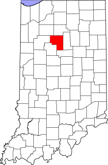 Location in the U.S. state of Indiana | |
 Indiana's location in the U.S. | |
| Founded | 1829 |
| Named for | Lewis Cass |
| Seat | Logansport |
| Largest city | Logansport |
| Area | |
| • Total | 414.85 sq mi (1,074 km2) |
| • Land | 412.16 sq mi (1,067 km2) |
| • Water | 2.69 sq mi (7 km2), 0.65% |
| Population | |
| • (2010) | 38,966 |
| • Density | 94/sq mi (36.44/km²) |
| Congressional district | 4th |
| Time zone | Eastern: UTC-5/-4 |
| Website |
www |
| Footnotes: Indiana county number 9 | |
Cass County is a county located in the U.S. state of Indiana. As of 2010, its population was 38,966.[1] The county seat is Logansport.[2] Cass County comprises the Logansport, IN Micropolitan Statistical Area.[3]
History
Cass County was formed in 1828.[4] It is named for Gen. Lewis Cass, 2nd Territorial Governor of Michigan and afterward U.S. Secretary of War.[5]
Geography
According to the 2010 census, the county has a total area of 414.85 square miles (1,074.5 km2) of which 412.16 square miles (1,067.5 km2) (or 99.35%) is land and 2.69 square miles (7.0 km2) (or 0.65%) is water.[6] The Wabash River flows through the county, mostly from east to west, and is joined by the Eel River in Logansport.
Adjacent counties
- Fulton County (north)
- Miami County (east)
- Howard County (south)
- Carroll County (southwest)
- White County (west)
- Pulaski County (northwest)
Cities and towns
Unincorporated towns
Extinct towns
- Circleville
- Taberville (absorbed into Logansport)
Townships
Major highways
 U.S. Route 24
 U.S. Route 35
 Indiana State Road 16
 Indiana State Road 17
 Indiana State Road 25
 Indiana State Road 29
Railroads
- Norfolk Southern Railway
- Winamac Southern Railroad
- Logansport and Eel River Shortline Company
- Toledo, Peoria and Western Railway
Climate and weather
| Logansport, Indiana | ||||||||||||||||||||||||||||||||||||||||||||||||||||||||||||
|---|---|---|---|---|---|---|---|---|---|---|---|---|---|---|---|---|---|---|---|---|---|---|---|---|---|---|---|---|---|---|---|---|---|---|---|---|---|---|---|---|---|---|---|---|---|---|---|---|---|---|---|---|---|---|---|---|---|---|---|---|
| Climate chart (explanation) | ||||||||||||||||||||||||||||||||||||||||||||||||||||||||||||
| ||||||||||||||||||||||||||||||||||||||||||||||||||||||||||||
| ||||||||||||||||||||||||||||||||||||||||||||||||||||||||||||
In recent years, average temperatures in Logansport have ranged from a low of 14 °F (−10 °C) in January to a high of 85 °F (29 °C) in July, although a record low of −24 °F (−31 °C) was recorded in January 1985 and a record high of 104 °F (40 °C) was recorded in June 1988. Average monthly precipitation ranged from 1.53 inches (39 mm) in February to 3.89 inches (99 mm) in June.[7]
Government
The county government is a constitutional body, and is granted specific powers by the Constitution of Indiana, and by the Indiana Code.
County Council: The county council is the legislative branch of the county government and controls all the spending and revenue collection in the county. Representatives are elected from county districts. The council members serve four-year terms. They are responsible for setting salaries, the annual budget, and special spending. The council also has limited authority to impose local taxes, in the form of an income and property tax that is subject to state level approval, excise taxes, and service taxes.[8][9]
Board of Commissioners: The executive body of the county is made of a board of commissioners. The commissioners are elected county-wide, in staggered terms, and each serves a four-year term. One of the commissioners, typically the most senior, serves as president. The commissioners are charged with executing the acts legislated by the council, collecting revenue, and managing the day-to-day functions of the county government.[8][9]
Court: The county maintains a small claims court that can handle some civil cases. The judge on the court is elected to a term of four years and must be a member of the Indiana Bar Association. The judge is assisted by a constable who is also elected to a four-year term. In some cases, court decisions can be appealed to the state level circuit court.[9]
County Officials: The county has several other elected offices, including sheriff, coroner, auditor, treasurer, recorder, surveyor, and circuit court clerk. Each of these elected officers serves a term of four years and oversees a different part of county government. Members elected to county government positions are required to declare a party affiliation and to be residents of the county.[9]
Cass County is part of Indiana's 2nd congressional district and in 2008 was represented by Joe Donnelly in the United States Congress.[10] It is also part of Indiana Senate district 18[11] and Indiana House of Representatives districts 16 and 24.[12]
Demographics
| Historical population | |||
|---|---|---|---|
| Census | Pop. | %± | |
| 1830 | 1,162 | — | |
| 1840 | 5,480 | 371.6% | |
| 1850 | 11,021 | 101.1% | |
| 1860 | 16,843 | 52.8% | |
| 1870 | 24,193 | 43.6% | |
| 1880 | 27,611 | 14.1% | |
| 1890 | 31,152 | 12.8% | |
| 1900 | 34,545 | 10.9% | |
| 1910 | 36,368 | 5.3% | |
| 1920 | 38,333 | 5.4% | |
| 1930 | 34,518 | −10.0% | |
| 1940 | 36,908 | 6.9% | |
| 1950 | 38,793 | 5.1% | |
| 1960 | 40,931 | 5.5% | |
| 1970 | 40,456 | −1.2% | |
| 1980 | 40,936 | 1.2% | |
| 1990 | 38,413 | −6.2% | |
| 2000 | 40,930 | 6.6% | |
| 2010 | 38,966 | −4.8% | |
| Est. 2015 | 37,979 | [13] | −2.5% |
| U.S. Decennial Census[14] 1790-1960[15] 1900-1990[16] 1990-2000[17] 2010-2013[1] | |||
As of the 2010 United States Census, there were 38,966 people, 14,858 households, and 10,144 families residing in the county.[18] The population density was 94.5 inhabitants per square mile (36.5/km2). There were 16,474 housing units at an average density of 40.0 per square mile (15.4/km2).[6] The racial makeup of the county was 88.2% white, 1.5% black or African American, 1.1% Asian, 0.5% American Indian, 0.1% Pacific islander, 7.0% from other races, and 1.6% from two or more races. Those of Hispanic or Latino origin made up 12.6% of the population.[18] In terms of ancestry, 24.0% were German, 15.0% were American, 11.8% were Irish, and 9.0% were English.[19]
Of the 14,858 households, 33.3% had children under the age of 18 living with them, 51.8% were married couples living together, 11.3% had a female householder with no husband present, 31.7% were non-families, and 27.3% of all households were made up of individuals. The average household size was 2.55 and the average family size was 3.08. The median age was 38.7 years.[18]
The median income for a household in the county was $47,697 and the median income for a family was $49,873. Males had a median income of $37,823 versus $26,938 for females. The per capita income for the county was $20,562. About 9.8% of families and 14.0% of the population were below the poverty line, including 18.7% of those under age 18 and 8.0% of those age 65 or over.[20]
Notable people
- Rollie Zeider (1883–1967), major league baseball player, 1910–1918, played for Chicago White Sox, New York Yankees, Chicago Chi-Feds, Chicago Whales and Chicago Cubs. He was born near the unincorporated town of Hoover in Cass County.
- Actor Greg Kinnear was born in Logansport.
Education
Public schools in Cass County are administered by the Logansport Community School Corporation, the Pioneer Regional School Corporation and the Southeastern School Corporation.
High Schools and Middle Schools
- Columbia Middle School
- Lewis Cass High School
- Lincoln Middle School
- Logansport High School
- Pioneer Junior – Senior High School
Elementary Schools
- Columbia Elementary School
- Fairview Elementary School
- Franklin Elementary School
- Galveston Elementary School
- Landis Elementary School
- Pioneer Elementary School
- Thompson Elementary School
See also
- List of public art in Cass County, Indiana
- National Register of Historic Places listings in Cass County, Indiana
Further reading
- Powell, Jehu Z. History of Cass County Indiana: From its earliest settlement to the present time : with biographical sketches and reference to biographies previously compiled, Volume 1. Lewis Publishing Company (1913).
References
- 1 2 "Cass County QuickFacts". United States Census Bureau. Retrieved 2011-09-17.
- ↑ "Find a County". National Association of Counties. Archived from the original on 2011-05-31. Retrieved 2011-06-07.
- ↑ Logansport, IN Micropolitan Statistical Area, citypopulation.de
- ↑ "History". Cass County, IN. Retrieved 1 May 2015.
- ↑ ""Lewis Cass(1831-1836)"". Miller Center of Public Affairs, University of Virginia. Retrieved 2015-10-02.
- 1 2 "Population, Housing Units, Area, and Density: 2010 - County". United States Census Bureau. Retrieved 2015-07-10.
- 1 2 "Monthly Averages for Logansport, Indiana". The Weather Channel. Retrieved 2011-01-27.
- 1 2 Indiana Code. "Title 36, Article 2, Section 3". IN.gov. Retrieved 2008-09-16.
- 1 2 3 4 Indiana Code. "Title 2, Article 10, Section 2" (PDF). IN.gov. Retrieved 2008-09-16.
- ↑ "US Congressman Joe Donnelly". US Congress. Retrieved 2008-10-08.
- ↑ "Indiana Senate Districts". State of Indiana. Retrieved 2011-01-23.
- ↑ "Indiana House Districts". State of Indiana. Retrieved 2011-01-23.
- ↑ "County Totals Dataset: Population, Population Change and Estimated Components of Population Change: April 1, 2010 to July 1, 2015". Retrieved July 2, 2016.
- ↑ "U.S. Decennial Census". United States Census Bureau. Archived from the original on April 22, 2013. Retrieved July 10, 2014.
- ↑ "Historical Census Browser". University of Virginia Library. Retrieved July 10, 2014.
- ↑ "Population of Counties by Decennial Census: 1900 to 1990". United States Census Bureau. Retrieved July 10, 2014.
- ↑ "Census 2000 PHC-T-4. Ranking Tables for Counties: 1990 and 2000" (PDF). United States Census Bureau. Retrieved July 10, 2014.
- 1 2 3 "DP-1 Profile of General Population and Housing Characteristics: 2010 Demographic Profile Data". United States Census Bureau. Retrieved 2015-07-10.
- ↑ "DP02 SELECTED SOCIAL CHARACTERISTICS IN THE UNITED STATES – 2006-2010 American Community Survey 5-Year Estimates". United States Census Bureau. Retrieved 2015-07-10.
- ↑ "DP03 SELECTED ECONOMIC CHARACTERISTICS – 2006-2010 American Community Survey 5-Year Estimates". United States Census Bureau. Retrieved 2015-07-10.
External links
 |
Pulaski County | Fulton County | | |
| White County | |
Miami County | ||
| ||||
| | ||||
| Carroll County | Howard County |
Municipalities and communities of Cass County, Indiana, United States | ||
|---|---|---|
| City | ||
| Towns | ||
| Townships | ||
| CDP | ||
| Other unincorporated communities | ||
| Footnotes | ‡This populated place also has portions in an adjacent county or counties | |

Coordinates: 40°46′N 86°21′W / 40.76°N 86.35°W