Dubois County, Indiana
| Dubois County, Indiana | |
|---|---|
 The Dubois County courthouse in Jasper, Indiana | |
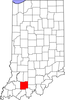 Location in the U.S. state of Indiana | |
 Indiana's location in the U.S. | |
| Founded | December 20, 1818 |
| Named for | Toussaint Dubois |
| Seat | Jasper |
| Largest city | Jasper |
| Area | |
| • Total | 435.33 sq mi (1,127 km2) |
| • Land | 427.27 sq mi (1,107 km2) |
| • Water | 8.06 sq mi (21 km2), 1.85% |
| Population | |
| • (2010) | 41,889 |
| • Density | 97/sq mi (37.61/km²) |
| Congressional district | 8th |
| Time zone | Eastern: UTC-5/-4 |
| Footnotes: Indiana county number 19 | |
Dubois County (/duːˈbɔɪz/ doo-BOYZ) is a county located in the U.S. state of Indiana. As of 2010, the population was 41,889.[1] The county seat is Jasper.[2]
Dubois County is part of the Jasper Micropolitan Statistical Area.
History
Dubois County was formed on December 20, 1818, from Orange, Pike and Perry counties. It is named for Toussaint Dubois,[3] a Frenchman who fought in the American Revolutionary War, the Battle of Tippecanoe and the War of 1812. DuBois was a merchant who lived mainly in Vincennes. He drowned in 1816 while crossing the Little Wabash River near Lawrenceville, Illinois.[4]
In 1818, as many as half of the residents of the county died of milk sickness.[5] There is one view that the mother of Abraham Lincoln, Nancy Hanks Lincoln died of this disease at that time.[6] It was caused by settlers drinking the milk or eating the meat of cows that had eaten the white snakeroot. The plant contains the potent toxin temetrol, which is passed through the milk.[7] The migrants from the East were unfamiliar with the Midwestern plant and its effects.[8]
Dubois County switched to the Central Time Zone on April 2, 2006, and returned to the Eastern Time Zone on November 4, 2007; both changes were controversial.[9][10]
The original county seat was Portersville. In 1830 the county seat was moved south to Jasper.
Geography
According to the 2010 census, the county has a total area of 435.33 square miles (1,127.5 km2), of which 427.27 square miles (1,106.6 km2) (or 98.15%) is land and 8.06 square miles (20.9 km2) (or 1.85%) is water.[11]
Cities and towns
Unincorporated towns
Townships
Adjacent counties
|
|
Climate and weather
| Jasper, Indiana | ||||||||||||||||||||||||||||||||||||||||||||||||||||||||||||
|---|---|---|---|---|---|---|---|---|---|---|---|---|---|---|---|---|---|---|---|---|---|---|---|---|---|---|---|---|---|---|---|---|---|---|---|---|---|---|---|---|---|---|---|---|---|---|---|---|---|---|---|---|---|---|---|---|---|---|---|---|
| Climate chart (explanation) | ||||||||||||||||||||||||||||||||||||||||||||||||||||||||||||
| ||||||||||||||||||||||||||||||||||||||||||||||||||||||||||||
| ||||||||||||||||||||||||||||||||||||||||||||||||||||||||||||
In recent years, average temperatures in Jasper have ranged from a low of 20 °F (−7 °C) in January to a high of 86 °F (30 °C) in July, although a record low of −25 °F (−32 °C) was recorded in January 1994 and a record high of 104 °F (40 °C) was recorded in July 1966. Average monthly precipitation ranged from 2.81 inches (71 mm) in February to 5.29 inches (134 mm) in May.[12]
Government
The county government is a constitutional body, and is granted specific powers by the Constitution of Indiana, and by the Indiana Code.
County Council: The county council is the legislative branch of the county government and controls all the spending and revenue collection in the county. Representatives are elected from county districts. The council members serve four-year terms. They are responsible for setting salaries, the annual budget, and special spending. The council also has limited authority to impose local taxes, in the form of an income and property tax that is subject to state level approval, excise taxes, and service taxes.[13][14]
Board of Commissioners: The executive body of the county is made of a board of commissioners. The commissioners are elected county-wide, in staggered terms, and each serves a four-year term. One of the commissioners, typically the most senior, serves as president. The commissioners are charged with executing the acts legislated by the council, collecting revenue, and managing the day-to-day functions of the county government.[13][14]
Court: The county maintains a small claims court that can handle some civil cases. The judge on the court is elected to a term of four years and must be a member of the Indiana Bar Association. The judge is assisted by a constable who is also elected to a four-year term. In some cases, court decisions can be appealed to the state level circuit court.[14]
County Officials: The county has several other elected offices, including sheriff, coroner, auditor, treasurer, recorder, surveyor, and circuit court clerk. Each of these elected officers serves a term of four years and oversees a different part of county government. Members elected to county government positions are required to declare party affiliations and to be residents of the county.[14]
Dubois County is part of Indiana's 9th congressional district and is represented in Congress by Republican Todd Young. It is also part of Indiana Senate districts 47 and 48,[15] and Indiana House of Representatives districts 63, 73 and 74.[16]
Demographics
| Historical population | |||
|---|---|---|---|
| Census | Pop. | %± | |
| 1820 | 1,168 | — | |
| 1830 | 1,778 | 52.2% | |
| 1840 | 3,632 | 104.3% | |
| 1850 | 6,321 | 74.0% | |
| 1860 | 10,394 | 64.4% | |
| 1870 | 12,597 | 21.2% | |
| 1880 | 15,992 | 27.0% | |
| 1890 | 20,253 | 26.6% | |
| 1900 | 20,357 | 0.5% | |
| 1910 | 19,843 | −2.5% | |
| 1920 | 19,915 | 0.4% | |
| 1930 | 20,553 | 3.2% | |
| 1940 | 22,579 | 9.9% | |
| 1950 | 23,785 | 5.3% | |
| 1960 | 27,463 | 15.5% | |
| 1970 | 30,934 | 12.6% | |
| 1980 | 34,238 | 10.7% | |
| 1990 | 36,616 | 6.9% | |
| 2000 | 39,674 | 8.4% | |
| 2010 | 41,889 | 5.6% | |
| Est. 2015 | 42,461 | [17] | 1.4% |
| U.S. Decennial Census[18] 1790-1960[19] 1900-1990[20] 1990-2000[21] 2010-2013[1] | |||
As of the 2010 United States Census, there were 41,889 people, 16,133 households, and 11,459 families residing in the county.[22] The population density was 98.0 inhabitants per square mile (37.8/km2). There were 17,384 housing units at an average density of 40.7 per square mile (15.7/km2).[11] The racial makeup of the county was 95.1% white, 0.5% Asian, 0.3% black or African American, 0.2% American Indian, 3.1% from other races, and 0.9% from two or more races. Those of Hispanic or Latino origin made up 6.0% of the population.[22] In terms of ancestry, 58.0% were German, 9.0% were American, 8.1% were Irish, and 6.7% were English.[23]
Of the 16,133 households, 34.2% had children under the age of 18 living with them, 58.3% were married couples living together, 8.6% had a female householder with no husband present, 29.0% were non-families, and 24.7% of all households were made up of individuals. The average household size was 2.54 and the average family size was 3.03. The median age was 39.9 years.[22]
The median income for a household in the county was $47,697 and the median income for a family was $64,286. Males had a median income of $42,078 versus $31,411 for females. The per capita income for the county was $24,801. About 6.9% of families and 9.6% of the population were below the poverty line, including 12.1% of those under age 18 and 10.4% of those age 65 or over.[24]
Economy
Personal income
The median income for a household in the county was $44,169, and the median income for a family was $50,342. Males had a median income of $32,484 versus $23,526 for females. The per capita income for the county was $20,225. About 2.90% of families and 6.20% of the population were below the poverty line, including 5.30% of those under age 18 and 7.30% of those age 65 or over.
Tourism
Patoka Lake is located along the county's eastern borders with both Crawford and Orange Counties. Several annual national tournaments are held there.
The Hoosier National Forest is located in the county. Part of it is protected.
Education
Public education in Dubois County is administered through four school corporations:
- Greater Jasper Consolidated Schools
- Southeast Dubois School Corporation
- Southwest Dubois School Corporation
- Northeast Dubois County School Corporation
High Schools
- Jasper High School (Greater Jasper Schools, Jasper)
- Forest Park High School (Southeast Dubois Schools, Ferdinand)
- Southridge High School (Southwest Dubois Schools, Huntingburg)
- Northeast Dubois High School (Northeast Dubois Schools, Dubois)
Infrastructure
Major highways
 Interstate 64
 U.S. Route 231
 Indiana State Road 56
 Indiana State Road 64
 Indiana State Road 145
 Indiana State Road 162
 Indiana State Road 164
See also
- List of public art in Dubois County, Indiana
- National Register of Historic Places listings in Dubois County, Indiana
References
- 1 2 "Dubois County QuickFacts". United States Census Bureau. Retrieved 2011-09-17.
- ↑ "Find a County". National Association of Counties. Retrieved 2011-06-07.
- ↑ Gannett, Henry (1905). The Origin of Certain Place Names in the United States. Govt. Print. Off. p. 109.
- ↑ De Witt Clinton Goodrich & Charles Richard Tuttle (1875). An Illustrated History of the State of Indiana. Indiana: R. S. Peale & co. p. 556.
- ↑
- ↑ "Abraham Lincoln Research Site", Roger J. Norton Website, accessed 1 July 2011
- ↑ "Abraham Lincoln Biography". Biography.com. Retrieved 28 April 2010.
- ↑ Walter J. Daly, "'The Slows', The Torment of Milk Sickness on the Midwest Frontier", Indiana Magazine of History, Vol. 102, No. 1, March 2006
- ↑ http://www.indystar.com/apps/pbcs.dll/article?AID=/20070921/LOCAL/709210491/-1/LOCAL17
- ↑ DOT Moves Five Indiana Counties from Central to Eastern Time
- 1 2 "Population, Housing Units, Area, and Density: 2010 - County". United States Census Bureau. Retrieved 2015-07-10.
- 1 2 "Monthly Averages for Jasper, Indiana". The Weather Channel. Retrieved 2011-01-27.
- 1 2 Indiana Code. "Title 36, Article 2, Section 3". IN.gov. Retrieved 2008-09-16.
- 1 2 3 4 Indiana Code. "Title 2, Article 10, Section 2" (PDF). IN.gov. Retrieved 2008-09-16.
- ↑ "Indiana Senate Districts". State of Indiana. Retrieved 2011-01-23.
- ↑ "Indiana House Districts". State of Indiana. Retrieved 2011-01-23.
- ↑ "County Totals Dataset: Population, Population Change and Estimated Components of Population Change: April 1, 2010 to July 1, 2015". Retrieved July 2, 2016.
- ↑ "U.S. Decennial Census". United States Census Bureau. Retrieved July 10, 2014.
- ↑ "Historical Census Browser". University of Virginia Library. Retrieved July 10, 2014.
- ↑ "Population of Counties by Decennial Census: 1900 to 1990". United States Census Bureau. Retrieved July 10, 2014.
- ↑ "Census 2000 PHC-T-4. Ranking Tables for Counties: 1990 and 2000" (PDF). United States Census Bureau. Retrieved July 10, 2014.
- 1 2 3 "DP-1 Profile of General Population and Housing Characteristics: 2010 Demographic Profile Data". United States Census Bureau. Retrieved 2015-07-10.
- ↑ "DP02 SELECTED SOCIAL CHARACTERISTICS IN THE UNITED STATES – 2006-2010 American Community Survey 5-Year Estimates". United States Census Bureau. Retrieved 2015-07-10.
- ↑ "DP03 SELECTED ECONOMIC CHARACTERISTICS – 2006-2010 American Community Survey 5-Year Estimates". United States Census Bureau. Retrieved 2015-07-10.
External links
 |
Daviess County | Martin County | Orange County | |
| Pike County | |
Crawford County | ||
| ||||
| | ||||
| Warrick County | Spencer County | Perry County |
The Region of Southwestern Indiana | ||
|---|---|---|
| Central Time Counties | 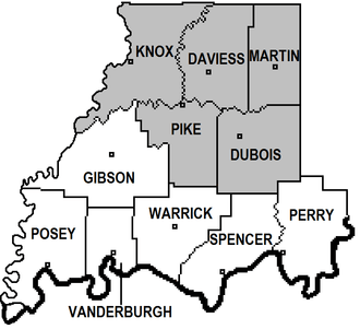 | |
| Eastern Time Counties | ||
| County Seats | ||
| Metropolitan & Micropolitan Areas | ||
| Colleges and Universities |
| |
Municipalities and communities of Dubois County, Indiana, United States | ||
|---|---|---|
| Cities | ||
| Towns | ||
| Townships | ||
| CDP | ||
| Other unincorporated communities | ||
| Ghost town | ||
| Footnotes | ‡This populated place also has portions in an adjacent county or counties | |

Coordinates: 38°22′N 86°53′W / 38.36°N 86.88°W