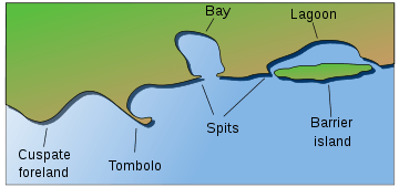
Fjard

A fjard (Swedish: fjärd, IPA: [ˈfjæːɖ]) is an inlet formed by the marine submergence of formerly glaciated valleys and depressions within a rocky glaciated terrain of low relief. Fjards are characterized by a profile that is shorter, shallower, and broader than the profile of a fjord.[1] A fjard lacks the steep walls that characterize a glacial trough that has been partially submerged to form a fjord. Examples of fjards are Bråviken on the coast of Sweden, Hjortsholm on the coast of Denmark, and Somes Sound in Acadia National Park, Maine. [2][3][4]
Fjards vs. fjords
Although fjards and fjords are similar in that they are a glacially-formed topography, they still differ in some key ways. Fjords are characterized by steep high relief cliffs carved by glacial activity and often have split or branching channels. Fjards are a glacial depression or valley that has much lower relief than a fjord. Fjards fill with eroded local materials which assists "filling" along with rising sea level since the last ice age contributing as well. Other low relief landforms that are only associated with fjards such as mud flats, salt marshes, and flood plains[5] further characterize the difference between fjords and fjards.
The "Förden" of the German coast and the fjords of Danish eastern Jutland together form a third type of glacial inlets.
References
- ↑ "Large shallow inlets and bays ", Joint Nature Conservation Committee
- ↑ Bird, E.C.F., 2008, Coastal Geomorphology: An Introduction, 2nd ed. John Wiley and Sons Ltd. West Sussex, England. ISBN 978-0-470-51729-1
- ↑ Jackson, J.A., 1997, Glossary of Geology. American Geological Institute. Alexandria, Virginia. ISBN 0-922152-34-9
- ↑ Goudie, A., 2004, Encyclopedia of Geomorphology. Routledge. London, England. ISBN 0-415-27298-X
- ↑ ABPmer and HR Wallingford. 2007. Understanding and Managing Morphological Change in Estuaries, Ch. 3 of The Estuary-Guide: A website based overview of how to identify and predict morphological change within estuaries., Joint Defra/EA Flood and Coastal Erosion Risk Management R&D Programme. UK Department for Environment, Food, and Public Affairs.