Kearny County, Kansas
| Kearny County, Kansas | |
|---|---|
| County | |
 Kearny County courthouse in Lakin | |
 Location in the U.S. state of Kansas | |
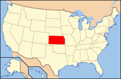 Kansas's location in the U.S. | |
| Founded | March 20, 1873 |
| Named for | Philip Kearny |
| Seat | Lakin |
| Largest city | Lakin |
| Area | |
| • Total | 871 sq mi (2,256 km2) |
| • Land | 871 sq mi (2,256 km2) |
| • Water | 0.4 sq mi (1 km2), 0.05% |
| Population | |
| • (2010) | 3,977 |
| • Density | 4.6/sq mi (2/km²) |
| Congressional district | 1st |
| Time zone | Central: UTC-6/-5 |
| Website |
KearnyCountyKansas |
Coordinates: 37°59′N 101°19′W / 37.983°N 101.317°W
Kearny County (county code KE) is a county located in the U.S. state of Kansas. As of the 2010 census, the county population was 3,977.[1] Its county seat and most populous city is Lakin.[2] The county is named in honor of General Philip Kearny.
History
The original Kearney County was established on March 6, 1873 and was dissolved in 1883, with the land area being split between Hamilton and Finney counties. It was reestablished with its original borders in 1887, and organized on March 27, 1888. The county is named in honor of Philip Kearny,[3] a U.S. Army officer in the Mexican–American War and a Union army general in the American Civil War. In 1889, the name was corrected to Kearny County.[4]
Geography
According to the U.S. Census Bureau, the county has a total area of 871 square miles (2,260 km2), of which 871 square miles (2,260 km2) is land and 0.4 square miles (1.0 km2) (0.05%) is water.[5]
Major highways
Time zones
Kearny County observed Mountain Standard Time until the late 1980s, when the United States Department of Commerce moved the county into the Central Time Zone, which 100 of the state's other 104 counties observe. Only four counties (Hamilton, Greeley, Wallace, and Sherman), all of which border Colorado, observe Mountain Time.
Adjacent counties
- Wichita County (north)
- Scott County (northeast)
- Finney County (east)
- Haskell County (southeast)
- Grant County (south)
- Stanton County (southwest)
- Hamilton County (west/MST Border)
Demographics
| Historical population | |||
|---|---|---|---|
| Census | Pop. | %± | |
| 1880 | 159 | — | |
| 1890 | 1,571 | 888.1% | |
| 1900 | 1,107 | −29.5% | |
| 1910 | 3,206 | 189.6% | |
| 1920 | 2,617 | −18.4% | |
| 1930 | 3,196 | 22.1% | |
| 1940 | 2,525 | −21.0% | |
| 1950 | 3,492 | 38.3% | |
| 1960 | 3,108 | −11.0% | |
| 1970 | 3,047 | −2.0% | |
| 1980 | 3,435 | 12.7% | |
| 1990 | 4,027 | 17.2% | |
| 2000 | 4,531 | 12.5% | |
| 2010 | 3,977 | −12.2% | |
| Est. 2015 | 3,956 | [6] | −0.5% |
| U.S. Decennial Census[7] 1790-1960[8] 1900-1990[9] 1990-2000[10] 2010-2013[1] | |||
Kearny County is included in the Garden City, KS Micropolitan Statistical Area.
As of the U.S. Census in 2000,[11] there were 4,531 people, 1,542 households, and 1,199 families residing in the county. The population density was 5 people per square mile (2/km²). There were 1,657 housing units at an average density of 2 per square mile (1/km²). The racial makeup of the county was 80.34% White, 0.55% Black or African American, 0.86% Native American, 0.31% Asian, 0.09% Pacific Islander, 15.71% from other races, and 2.14% from two or more races. Hispanic or Latino of any race were 26.55% of the population.
There were 1,542 households out of which 43.50% had children under the age of 18 living with them, 65.10% were married couples living together, 8.30% had a female householder with no husband present, and 22.20% were non-families. 20.20% of all households were made up of individuals and 8.50% had someone living alone who was 65 years of age or older. The average household size was 2.91 and the average family size was 3.35.
In the county the population was spread out with 34.30% under the age of 18, 8.30% from 18 to 24, 27.10% from 25 to 44, 19.20% from 45 to 64, and 11.10% who were 65 years of age or older. The median age was 32 years. For every 100 females there were 104.70 males. For every 100 females age 18 and over, there were 98.50 males.
The median income for a household in the county was $40,149, and the median income for a family was $43,703. Males had a median income of $30,117 versus $20,179 for females. The per capita income for the county was $15,708. About 8.40% of families and 11.70% of the population were below the poverty line, including 15.90% of those under age 18 and 4.80% of those age 65 or over.
Law and government
Following amendment to the Kansas Constitution in 1986, the county remained a prohibition, or "dry", county until 1988, when voters approved the sale of alcoholic liquor by the individual drink with a 30% food sales requirement.[12]
Education
Unified school districts
Communities

Cities
Townships
Kearny County is divided into seven townships. None of the cities within the county are considered governmentally independent, and all figures for the townships include those of the cities. In the following table, the population center is the largest city (or cities) included in that township's population total, if it is of a significant size.
| Township | FIPS | Population center |
Population | Population density /km² (/sq mi) |
Land area km² (sq mi) | Water area km² (sq mi) | Water % | Geographic coordinates |
|---|---|---|---|---|---|---|---|---|
| Deerfield | 17250 | 1,104 | 9 (24) | 120 (46) | 1 (0) | 0.66% | 38°0′30″N 101°8′55″W / 38.00833°N 101.14861°W | |
| East Hibbard | 19550 | 131 | 0 (1) | 403 (156) | 0 (0) | 0% | 38°9′19″N 101°12′14″W / 38.15528°N 101.20389°W | |
| Hartland | 30500 | 128 | 0 (1) | 388 (150) | 0 (0) | 0.03% | 38°0′44″N 101°24′49″W / 38.01222°N 101.41361°W | |
| Kendall | 36450 | 157 | 0 (1) | 494 (191) | 0 (0) | 0% | 37°46′56″N 101°18′32″W / 37.78222°N 101.30889°W | |
| Lakin | 38200 | 2,587 | 16 (41) | 164 (63) | 0 (0) | 0.04% | 37°57′16″N 101°15′45″W / 37.95444°N 101.26250°W | |
| Southside | 67025 | 359 | 1 (3) | 286 (110) | 0 (0) | 0.06% | 37°55′9″N 101°12′12″W / 37.91917°N 101.20333°W | |
| West Hibbard | 77050 | 65 | 0 (0) | 402 (155) | 0 (0) | 0% | 38°10′10″N 101°25′23″W / 38.16944°N 101.42306°W | |
| Sources: "Census 2000 U.S. Gazetteer Files". U.S. Census Bureau, Geography Division. | ||||||||
See also
|
|
References
- 1 2 "State & County QuickFacts". United States Census Bureau. Retrieved July 26, 2014.
- ↑ "Find a County". National Association of Counties. Retrieved 2011-06-07.
- ↑ Gannett, Henry (1905). The Origin of Certain Place Names in the United States. Govt. Print. Off. p. 172.
- ↑ Hicks, Virginia Pierce (February 1938). "Sketches of Early Days in Kearny County". Kansas Historical Quarterly. VII (1): 54–80. Retrieved 2007-01-04.
- ↑ "US Gazetteer files: 2010, 2000, and 1990". United States Census Bureau. 2011-02-12. Retrieved 2011-04-23.
- ↑ "County Totals Dataset: Population, Population Change and Estimated Components of Population Change: April 1, 2010 to July 1, 2015". Retrieved July 2, 2016.
- ↑ "U.S. Decennial Census". United States Census Bureau. Retrieved July 26, 2014.
- ↑ "Historical Census Browser". University of Virginia Library. Retrieved July 26, 2014.
- ↑ "Population of Counties by Decennial Census: 1900 to 1990". United States Census Bureau. Retrieved July 26, 2014.
- ↑ "Census 2000 PHC-T-4. Ranking Tables for Counties: 1990 and 2000" (PDF). United States Census Bureau. Retrieved July 26, 2014.
- ↑ "American FactFinder". United States Census Bureau. Retrieved 2008-01-31.
- ↑ "Map of Wet and Dry Counties". Alcoholic Beverage Control, Kansas Department of Revenue. November 2006. Retrieved 2007-12-26.
Further reading
- History of the State of Kansas; William G. Cutler; A.T. Andreas Publisher; 1883. (Online HTML eBook)
- Kansas : A Cyclopedia of State History, Embracing Events, Institutions, Industries, Counties, Cities, Towns, Prominent Persons, Etc; 3 Volumes; Frank W. Blackmar; Standard Publishing Co; 944 / 955 / 824 pages; 1912. (Volume1 - Download 54MB PDF eBook),(Volume2 - Download 53MB PDF eBook), (Volume3 - Download 33MB PDF eBook)
External links
| Wikimedia Commons has media related to Kearny County, Kansas. |
- County
- Maps
- Kearny County Maps: Current, Historic, KDOT
- Kansas Highway Maps: Current, Historic, KDOT
- Kansas Railroad Maps: Current, 1996, 1915, KDOT and Kansas Historical Society
 |
Greeley County | Wichita County | Scott County | |
| Hamilton County | |
Finney County | ||
| ||||
| | ||||
| Stanton County | Grant County | Haskell County |
Municipalities and communities of Kearny County, Kansas, United States | ||
|---|---|---|
| Cities | | |
| Townships | ||