Brown County, Kansas
| Brown County, Kansas | |
|---|---|
| County | |
 Brown County Courthouse in Hiawatha | |
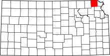 Location in the U.S. state of Kansas | |
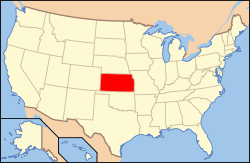 Kansas's location in the U.S. | |
| Founded | August 25, 1855 |
| Named for | Albert Gallatin Brown |
| Seat | Hiawatha |
| Largest city | Hiawatha |
| Area | |
| • Total | 572 sq mi (1,481 km2) |
| • Land | 571 sq mi (1,479 km2) |
| • Water | 1.2 sq mi (3 km2), 0.2% |
| Population | |
| • (2010) | 9,984 |
| • Density | 17/sq mi (7/km²) |
| Congressional district | 2nd |
| Time zone | Central: UTC-6/-5 |
| Website |
ks-brown |
Coordinates: 39°48′N 95°35′W / 39.800°N 95.583°W
Brown County (county code BR) is a county located in the northeast portion of the U.S. state of Kansas. As of the 2010 census, the county population was 9,984.[1] Its county seat and most populous city is Hiawatha.[2] Brown County is the location of the Kickapoo Indian Reservation of Kansas, the majority of the Sac and Fox Reservation and the majority of the Iowa Reservation of Kansas and Nebraska.
History
Early history
For many millennia, the Great Plains of North America was inhabited by nomadic Native Americans. From the 16th century to 18th century, the Kingdom of France claimed ownership of large parts of North America. In 1762, after the French and Indian War, France secretly ceded New France to Spain, per the Treaty of Fontainebleau.
19th century
In 1802, Spain returned most of the land to France, but keeping title to about 7,500 square miles. In 1803, most of the land for modern day Kansas was acquired by the United States from France as part of the 828,000 square mile Louisiana Purchase for 2.83 cents per acre.
In 1854, the Kansas Territory was organized, then in 1861 Kansas became the 34th U.S. state. Brown County was founded in 1855,[3] was named for Albert G. Brown.[4]
Geography
According to the U.S. Census Bureau, the county has a total area of 572 square miles (1,480 km2), of which 571 square miles (1,480 km2) is land and 1.2 square miles (3.1 km2) (0.2%) is water.[5] The Wolf River has its source in the county.[6] Brown State Fishing Lake, formerly known as "Brown County State Park" is in the county, 8 miles (13 km) east of Hiawatha.
Adjacent counties
- Richardson County, Nebraska (north)
- Doniphan County (east)
- Atchison County (southeast)
- Jackson County (southwest)
- Nemaha County (west)
Major highways
Sources: National Atlas,[7] U.S. Census Bureau[8]
- U.S. Route 36
- U.S. Route 73
- U.S. Route 75
- U.S. Route 159
- Kansas Highway 20
- Kansas Highway 246
Demographics
| Historical population | |||
|---|---|---|---|
| Census | Pop. | %± | |
| 1860 | 2,607 | — | |
| 1870 | 6,823 | 161.7% | |
| 1880 | 12,817 | 87.8% | |
| 1890 | 20,319 | 58.5% | |
| 1900 | 22,369 | 10.1% | |
| 1910 | 21,314 | −4.7% | |
| 1920 | 20,949 | −1.7% | |
| 1930 | 20,553 | −1.9% | |
| 1940 | 17,395 | −15.4% | |
| 1950 | 14,651 | −15.8% | |
| 1960 | 13,229 | −9.7% | |
| 1970 | 11,685 | −11.7% | |
| 1980 | 11,955 | 2.3% | |
| 1990 | 11,128 | −6.9% | |
| 2000 | 10,724 | −3.6% | |
| 2010 | 9,984 | −6.9% | |
| Est. 2015 | 9,776 | [9] | −2.1% |
| U.S. Decennial Census[10] 1790-1960[11] 1900-1990[12] 1990-2000[13] 2010-2013[1] | |||

As of the U.S. Census in 2000,[14] there were 10,724 people, 4,318 households, and 2,949 families residing in the county. The population density was 19 people per square mile (7/km²). There were 4,815 housing units at an average density of 8 per square mile (3/km²). The racial makeup of the county was 86.87% White, 1.56% Black or African American, 8.82% Native American, 0.21% Asian, 0.01% Pacific Islander, 0.73% from other races, and 1.81% from two or more races. Hispanic or Latino of any race were 2.32% of the population.
There were 4,318 households out of which 31.40% had children under the age of 18 living with them, 55.80% were married couples living together, 9.20% had a female householder with no husband present, and 31.70% were non-families. 28.80% of all households were made up of individuals and 15.70% had someone living alone who was 65 years of age or older. The average household size was 2.44 and the average family size was 2.99.
In the county the population was spread out with 26.40% under the age of 18, 7.40% from 18 to 24, 24.00% from 25 to 44, 22.70% from 45 to 64, and 19.50% who were 65 years of age or older. The median age was 40 years. For every 100 females there were 93.50 males. For every 100 females age 18 and over, there were 89.80 males.
The median income for a household in the county was $31,971, and the median income for a family was $39,525. Males had a median income of $29,163 versus $19,829 for females. The per capita income for the county was $15,163. About 10.60% of families and 12.90% of the population were below the poverty line, including 16.40% of those under age 18 and 11.80% of those age 65 or over.
Law and government
Following amendment to the Kansas Constitution in 1986, the county remained a prohibition, or "dry", county until 2000, when voters approved the sale of alcoholic liquor by the individual drink without a food sales requirement.[15]
Education
Unified school districts
Communities

Cities
Unincorporated communities
Townships
Brown County is divided into ten townships. The cities of Hiawatha, Horton, and Sabetha are considered governmentally independent and are excluded from the census figures for the townships. In the following table, the population center is the largest city (or cities) included in that township's population total, if it is of a significant size.
| Township | FIPS | Population center |
Population | Population density /km² (/sq mi) |
Land area km² (sq mi) | Water area km² (sq mi) | Water % | Geographic coordinates |
|---|---|---|---|---|---|---|---|---|
| Hamlin | 29725 | 344 | 3 (8) | 106 (41) | 0 (0) | 0.18% | 39°57′1″N 95°36′40″W / 39.95028°N 95.61111°W | |
| Hiawatha | 31700 | 739 | 4 (12) | 164 (63) | 0 (0) | 0.18% | 39°50′25″N 95°31′59″W / 39.84028°N 95.53306°W | |
| Irving | 34500 | 311 | 2 (6) | 137 (53) | 0 (0) | 0.04% | 39°57′24″N 95°23′36″W / 39.95667°N 95.39333°W | |
| Mission | 47200 | 645 | 3 (8) | 219 (84) | 2 (1) | 0.73% | 39°43′14″N 95°32′12″W / 39.72056°N 95.53667°W | |
| Morrill | 48325 | Morrill | 503 | 5 (12) | 105 (41) | 0 (0) | 0.24% | 39°56′23″N 95°43′20″W / 39.93972°N 95.72222°W |
| Padonia | 54025 | 259 | 2 (6) | 107 (41) | 0 (0) | 0.14% | 39°57′2″N 95°31′4″W / 39.95056°N 95.51778°W | |
| Powhattan | 57375 | 874 | 4 (10) | 232 (90) | 0 (0) | 0.06% | 39°43′49″N 95°41′59″W / 39.73028°N 95.69972°W | |
| Robinson | 60350 | Robinson | 452 | 4 (10) | 116 (45) | 0 (0) | 0.25% | 39°48′29″N 95°23′49″W / 39.80806°N 95.39694°W |
| Walnut | 74875 | Fairview | 665 | 4 (11) | 161 (62) | 1 (0) | 0.46% | 39°50′53″N 95°42′27″W / 39.84806°N 95.70750°W |
| Washington | 75525 | Everest | 541 | 5 (12) | 116 (45) | 0 (0) | 0.17% | 39°41′43″N 95°24′41″W / 39.69528°N 95.41139°W |
| Sources: "Census 2000 U.S. Gazetteer Files". U.S. Census Bureau, Geography Division. | ||||||||
See also
|
|
References
- 1 2 "State & County QuickFacts". United States Census Bureau. Retrieved July 21, 2014.
- ↑ "Find a County". National Association of Counties. Archived from the original on 2011-05-31. Retrieved 2011-06-07.
- ↑ Blackmar, Frank Wilson (1912). Kansas: A Cyclopedia of State History, Embracing Events, Institutions, Industries, Counties, Cities, Towns, Prominent Persons, Etc. Standard Publishing Company. p. 237.
- ↑ History of the State of Kansas: Containing a Full Account of Its Growth from an Uninhabited Territory to a Wealthy and Important State. A. T. Andreas. 1883. p. 710.
- ↑ "US Gazetteer files: 2010, 2000, and 1990". United States Census Bureau. 2011-02-12. Retrieved 2011-04-23.
- ↑ DeLorme (2003). Kansas Atlas & Gazetteer. p. 26. Yarmouth, Maine: DeLorme. ISBN 0-89933-342-7.
- ↑ National Atlas Archived December 5, 2008, at the Wayback Machine.
- ↑ U.S. Census Bureau TIGER shape files
- ↑ "County Totals Dataset: Population, Population Change and Estimated Components of Population Change: April 1, 2010 to July 1, 2015". Retrieved July 2, 2016.
- ↑ "U.S. Decennial Census". United States Census Bureau. Archived from the original on May 11, 2015. Retrieved July 21, 2014.
- ↑ "Historical Census Browser". University of Virginia Library. Retrieved July 21, 2014.
- ↑ "Population of Counties by Decennial Census: 1900 to 1990". United States Census Bureau. Retrieved July 21, 2014.
- ↑ "Census 2000 PHC-T-4. Ranking Tables for Counties: 1990 and 2000" (PDF). United States Census Bureau. Retrieved July 21, 2014.
- ↑ "American FactFinder". United States Census Bureau. Archived from the original on 2013-09-11. Retrieved 2008-01-31.
- ↑ "Map of Wet and Dry Counties". Alcoholic Beverage Control, Kansas Department of Revenue. November 2006. Archived from the original on 2007-10-08. Retrieved 2007-12-28.
Further reading
- History of the State of Kansas; William G. Cutler; A.T. Andreas Publisher; 1883. (Online HTML eBook)
- Kansas : A Cyclopedia of State History, Embracing Events, Institutions, Industries, Counties, Cities, Towns, Prominent Persons, Etc; 3 Volumes; Frank W. Blackmar; Standard Publishing Co; 944 / 955 / 824 pages; 1912. (Volume1 - Download 54MB PDF eBook),(Volume2 - Download 53MB PDF eBook), (Volume3 - Download 33MB PDF eBook)
External links
| Wikimedia Commons has media related to Brown County, Kansas. |
- County
- Maps
- Brown County Maps: Current, Historic, KDOT
- Kansas Highway Maps: Current, Historic, KDOT
- Kansas Railroad Maps: Current, 1996, 1915, KDOT and Kansas Historical Society
 |
Richardson County, Nebraska | Richardson County, Nebraska | Holt County, Missouri | |
| Nemaha County | |
Doniphan County | ||
| ||||
| | ||||
| Nemaha County | Jackson County | Atchison County |
Municipalities and communities of Brown County, Kansas, United States | ||
|---|---|---|
| Cities | | |
| CDPs | ||
| Unincorporated communities | ||
| Indian reservations | ||
| Townships | ||
| Footnotes | ‡This populated place also has portions in an adjacent county or counties | |