Microregion of Fernandópolis
| Microregion of Fernandópolis | |
|---|---|
| Microregion | |
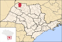 Location of the Microregion of Fernandópolis | |
| Coordinates: 20°17′02″S 50°14′45″W / 20.28389°S 50.24583°WCoordinates: 20°17′02″S 50°14′45″W / 20.28389°S 50.24583°W | |
| Country |
|
| Region | Southeast |
| State |
|
| Mesoregion | São José do Rio Preto |
| Area | |
| • Total | 2,811.7 km2 (1,085.6 sq mi) |
| Population (2010/IBGE) | |
| • Total | 104,623 |
| • Density | 37/km2 (96/sq mi) |
| Time zone | UTC-3 (UTC-3) |
| • Summer (DST) | UTC-2 (UTC-2) |
| Postal Code | 15600-000 |
| Area code(s) | +55 17 |
The Microregion of Fernandópolis (Portuguese: Microrregião de Fernandópolis) is located on the northwest of São Paulo state, Brazil, and is made up of 13 municipalities. It belongs to the Mesoregion of São José do Rio Preto.
The microregion has a population of 104,623 inhabitants, in an area of 2,811.7 km²[1]
Municipalities
The microregion consists of the following municipalities,[2] listed below with their 2010 Census populations (IBGE/2010):[3]
- Estrela d'Oeste: 8,208
- Fernandópolis: 64,696
- Guarani d'Oeste: 1,970
- Indiaporã: 3,903
- Macedônia: 3,664
- Meridiano: 3,885
- Mira Estrela: 2,820
- Ouroeste: 8,405
- Pedranópolis: 2,558
- São João das Duas Pontes: 2,566
- Turmalina: 1,978
References
- ↑ "2010 Census of the IBGE - Synopsis - Tables 761 and 1301" (in Portuguese). IBGE.gov.br. Retrieved 13 July 2011.
- ↑ Instituto Brasileiro de Geografia e Estatística, territorial division.
- ↑ "2010 Census of the IBGE - Population - Table 2.1.20" (PDF). IBGE.gov.br. Retrieved 13 July 2011.
| Mesoregions |
|
|---|---|
| Microregions |
|
This article is issued from Wikipedia - version of the 11/5/2016. The text is available under the Creative Commons Attribution/Share Alike but additional terms may apply for the media files.