| [3] |
Name on the Register |
Image |
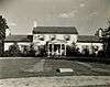
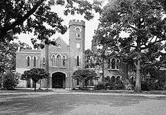
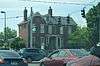
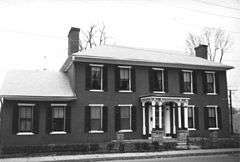
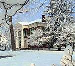
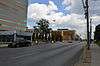
Date listed[4] |
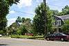
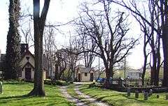
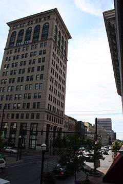
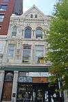
Location |
City or town |
Description |
|---|
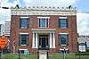
| 1 |
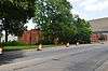
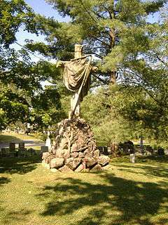
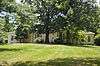
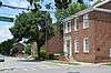
African Cemetery No. 2 |
|
000000002004-03-31-0000March 31, 2004
(#04000245) |
419 E. 7th St.
38°03′04″N 84°28′41″W / 38.051111°N 84.478056°W / 38.051111; -84.478056 (African Cemetery No. 2) |
Lexington |
|
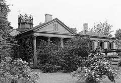
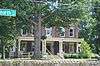
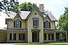
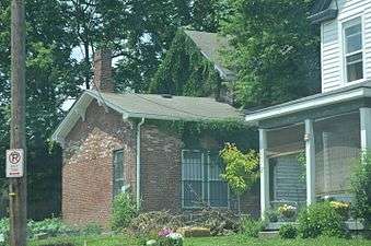
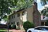
| 2 |
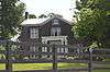
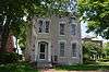
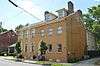
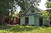
James Allen House |
|
000000001982-12-30-0000December 30, 1982
(#82001564) |
1020 Lane Allen Rd.
38°01′54″N 84°33′10″W / 38.031667°N 84.552778°W / 38.031667; -84.552778 (James Allen House) |
Lexington |
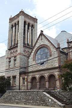
|
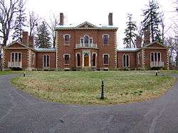
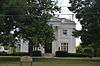
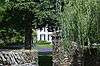
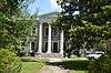
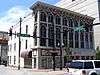
| 3 |
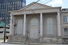
Ashland |
|
000000001966-10-15-0000October 15, 1966
(#66000357) |
2 miles (3.2 km) southeast of Lexington on Richmond Rd.
38°01′43″N 84°28′48″W / 38.028611°N 84.48°W / 38.028611; -84.48 (Ashland) |
Lexington |
|
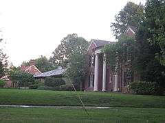
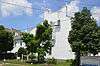
| 4 |
Ashland Park Historic District |
|
000000001986-03-31-0000March 31, 1986
(#86000755) |
Roughly bounded by Ashland Ave., Richmond Rd., Chinoe Rd., and Fontaine Rd.
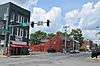
38°01′45″N 84°28′56″W / 38.029167°N 84.482222°W / 38.029167; -84.482222 (Ashland Park Historic District) |
Lexington |
|
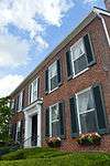
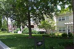
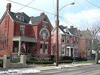
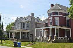
| 5 |
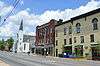
Athens Historic District |
Upload image |
000000001979-10-11-0000October 11, 1979
(#79000971) |
Athens-Boonesboro Pike
37°56′58″N 84°21′53″W / 37.949444°N 84.364722°W / 37.949444; -84.364722 (Athens Historic District) |
Athens |
|
| 6 |
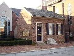
Abraham Barton House |
|
000000001977-08-26-0000August 26, 1977
(#77000611) |
200 N. Upper St.
38°02′56″N 84°29′42″W / 38.048889°N 84.495000°W / 38.048889; -84.495000 (Abraham Barton House) |
Lexington |
|
| 7 |
T.D. Basye House |
Upload image |
000000001987-10-22-0000October 22, 1987
(#87001886) |
3501 Georgetown Rd.
38°07′36″N 84°31′38″W / 38.126667°N 84.527222°W / 38.126667; -84.527222 (T.D. Basye House) |
Lexington |
|
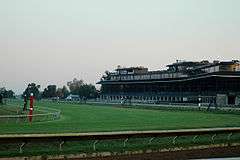
| 8 |
Bates Log House |
Upload image |
000000001982-08-26-0000August 26, 1982
(#82002683) |
5143 Spurr Rd.
38°07′11″N 84°34′11″W / 38.119722°N 84.569722°W / 38.119722; -84.569722 (Bates Log House) |
Lexington |
|
| 9 |
James Burnie Beck House |
|
000000001982-08-26-0000August 26, 1982
(#82002684) |
209 E. High St.
38°02′35″N 84°29′46″W / 38.043056°N 84.496111°W / 38.043056; -84.496111 (James Burnie Beck House) |
Lexington |
|
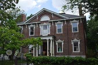
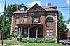
| 10 |
Bell Court Neighborhood Historic District |
|
000000001980-12-08-0000December 8, 1980
(#80001507) |
Roughly bounded by railroad tracks, Main St., Boonesboro and Walton Aves.
38°02′22″N 84°29′09″W / 38.039444°N 84.485833°W / 38.039444; -84.485833 (Bell Court Neighborhood Historic District) |
Lexington |
|
| 11 |
Bell Place |
|
000000001978-02-17-0000February 17, 1978
(#78001312) |
Sayre Ave.
38°02′20″N 84°29′09″W / 38.038889°N 84.485833°W / 38.038889; -84.485833 (Bell Place) |
Lexington |
|
| 12 |
John Bell House |
Upload image |
000000001983-06-23-0000June 23, 1983
(#83002757) |
Kentucky Route 1978
38°04′59″N 84°31′48″W / 38.083056°N 84.53°W / 38.083056; -84.53 (John Bell House) |
Lexington |
|
| 13 |
Boone Creek Rural Historic District |
Upload image |
000000001994-08-19-0000August 19, 1994
(#94000839) |
Roughly bounded by Interstate 75, Cleveland Rd., Athens-Boonesboro Rd. and Grimes Rd.
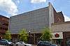
37°56′21″N 84°21′51″W / 37.939167°N 84.364167°W / 37.939167; -84.364167 (Boone Creek Rural Historic District) |
Lexington |
Extends into Clark County
|
| 14 |
Botherum |
|
000000001973-03-07-0000March 7, 1973
(#73000795) |
341 Madison Pl.
38°02′59″N 84°30′26″W / 38.049722°N 84.507222°W / 38.049722; -84.507222 (Botherum) |
Lexington |
|
| 15 |
Bowman Houses |
Upload image |
000000001979-08-09-0000August 9, 1979
(#79000973) |
West of Lexington on Bowman's Mill Rd.
38°00′31″N 84°35′55″W / 38.008611°N 84.598611°W / 38.008611; -84.598611 (Bowman Houses) |
Lexington |
|
| 16 |
Bowman Mill Road Rural Historic District |
Upload image |
000000001999-07-28-0000July 28, 1999
(#99000901) |
Bowman Mill Rd., Parkers Mill Rd., and Cave Hill Ln.
38°00′48″N 84°35′56″W / 38.013333°N 84.598889°W / 38.013333; -84.598889 (Bowman Mill Road Rural Historic District) |
Lexington |
|
| 17 |
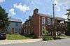
Brand-Barrow House |
|
000000001976-08-11-0000August 11, 1976
(#76000866) |
203 E. 4th St.
38°02′58″N 84°29′18″W / 38.049444°N 84.488333°W / 38.049444; -84.488333 (Brand-Barrow House) |
Lexington |
|
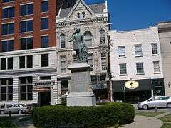
| 18 |
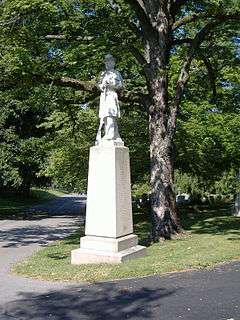
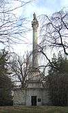
John C. Breckinridge Memorial |
|
000000001997-07-17-0000July 17, 1997
(#97000705) |
Courthouse Lawn, junction of N. Upper and E. Main Sts.
38°02′52″N 84°29′54″W / 38.047778°N 84.498417°W / 38.047778; -84.498417 (John C. Breckinridge Memorial) |
Lexington |
|
| 19 |
Joshua Brown House |
|
000000001979-12-27-0000December 27, 1979
(#79000974) |
2705 Tates Creek Rd.
38°00′43″N 84°29′47″W / 38.011944°N 84.496389°W / 38.011944; -84.496389 (Joshua Brown House) |
Lexington |
|
| 20 |
Buenna Hill |
Upload image |
000000001983-06-29-0000June 29, 1983
(#83002758) |
Off Ferguson Rd.
38°10′22″N 84°24′18″W / 38.172778°N 84.405°W / 38.172778; -84.405 (Buenna Hill) |
Centerville |
|
| 21 |
John Burrier House |
Upload image |
000000001983-06-23-0000June 23, 1983
(#83002759) |
Kentucky Route 1966
38°00′47″N 84°37′14″W / 38.013056°N 84.620556°W / 38.013056; -84.620556 (John Burrier House) |
Lexington |
|
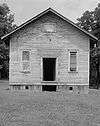
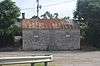
| 22 |
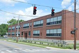
Cadentown School |
|
000000002006-04-05-0000April 5, 2006
(#06000213) |
705 Caden Ln.
38°00′38″N 84°25′48″W / 38.010556°N 84.43°W / 38.010556; -84.43 (Cadentown School) |
Lexington |
|
| 23 |
Cave Place |
Upload image |
000000001980-12-05-0000December 5, 1980
(#80001508) |
West of Lexington
38°01′07″N 84°35′04″W / 38.018611°N 84.584444°W / 38.018611; -84.584444 (Cave Place) |
Lexington |
|
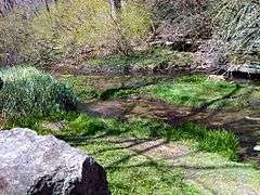
| 24 |
Cave Spring |
Upload image |
000000001978-12-22-0000December 22, 1978
(#78001313) |
Southeast of Lexington off U.S. Route 25
37°56′53″N 84°23′48″W / 37.948056°N 84.396667°W / 37.948056; -84.396667 (Cave Spring) |
Lexington |
|
| 25 |
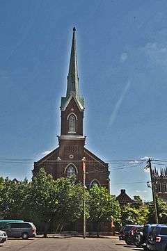
Central Christian Church |
|
000000001979-09-11-0000September 11, 1979
(#79000975) |
207 E. Short St.
38°02′44″N 84°29′39″W / 38.045556°N 84.494167°W / 38.045556; -84.494167 (Central Christian Church) |
Lexington |
|
| 26 |
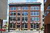
Central Kentucky Blue Grass Seed Co. |
|
000000002005-08-03-0000August 3, 2005
(#05000790) |
321 Henry St.
38°03′28″N 84°30′01″W / 38.057639°N 84.500278°W / 38.057639; -84.500278 (Central Kentucky Blue Grass Seed Co.) |
Lexington |
|
| 27 |
Chandler Normal School Building and Webster Hall |
|
000000001980-12-04-0000December 4, 1980
(#80001509) |
548 Georgetown St.
38°03′50″N 84°30′07″W / 38.063889°N 84.501944°W / 38.063889; -84.501944 (Chandler Normal School Building and Webster Hall) |
Lexington |
|
| 28 |
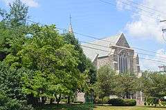
Christ Church Episcopal |
|
000000001976-10-21-0000October 21, 1976
(#76000867) |
Church and Market Sts.
38°02′55″N 84°29′48″W / 38.048611°N 84.496667°W / 38.048611; -84.496667 (Christ Church Episcopal) |
Lexington |
|
| 29 |
Clark Hardware Company Building |
|
000000001979-07-16-0000July 16, 1979
(#79000976) |
367-369 W. Short St. and 142 N. Broadway
38°02′58″N 84°29′56″W / 38.049444°N 84.498889°W / 38.049444; -84.498889 (Clark Hardware Company Building) |
Lexington |
|
| 30 |
John Clark House |
|
000000001980-11-25-0000November 25, 1980
(#80001510) |
Tates Creek Pk.
38°00′47″N 84°29′36″W / 38.013056°N 84.493333°W / 38.013056; -84.493333 (John Clark House) |
Lexington |
|
| 31 |
Henry Clay's Law Office |
|
000000001971-03-11-0000March 11, 1971
(#71000340) |
176 N. Mill St.
38°02′58″N 84°29′49″W / 38.049444°N 84.496944°W / 38.049444; -84.496944 (Henry Clay's Law Office) |
Lexington |
|
| 32 |
Cleveland-Rogers House |
Upload image |
000000001980-08-26-0000August 26, 1980
(#80001511) |
Southeast of Lexington at 8151 Richmond Rd.
37°54′09″N 84°21′14″W / 37.9025°N 84.353889°W / 37.9025; -84.353889 (Cleveland-Rogers House) |
Lexington |
|
| 33 |
Cloud House |
Upload image |
000000001982-06-17-0000June 17, 1982
(#82002685) |
3740 Versailles Rd.
38°02′03″N 84°35′17″W / 38.034167°N 84.588056°W / 38.034167; -84.588056 (Cloud House) |
Lexington |
|
| 34 |
William Conant House |
Upload image |
000000001991-02-22-0000February 22, 1991
(#91000123) |
1701 Elkchester Rd.
38°04′42″N 84°36′25″W / 38.078333°N 84.606944°W / 38.078333; -84.606944 (William Conant House) |
Lexington |
|
| 35 |
Confederate Soldier Monument in Lexington |
|
000000001997-07-17-0000July 17, 1997
(#97000703) |
833 W. Main St.
38°03′31″N 84°30′41″W / 38.058611°N 84.511250°W / 38.058611; -84.511250 (Confederate Soldier Monument in Lexington) |
Lexington |
|
| 36 |
Constitution Historic District |
|
000000001982-08-30-0000August 30, 1982
(#82002686) |
Roughly bounded by E. 3rd., Limestone, Walnut, and Pleasant Stone Sts.
38°02′54″N 84°29′31″W / 38.048333°N 84.491944°W / 38.048333; -84.491944 (Constitution Historic District) |
Lexington |
|
| 37 |
Corinthia |
Upload image |
000000001983-06-29-0000June 29, 1983
(#83002760) |
Off Lemons Mill Rd.
38°10′22″N 84°24′50″W / 38.172778°N 84.413889°W / 38.172778; -84.413889 (Corinthia) |
Centerville |
|
| 38 |
DeLong Agricultural Implements Warehouse |
|
000000001980-11-25-0000November 25, 1980
(#80001512) |
Patterson St.
38°03′00″N 84°30′12″W / 38.050000°N 84.503333°W / 38.050000; -84.503333 (DeLong Agricultural Implements Warehouse) |
Lexington |
|
| 39 |
Delta |
Upload image |
000000001978-08-10-0000August 10, 1978
(#78001314) |
South of Lexington at 2450 Armstrong Mill Rd.
37°57′08″N 84°27′57″W / 37.952222°N 84.465833°W / 37.952222; -84.465833 (Delta) |
Lexington |
|
| 40 |
Douglass School |
|
000000001998-08-14-0000August 14, 1998
(#98000933) |
465 Price Rd.
38°04′12″N 84°30′22″W / 38.07°N 84.506111°W / 38.07; -84.506111 (Douglass School) |
Lexington |
|
| 41 |
Downtown Commercial District |
|
000000001983-08-25-0000August 25, 1983
(#83000559) |
Roughly bounded by Main, Church, Walnut Sts., and Broadway
38°02′50″N 84°29′50″W / 38.047222°N 84.497222°W / 38.047222; -84.497222 (Downtown Commercial District) |
Lexington |
|
| 42 |
Edgewood |
Upload image |
000000002016-08-04-0000August 4, 2016
(#16000494) |
5910 Winchester Rd.
38°01′46″N 84°18′20″W / 38.029556°N 84.305593°W / 38.029556; -84.305593 (Edgewood) |
Lexington |
|
| 43 |
Elam Mound Archeological Site |
Upload image |
000000001975-10-10-0000October 10, 1975
(#75000749) |
Address Restricted
|
Lexington |
|
| 44 |
Elley Villa |
|
000000001978-01-09-0000January 9, 1978
(#78001315) |
320 Linden Walk
38°02′17″N 84°29′48″W / 38.038056°N 84.496667°W / 38.038056; -84.496667 (Elley Villa) |
Lexington |
|
| 45 |
Elsmere Park Historic District |
|
000000001976-04-26-0000April 26, 1976
(#76000868) |
Off N. Broadway, between W. 6th and 7th Sts.
38°03′22″N 84°29′13″W / 38.056111°N 84.486944°W / 38.056111; -84.486944 (Elsmere Park Historic District) |
Lexington |
|
| 46 |
Episcopal Burying Ground and Chapel |
|
000000001976-06-24-0000June 24, 1976
(#76000869) |
251 E. 3rd St.
38°02′49″N 84°29′21″W / 38.046944°N 84.489167°W / 38.046944; -84.489167 (Episcopal Burying Ground and Chapel) |
Lexington |
|
| 47 |
Fairlawn |
Upload image |
000000001976-10-14-0000October 14, 1976
(#76000870) |
6 miles (9.7 km) northeast of Lexington on U.S. Route 68
38°06′55″N 84°23′34″W / 38.115278°N 84.392778°W / 38.115278; -84.392778 (Fairlawn) |
Lexington |
|
| 48 |
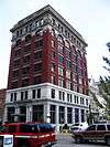
Fayette National Bank Building |
|
000000001980-02-27-0000February 27, 1980
(#80001513) |
159-167 W. Main St.
38°02′50″N 84°29′53″W / 38.047222°N 84.498056°W / 38.047222; -84.498056 (Fayette National Bank Building) |
Lexington |
|
| 49 |
Fayette Safety Vault and Trust Company Building |
|
000000001980-08-11-0000August 11, 1980
(#80001514) |
111-113 Cheapside St.
38°02′53″N 84°29′54″W / 38.048194°N 84.498472°W / 38.048194; -84.498472 (Fayette Safety Vault and Trust Company Building) |
Lexington |
|
| 50 |
Featherston, Edmonson and Clark Houses |
|
000000001983-07-21-0000July 21, 1983
(#83002761) |
218, 226, and 232 E. Maxwell St.
38°02′26″N 84°29′55″W / 38.040556°N 84.498611°W / 38.040556; -84.498611 (Featherston, Edmonson and Clark Houses) |
Lexington |
|
| 51 |
First African Baptist Church |
|
000000001986-04-24-0000April 24, 1986
(#86000854) |
264-272 E. Short St.
38°02′38″N 84°29′35″W / 38.043889°N 84.493056°W / 38.043889; -84.493056 (First African Baptist Church) |
Lexington |
|
| 52 |
First Presbyterian Church, Lexington |
|
000000001974-12-30-0000December 30, 1974
(#74000861) |
174 N. Mill St.
38°02′57″N 84°29′49″W / 38.049167°N 84.496944°W / 38.049167; -84.496944 (First Presbyterian Church, Lexington) |
Lexington |
|
| 53 |
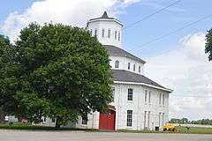
Floral Hall |
|
000000001977-08-29-0000August 29, 1977
(#77000612) |
847 S. Broadway
38°02′27″N 84°31′03″W / 38.040833°N 84.517500°W / 38.040833; -84.517500 (Floral Hall) |
Lexington |
|
| 54 |
Monsieur Giron's Confectionary |
|
000000001974-12-27-0000December 27, 1974
(#74000866) |
125 N. Mill St.
38°02′55″N 84°29′54″W / 38.048611°N 84.498472°W / 38.048611; -84.498472 (Monsieur Giron's Confectionary) |
Lexington |
|
| 55 |
George W. Grant House |
Upload image |
000000001980-10-24-0000October 24, 1980
(#80001515) |
519 W. 4th St.
38°03′27″N 84°29′48″W / 38.0575°N 84.496667°W / 38.0575; -84.496667 (George W. Grant House) |
Lexington |
|
| 56 |
Gratz Park Historic District |
|
000000001973-03-14-0000March 14, 1973
(#73000796) |
Bounded by 2nd and 3rd Sts., the Byway, and Bark Alley
38°03′00″N 84°29′46″W / 38.05°N 84.496111°W / 38.05; -84.496111 (Gratz Park Historic District) |
Lexington |
|
| 57 |
Graves Tavern |
Upload image |
000000001983-06-23-0000June 23, 1983
(#83002766) |
Off U.S. Route 60
38°02′28″N 84°37′37″W / 38.041111°N 84.626944°W / 38.041111; -84.626944 (Graves Tavern) |
Versailles |
|
| 58 |
Grimes House and Mill Complex |
Upload image |
000000001982-06-21-0000June 21, 1982
(#82002687) |
Grimes Mill Rd.
37°54′57″N 84°20′34″W / 37.915833°N 84.342778°W / 37.915833; -84.342778 (Grimes House and Mill Complex) |
Lexington |
|
| 59 |
Guilfoil Village Site (15FA176) |
Upload image |
000000001985-12-05-0000December 5, 1985
(#85003063) |
Address Restricted
|
Athens |
|
| 60 |
Hartland |
|
000000001987-04-02-0000April 2, 1987
(#87000568) |
2230 Armstrong Mill Rd.
37°57′35″N 84°28′21″W / 37.959722°N 84.4725°W / 37.959722; -84.4725 (Hartland) |
Lexington |
|
| 61 |
Samuel T. Hayes House |
Upload image |
000000001980-03-19-0000March 19, 1980
(#80001516) |
Southeast of Lexington on Sulphur Well Rd.
37°58′57″N 84°21′23″W / 37.9825°N 84.356389°W / 37.9825; -84.356389 (Samuel T. Hayes House) |
Lexington |
|
| 62 |
George Headley House |
Upload image |
000000001991-03-04-0000March 4, 1991
(#91000122) |
4435 Old Frankfort Pike
38°05′42″N 84°36′34″W / 38.095°N 84.609444°W / 38.095; -84.609444 (George Headley House) |
Lexington |
|
| 63 |
Hal Price Headley Sr. House |
|
000000002010-11-15-0000November 15, 2010
(#10000907) |
1236 Standish Way
38°02′35″N 84°33′44″W / 38.043056°N 84.562222°W / 38.043056; -84.562222 (Hal Price Headley Sr. House) |
Lexington |
|
| 64 |
Helm Place |
Upload image |
000000001978-08-03-0000August 3, 1978
(#78001318) |
Southwest of Lexington on Bowman Mill Rd.
38°00′10″N 84°35′19″W / 38.002778°N 84.588611°W / 38.002778; -84.588611 (Helm Place) |
Lexington |
|
| 65 |
Higgins Block |
|
000000001977-08-12-0000August 12, 1977
(#77000613) |
145-151 W. Main St.
38°02′49″N 84°29′52″W / 38.046944°N 84.497778°W / 38.046944; -84.497778 (Higgins Block) |
Lexington |
|
| 66 |
Highland Hall |
|
000000001977-12-16-0000December 16, 1977
(#77000614) |
6208 Richmond Rd.
37°56′04″N 84°23′50″W / 37.934444°N 84.397222°W / 37.934444; -84.397222 (Highland Hall) |
Lexington |
|
| 67 |
Hollywood Terrace Historic District |
Upload image |
000000002008-07-08-0000July 8, 2008
(#08000652) |
Tates Creek Rd. and the rear property lines of the properties facing Euclid, Tremont, and Park Ave.
38°01′33″N 84°29′29″W / 38.025833°N 84.491389°W / 38.025833; -84.491389 (Hollywood Terrace Historic District) |
Lexington |
|
| 68 |
Hurricane Hall |
Upload image |
000000001976-04-22-0000April 22, 1976
(#76000871) |
North of Lexington off U.S. Route 25
38°08′09″N 84°32′11″W / 38.135833°N 84.536389°W / 38.135833; -84.536389 (Hurricane Hall) |
Lexington |
|
| 69 |
Innes House |
Upload image |
000000001983-06-29-0000June 29, 1983
(#83002762) |
Off Lemons Mill Rd.
38°10′23″N 84°24′30″W / 38.173056°N 84.408333°W / 38.173056; -84.408333 (Innes House) |
Centerville |
|
| 70 |
Thomas January House |
|
000000001974-12-27-0000December 27, 1974
(#74000862) |
437 W. 2nd St.
38°03′08″N 84°29′54″W / 38.052222°N 84.498333°W / 38.052222; -84.498333 (Thomas January House) |
Lexington |
|
| 71 |
Keeneland-Keeneland Racetrack |
|
000000001986-09-24-0000September 24, 1986
(#86003487) |
Off Versailles and Rice Rds.
38°02′57″N 84°36′22″W / 38.049167°N 84.606111°W / 38.049167; -84.606111 (Keeneland-Keeneland Racetrack) |
Lexington |
|
| 72 |
Matthew Kennedy House |
|
000000001973-06-19-0000June 19, 1973
(#73000797) |
216 N. Limestone St.
38°02′54″N 84°29′37″W / 38.048472°N 84.493611°W / 38.048472; -84.493611 (Matthew Kennedy House) |
Lexington |
|
| 73 |
Kinkead House |
|
000000001982-06-29-0000June 29, 1982
(#82002688) |
362 Walnut St.
38°02′56″N 84°29′19″W / 38.048889°N 84.488611°W / 38.048889; -84.488611 (Kinkead House) |
Lexington |
|
| 74 |
Henry P. Kinkead House |
|
000000001984-07-12-0000July 12, 1984
(#84001411) |
403 N. Martin Luther King Blvd.
38°02′58″N 84°29′19″W / 38.049444°N 84.488611°W / 38.049444; -84.488611 (Henry P. Kinkead House) |
Lexington |
|
| 75 |
The Ladies' Confederate Memorial |
|
000000001997-07-17-0000July 17, 1997
(#97000706) |
833 W. Main St.
38°03′32″N 84°30′42″W / 38.058889°N 84.511667°W / 38.058889; -84.511667 (The Ladies' Confederate Memorial) |
Lexington |
|
| 76 |
Lemon Hill |
Upload image |
000000001978-11-20-0000November 20, 1978
(#78001319) |
East of Lexington off U.S. Route 60
38°03′16″N 84°20′37″W / 38.054444°N 84.343611°W / 38.054444; -84.343611 (Lemon Hill) |
Lexington |
|
| 77 |
James Lemon Houses |
|
000000001974-11-21-0000November 21, 1974
(#74000863) |
329-331 S. Mill St.
38°02′47″N 84°30′06″W / 38.046389°N 84.501667°W / 38.046389; -84.501667 (James Lemon Houses) |
Lexington |
|
| 78 |
Lewis Manor |
Upload image |
000000001976-04-26-0000April 26, 1976
(#76000872) |
Northwest of Lexington on Viley Rd.
38°04′36″N 84°33′07″W / 38.076667°N 84.551944°W / 38.076667; -84.551944 (Lewis Manor) |
Lexington |
|
| 79 |
Lexington Cemetery and Henry Clay Monument |
|
000000001976-07-12-0000July 12, 1976
(#76000873) |
833 W. Main St.
38°03′43″N 84°30′41″W / 38.061944°N 84.511389°W / 38.061944; -84.511389 (Lexington Cemetery and Henry Clay Monument) |
Lexington |
|
| 80 |
Lexington City National Bank Building |
|
000000001980-04-01-0000April 1, 1980
(#80001517) |
259-265 W. Main St.
38°02′52″N 84°29′55″W / 38.047778°N 84.498611°W / 38.047778; -84.498611 (Lexington City National Bank Building) |
Lexington |
|
| 81 |
Lexington Dry Goods Company Building |
|
000000001988-05-31-0000May 31, 1988
(#88000182) |
249-251 E. Main St.
38°02′38″N 84°29′38″W / 38.043889°N 84.493889°W / 38.043889; -84.493889 (Lexington Dry Goods Company Building) |
Lexington |
|
| 82 |
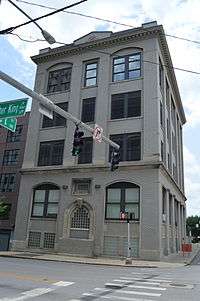
Lexington Herald Building |
|
000000001982-10-29-0000October 29, 1982
(#82001565) |
121 Walnut St.
38°02′44″N 84°29′41″W / 38.045556°N 84.494722°W / 38.045556; -84.494722 (Lexington Herald Building) |
Lexington |
|
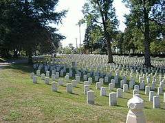
| 83 |
Lexington National Cemetery |
|
000000001998-09-03-0000September 3, 1998
(#98001135) |
833 W. Main St.
38°03′28″N 84°30′40″W / 38.057778°N 84.511111°W / 38.057778; -84.511111 (Lexington National Cemetery) |
Lexington |
|
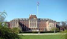
| 84 |
Lexington Veterans Administration Hospital |
|
000000002012-03-28-0000March 28, 2012
(#12000150) |
2250 Leestown Rd.
38°04′20″N 84°32′24″W / 38.072351°N 84.540088°W / 38.072351; -84.540088 (Lexington Veterans Administration Hospital) |
Lexington |
|
| 85 |
Lexington-Fayette County Government Building Block |
|
000000001983-05-19-0000May 19, 1983
(#83002763) |
200-228 E. Main St.
38°02′41″N 84°29′44″W / 38.044722°N 84.495556°W / 38.044722; -84.495556 (Lexington-Fayette County Government Building Block) |
Lexington |
|
| 86 |
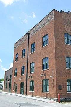
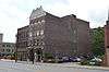
Liggett and Myers Harpring Tobacco Storage Warehouse |
|
000000002013-03-27-0000March 27, 2013
(#13000110) |
1211 Manchester St.
38°03′27″N 84°31′12″W / 38.057500°N 84.520000°W / 38.057500; -84.520000 (Liggett and Myers Harpring Tobacco Storage Warehouse) |
Lexington |
The Liggett and Myers Harpring Tobacco Storage Warehouse as it originally was - with both water towers.
|
| 87 |
Liggett and Myers Tobacco Re-handling Facility |
|
000000002003-04-11-0000April 11, 2003
(#03000261) |
200 Bolivar St.
38°02′33″N 84°30′23″W / 38.042500°N 84.506389°W / 38.042500; -84.506389 (Liggett and Myers Tobacco Re-handling Facility) |
Lexington |
|
| 88 |
Mary Todd Lincoln House |
|
000000001971-08-12-0000August 12, 1971
(#71000341) |
574 W. Main St.
38°03′05″N 84°30′10″W / 38.051389°N 84.502778°W / 38.051389; -84.502778 (Mary Todd Lincoln House) |
Lexington |
|
| 89 |
Loudoun House |
|
000000001973-02-06-0000February 6, 1973
(#73000798) |
Corner of Bryan Ave. and Castlewood Dr.
38°03′19″N 84°28′33″W / 38.055278°N 84.475833°W / 38.055278; -84.475833 (Loudoun House) |
Lexington |
|
| 90 |
Mansfield |
|
000000001982-08-19-0000August 19, 1982
(#82002689) |
Richmond Rd.
38°01′16″N 84°28′13″W / 38.021111°N 84.470278°W / 38.021111; -84.470278 (Mansfield) |
Lexington |
|
| 91 |
Courtney Mathews House |
|
000000002011-08-18-0000August 18, 2011
(#11000535) |
547 Breckinridge St.
38°02′53″N 84°28′37″W / 38.048056°N 84.476944°W / 38.048056; -84.476944 (Courtney Mathews House) |
Lexington |
|
| 92 |
Maxwell Place |
|
000000001982-10-29-0000October 29, 1982
(#82000472) |
Rose St., University of Kentucky
38°02′10″N 84°30′11″W / 38.036111°N 84.503056°W / 38.036111; -84.503056 (Maxwell Place) |
Lexington |
|
| 93 |
McAdams and Morford Building |
|
000000001973-10-25-0000October 25, 1973
(#73000799) |
200-210 W. Main St.
38°02′50″N 84°29′54″W / 38.047222°N 84.498333°W / 38.047222; -84.498333 (McAdams and Morford Building) |
Lexington |
|
| 94 |
Benjamin McCann House |
Upload image |
000000001982-06-03-0000June 3, 1982
(#82002690) |
Old Richmond Pike
37°57′51″N 84°25′01″W / 37.964167°N 84.416944°W / 37.964167; -84.416944 (Benjamin McCann House) |
Lexington |
|
| 95 |
Neal McCann House |
Upload image |
000000001982-06-03-0000June 3, 1982
(#82002691) |
5364 Todds Rd.
37°59′37″N 84°21′07″W / 37.993611°N 84.351944°W / 37.993611; -84.351944 (Neal McCann House) |
Lexington |
|
| 96 |
John McCauley House |
|
000000001980-12-04-0000December 4, 1980
(#80001518) |
319 Lexington Ave.
38°02′28″N 84°30′00″W / 38.041111°N 84.500000°W / 38.041111; -84.500000 (John McCauley House) |
Lexington |
|
| 97 |
McConnell Springs |
|
000000001976-01-17-0000January 17, 1976
(#76000874) |
Address Restricted
|
Lexington |
|
| 98 |
James McConnell House |
|
000000001983-06-23-0000June 23, 1983
(#83002764) |
Old Frankfort Pike
38°03′27″N 84°31′15″W / 38.057500°N 84.520972°W / 38.057500; -84.520972 (James McConnell House) |
Lexington |
|
| 99 |
William McConnell House |
|
000000001983-06-23-0000June 23, 1983
(#83002765) |
Forbes Rd.
38°03′33″N 84°31′24″W / 38.059167°N 84.523333°W / 38.059167; -84.523333 (William McConnell House) |
Lexington |
|
| 100 |
McCracken-Wilgus House |
|
000000001978-12-22-0000December 22, 1978
(#78001320) |
327 Wilgus St.
38°02′43″N 84°29′09″W / 38.045278°N 84.485972°W / 38.045278; -84.485972 (McCracken-Wilgus House) |
Lexington |
|
| 101 |
Dr. John McGarvey House |
|
000000001974-05-15-0000May 15, 1974
(#74000864) |
362 S. Mill St.
38°02′44″N 84°30′08″W / 38.045556°N 84.502361°W / 38.045556; -84.502361 (Dr. John McGarvey House) |
Lexington |
|
| 102 |
Charles McPheeters House |
|
000000001974-05-15-0000May 15, 1974
(#74000865) |
352 S. Mill St.
38°02′45″N 84°30′07″W / 38.045833°N 84.502083°W / 38.045833; -84.502083 (Charles McPheeters House) |
Lexington |
|
| 103 |
Mentelle Park |
|
000000001985-11-27-0000November 27, 1985
(#85002973) |
Mentelle Pk.
38°02′06″N 84°28′48″W / 38.035°N 84.48°W / 38.035; -84.48 (Mentelle Park) |
Lexington |
|
| 104 |
Middle Reaches of Boone Creek Rural Historic District |
Upload image |
000000001996-05-31-0000May 31, 1996
(#96000429) |
Roughly bounded by U.S. Route 421, Jones Nursery, Coombs Ferry, Sulpher Well Rds., and U.S. Route 25
37°57′34″N 84°19′17″W / 37.959444°N 84.321389°W / 37.959444; -84.321389 (Middle Reaches of Boone Creek Rural Historic District) |
Lexington |
Extends into Clark County
|
| 105 |
Miller Brothers Building |
|
000000001980-04-02-0000April 2, 1980
(#80001519) |
359-361 W. Main St.
38°02′56″N 84°29′58″W / 38.048889°N 84.499444°W / 38.048889; -84.499444 (Miller Brothers Building) |
Lexington |
|
| 106 |
Moore-Redd-Frazer House |
|
000000001976-10-21-0000October 21, 1976
(#76000875) |
Georgetown Pike
38°04′48″N 84°30′47″W / 38.08°N 84.513056°W / 38.08; -84.513056 (Moore-Redd-Frazer House) |
Lexington |
|
| 107 |
John Hunt Morgan Memorial |
|
000000001997-07-17-0000July 17, 1997
(#97000704) |
Courthouse Lawn, junction of N. Upper and E. Main St.
38°02′51″N 84°29′55″W / 38.0475°N 84.498611°W / 38.0475; -84.498611 (John Hunt Morgan Memorial) |
Lexington |
|
| 108 |
Will Morton Tavern Stand |
|
000000001978-01-03-0000January 3, 1978
(#78001321) |
137 S. Limestone St.
38°02′44″N 84°29′54″W / 38.045556°N 84.498333°W / 38.045556; -84.498333 (Will Morton Tavern Stand) |
Lexington |
|
| 109 |
William Morton House |
|
000000001975-06-10-0000June 10, 1975
(#75000750) |
518 Limestone St.
38°03′08″N 84°29′14″W / 38.052222°N 84.487222°W / 38.052222; -84.487222 (William Morton House) |
Lexington |
|
| 110 |
Mt. Horeb Archeological District |
Upload image |
000000001998-02-12-0000February 12, 1998
(#98000088) |
Address Restricted
|
Lexington vicinity |
|
| 111 |
Mt. Horeb Earthworks, Unit A |
Upload image |
000000001975-10-10-0000October 10, 1975
(#75000751) |
Address Restricted
|
Lexington |
|
| 112 |
New Zion Historic District |
Upload image |
000000002008-12-04-0000December 4, 2008
(#08001118) |
4972 Newtown Pike through 5200 Newtown Pike, and 103-135 New Zion Rd.
38°10′43″N 84°29′20″W / 38.178704°N 84.488779°W / 38.178704; -84.488779 (New Zion Historic District) |
Georgetown |
Extends into Scott County
|
| 113 |
North Broadway-Short Street Historic District |
|
000000001983-09-15-0000September 15, 1983
(#83000560) |
N. Broadway and W. Short St.
38°02′59″N 84°29′55″W / 38.049722°N 84.498611°W / 38.049722; -84.498611 (North Broadway-Short Street Historic District) |
Lexington |
|
| 114 |
North Limestone Commercial District |
|
000000001983-11-03-0000November 3, 1983
(#83003652) |
N. Limestone St. between Church and 3rd Sts.
38°02′52″N 84°29′43″W / 38.047778°N 84.495278°W / 38.047778; -84.495278 (North Limestone Commercial District) |
Lexington |
|
| 115 |
Northeast Residential Historic District |
|
000000001985-10-17-0000October 17, 1985
(#85003151) |
Roughly bounded by E. 5th St., Kleiser Ave. and Campsie Pl., E. 4th St., and Humbard Alley
38°02′58″N 84°29′18″W / 38.049444°N 84.488333°W / 38.049444; -84.488333 (Northeast Residential Historic District) |
Lexington |
|
| 116 |
Northside Historic Residential District |
|
000000001979-08-28-0000August 28, 1979
(#79000977) |
Roughly bounded by railroad tracks, N. Limestone, W. Short, and Newtown Sts.; also 337-371 N. Limestone, 400-465 N. Limestone, and 356 Morris St.
38°03′17″N 84°29′37″W / 38.054722°N 84.493611°W / 38.054722; -84.493611 (Northside Historic Residential District) |
Lexington |
Second set of boundaries represents a boundary increase of 000000001982-05-24-0000May 24, 1982
|
| 117 |
Odd Fellows Temple |
|
000000001980-02-27-0000February 27, 1980
(#80001520) |
115-119 W. Main St.
38°02′48″N 84°29′50″W / 38.046667°N 84.497222°W / 38.046667; -84.497222 (Odd Fellows Temple) |
Lexington |
|
| 118 |
Old Morrison, Transylvania College |
|
000000001966-10-15-0000October 15, 1966
(#66000358) |
W. 3rd St. between Upper St. and Broadway
38°03′05″N 84°29′36″W / 38.051389°N 84.493333°W / 38.051389; -84.493333 (Old Morrison, Transylvania College) |
Lexington |
|
| 119 |
Opera House and Yates Bookshop Building |
|
000000001975-06-11-0000June 11, 1975
(#75000752) |
141 and 145 N. Broadway
38°02′59″N 84°29′57″W / 38.049722°N 84.499028°W / 38.049722; -84.499028 (Opera House and Yates Bookshop Building) |
Lexington |
|
| 120 |
Henry Payne House |
Upload image |
000000001983-06-23-0000June 23, 1983
(#83002767) |
Off U.S. Route 421
38°06′56″N 84°37′01″W / 38.115556°N 84.616944°W / 38.115556; -84.616944 (Henry Payne House) |
Lexington |
|
| 121 |
James E. Pepper Distillery |
|
000000002009-02-11-0000February 11, 2009
(#09000006) |
1200 Manchester St.
38°03′24″N 84°31′12″W / 38.056667°N 84.520000°W / 38.056667; -84.520000 (James E. Pepper Distillery) |
Lexington |
|
| 122 |
Peoples Federal Savings and Loan Association |
Upload image |
000000002016-02-12-0000February 12, 2016
(#15000650) |
343 S. Broadway
38°02′49″N 84°30′10″W / 38.046854°N 84.502908°W / 38.046854; -84.502908 (Peoples Federal Savings and Loan Association) |
Lexington |
|
| 123 |
James Pettit's Mill |
Upload image |
000000001983-06-23-0000June 23, 1983
(#83002768) |
Kentucky Route 418
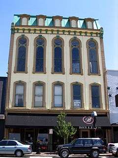
37°55′56″N 84°20′24″W / 37.932222°N 84.34°W / 37.932222; -84.34 (James Pettit's Mill) |
Ford |
|
| 124 |
Pisgah Rural Historic District |
Upload image |
000000001989-02-10-0000February 10, 1989
(#88003348) |
Area northeast of Versailles roughly bounded by S. Elkhorn Creek, U.S. Route 60, and Big Sink Rd.
38°05′08″N 84°39′40″W / 38.085556°N 84.661111°W / 38.085556; -84.661111 (Pisgah Rural Historic District) |
Lexington |
|
| 125 |
William Poindexter House |
|
000000001974-05-15-0000May 15, 1974
(#74000867) |
359 S. Mill St.
38°02′45″N 84°30′09″W / 38.045833°N 84.502500°W / 38.045833; -84.502500 (William Poindexter House) |
Lexington |
|
| 126 |
Poplar Grove |
Upload image |
000000001982-08-19-0000August 19, 1982
(#82002693) |
2088 Parkers Mill Rd.
38°01′42″N 84°34′27″W / 38.028333°N 84.574167°W / 38.028333; -84.574167 (Poplar Grove) |
Lexington |
|
| 127 |
Pugh Price House |
Upload image |
000000001979-09-25-0000September 25, 1979
(#79000978) |
2245 Liberty Rd.
38°01′40″N 84°26′36″W / 38.027778°N 84.443333°W / 38.027778; -84.443333 (Pugh Price House) |
Lexington |
|
| 128 |
Williamson Price House |
Upload image |
000000001979-09-25-0000September 25, 1979
(#79000979) |
2497 Liberty Rd.
38°01′14″N 84°26′09″W / 38.020556°N 84.435833°W / 38.020556; -84.435833 (Williamson Price House) |
Lexington |
|
| 129 |
Lewis Ramsey, Jr., House |
Upload image |
000000001991-03-06-0000March 6, 1991
(#91000121) |
3797 Old Frankfort Pike
38°05′17″N 84°35′36″W / 38.088056°N 84.593333°W / 38.088056; -84.593333 (Lewis Ramsey, Jr., House) |
Lexington |
|
| 130 |
Randall Building Bogaert's Jewelry Store |
|
000000001982-09-09-0000September 9, 1982
(#82002694) |
127-129 W. Main St.
38°02′49″N 84°29′50″W / 38.046944°N 84.497222°W / 38.046944; -84.497222 (Randall Building Bogaert's Jewelry Store) |
Lexington |
|
| 131 |
Redd Road Rural Historic District |
Upload image |
000000001991-02-28-0000February 28, 1991
(#91000153) |
Area largely south and east of the junction of Redd and Frankfort Roads
38°05′30″N 84°37′34″W / 38.091667°N 84.626111°W / 38.091667; -84.626111 (Redd Road Rural Historic District) |
Lexington |
|
| 132 |
Ridgely House |
|
000000001973-05-07-0000May 7, 1973
(#73000800) |
190 Market St.
38°02′58″N 84°29′45″W / 38.049306°N 84.495833°W / 38.049306; -84.495833 (Ridgely House) |
Lexington |
|
| 133 |
Rockefeller Mound |
Upload image |
000000001998-02-12-0000February 12, 1998
(#98000087) |
Address Restricted
|
Lexington |
|
| 134 |
Joseph Hale Rogers House |
Upload image |
000000001979-11-15-0000November 15, 1979
(#79000980) |
East of Lexington on Bryan Station Pike
38°04′37″N 84°24′53″W / 38.076944°N 84.414722°W / 38.076944; -84.414722 (Joseph Hale Rogers House) |
Lexington |
|
| 135 |
Rose Hill |
|
000000001974-12-30-0000December 30, 1974
(#74000868) |
461 N. Limestone St.
38°03′08″N 84°29′22″W / 38.052222°N 84.489444°W / 38.052222; -84.489444 (Rose Hill) |
Lexington |
|
| 136 |
Robert Russel House |
Upload image |
000000001983-06-23-0000June 23, 1983
(#83002769) |
Off Kentucky Route 353
38°08′55″N 84°25′43″W / 38.148611°N 84.428611°W / 38.148611; -84.428611 (Robert Russel House) |
Centerville |
|
| 137 |
Russell School |
|
000000002006-04-05-0000April 5, 2006
(#06000215) |
201 W. 5th St.
38°03′14″N 84°29′22″W / 38.053889°N 84.489444°W / 38.053889; -84.489444 (Russell School) |
Lexington |
|
| 138 |
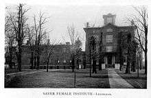
Sayre Female Institute |
|
000000001982-08-19-0000August 19, 1982
(#82002695) |
194 N. Limestone St.
38°02′53″N 84°29′39″W / 38.048056°N 84.494167°W / 38.048056; -84.494167 (Sayre Female Institute) |
Lexington |
|
| 139 |
Scott and Wilson Houses District |
|
000000001974-12-31-0000December 31, 1974
(#74000869) |
324, 328, 330, 336 S. Mill St.
38°02′46″N 84°30′06″W / 38.046111°N 84.501667°W / 38.046111; -84.501667 (Scott and Wilson Houses District) |
Lexington |
|
| 140 |
Second Presbyterian Church |
|
000000001980-08-11-0000August 11, 1980
(#80001522) |
460 E. Main St.
38°02′24″N 84°29′25″W / 38.040000°N 84.490278°W / 38.040000; -84.490278 (Second Presbyterian Church) |
Lexington |
|
| 141 |
Shady Side |
Upload image |
000000001976-11-07-0000November 7, 1976
(#76000876) |
4 miles (6.4 km) east of Lexington on U.S. Route 68
38°05′27″N 84°25′45″W / 38.090833°N 84.429167°W / 38.090833; -84.429167 (Shady Side) |
Lexington |
|
| 142 |
Shelby Family Houses |
Upload image |
000000001978-11-17-0000November 17, 1978
(#78001322) |
Southeast of Lexington on Richmond Rd., Shelby Lane, and Jacks Creek Pike
37°56′11″N 84°25′24″W / 37.936389°N 84.423333°W / 37.936389; -84.423333 (Shelby Family Houses) |
Lexington |
|
| 143 |
Frederick Shryack House |
Upload image |
000000001983-06-23-0000June 23, 1983
(#83002770) |
Off Kentucky Route 859
38°03′44″N 84°20′03″W / 38.062222°N 84.334167°W / 38.062222; -84.334167 (Frederick Shryack House) |
Clintonville |
|
| 144 |
Mitchell Baker Smith Company Building |
Upload image |
000000001980-08-26-0000August 26, 1980
(#80001523) |
230-232 W. Main St.
38°02′51″N 84°29′55″W / 38.047500°N 84.498611°W / 38.047500; -84.498611 (Mitchell Baker Smith Company Building) |
Lexington |
|
| 145 |
South Hill Historic District |
|
000000001978-06-13-0000June 13, 1978
(#78001323) |
Roughly bounded by S. Broadway, W. High, S. Limestone, and Pine Sts.
38°02′42″N 84°30′07″W / 38.045°N 84.501944°W / 38.045; -84.501944 (South Hill Historic District) |
Lexington |
|
| 146 |
Southeast Greyhound Line Building |
Upload image |
000000002014-01-08-0000January 8, 2014
(#13001048) |
101 W. Loudon St.
38°03′28″N 84°28′54″W / 38.057778°N 84.481667°W / 38.057778; -84.481667 (Southeast Greyhound Line Building) |
Lexington |
|
| 147 |
Southeast Lexington Residential and Commercial District |
|
000000001984-08-01-0000August 1, 1984
(#84001415) |
Roughly bounded by High St., Rose Lane, and Lexington and Woodland Aves.
38°02′18″N 84°29′46″W / 38.038333°N 84.496111°W / 38.038333; -84.496111 (Southeast Lexington Residential and Commercial District) |
Lexington |
|
| 148 |
Southern Railway Passenger Depot |
|
000000001987-08-13-0000August 13, 1987
(#87001364) |
701 S. Broadway
38°02′34″N 84°30′37″W / 38.042778°N 84.510278°W / 38.042778; -84.510278 (Southern Railway Passenger Depot) |
Lexington |
|
| 149 |
Spindletop Farm |
Upload image |
000000002012-09-20-0000September 20, 2012
(#12000447) |
3414 Ironworks Pike
38°07′55″N 84°30′18″W / 38.131898°N 84.504917°W / 38.131898; -84.504917 (Spindletop Farm) |
Lexington |
|
| 150 |
Spring Hill Farm |
|
000000001978-02-17-0000February 17, 1978
(#78001324) |
1401 Old Frankfort Pike
38°03′30″N 84°31′46″W / 38.058472°N 84.529444°W / 38.058472; -84.529444 (Spring Hill Farm) |
Lexington |
|
| 151 |
Springview Farm |
|
000000002012-08-06-0000August 6, 2012
(#12000448) |
3076 Royster Rd.
38°03′00″N 84°22′49″W / 38.049941°N 84.380141°W / 38.049941; -84.380141 (Springview Farm) |
Lexington |
|
| 152 |
Drewsilla Steele House |
Upload image |
000000001991-02-22-0000February 22, 1991
(#91000120) |
3951 Old Frankfort Pike
38°05′22″N 84°35′55″W / 38.089444°N 84.598611°W / 38.089444; -84.598611 (Drewsilla Steele House) |
Lexington |
|
| 153 |
Stony Point |
Upload image |
000000001979-08-07-0000August 7, 1979
(#79000981) |
4935 Parkers Mill Rd.
38°01′34″N 84°37′10″W / 38.026111°N 84.619444°W / 38.026111; -84.619444 (Stony Point) |
Lexington |
|
| 154 |
William Lytle Todd House |
Upload image |
000000001979-07-17-0000July 17, 1979
(#79000982) |
West of Lexington at 3725 Bowman Mill
38°01′19″N 84°35′40″W / 38.021944°N 84.594444°W / 38.021944; -84.594444 (William Lytle Todd House) |
Lexington |
|
| 155 |
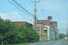
Trotter's Warehouse |
|
000000001976-06-18-0000June 18, 1976
(#76000877) |
122-124 S. Mill St.
38°02′51″N 84°29′58″W / 38.0475°N 84.499444°W / 38.0475; -84.499444 (Trotter's Warehouse) |
Lexington |
Site now occupied by the Lexington Financial Center
|
| 156 |
United States Post Office and Court House |
|
000000001999-03-18-0000March 18, 1999
(#99000335) |
101 Barr St.
38°02′50″N 84°29′42″W / 38.047222°N 84.495000°W / 38.047222; -84.495000 (United States Post Office and Court House) |
Lexington |
|
| 157 |
Victorian Commercial Block |
|
000000001978-07-21-0000July 21, 1978
(#78001325) |
Bounded by Broadway, Main, Short, and Spring Sts.
38°02′58″N 84°30′00″W / 38.049444°N 84.5°W / 38.049444; -84.5 (Victorian Commercial Block) |
Lexington |
|
| 158 |
Walnut Hill Presbyterian Church |
Upload image |
000000001973-05-07-0000May 7, 1973
(#73000801) |
East of Lexington off U.S. Route 25
37°58′07″N 84°25′29″W / 37.968611°N 84.424722°W / 37.968611; -84.424722 (Walnut Hill Presbyterian Church) |
Lexington |
|
| 159 |
Dr. Walter Warfield Building |
|
000000001980-08-11-0000August 11, 1980
(#80001524) |
122-124 N. Upper St. and 140-160 W. Short St.
38°02′51″N 84°29′50″W / 38.047500°N 84.497222°W / 38.047500; -84.497222 (Dr. Walter Warfield Building) |
Lexington |
|
| 160 |
Thomas B. Watkins House |
|
000000001982-06-29-0000June 29, 1982
(#82002696) |
1008 S. Broadway
38°02′18″N 84°30′55″W / 38.038333°N 84.515278°W / 38.038333; -84.515278 (Thomas B. Watkins House) |
Lexington |
|
| 161 |
Henry Watt House |
|
000000001977-12-16-0000December 16, 1977
(#77000615) |
703 W. High St.
38°03′01″N 84°30′17″W / 38.050278°N 84.504722°W / 38.050278; -84.504722 (Henry Watt House) |
Lexington |
|
| 162 |
Waveland |
|
000000001971-08-12-0000August 12, 1971
(#71000342) |
5 miles (8.0 km) south of Lexington off U.S. Route 27
37°58′17″N 84°32′14″W / 37.971389°N 84.537222°W / 37.971389; -84.537222 (Waveland) |
Lexington |
|
| 163 |
West Fayette County Rural Historic District |
Upload image |
000000001991-02-28-0000February 28, 1991
(#91000154) |
Roughly bounded by Rice, Van Meter, Elk Chester, Yarnallton, Leestown, and Viley Rds., and U.S. Route 60
38°04′02″N 84°35′00″W / 38.067222°N 84.583333°W / 38.067222; -84.583333 (West Fayette County Rural Historic District) |
Lexington |
|
| 164 |
West High Street Historic District |
|
000000001969-07-10-0000July 10, 1969
(#69000366) |
Northern side of the 100-300 blocks of W. High St.
38°02′49″N 84°30′03″W / 38.046944°N 84.500833°W / 38.046944; -84.500833 (West High Street Historic District) |
Lexington |
|
| 165 |
Western Suburb Historic District |
|
000000001976-06-18-0000June 18, 1976
(#76000878) |
Irregular pattern along W. Short St. from Saunter to Kentucky Route 922
38°03′09″N 84°30′09″W / 38.052500°N 84.502500°W / 38.052500; -84.502500 (Western Suburb Historic District) |
Lexington |
|
| 166 |
Wolf Wile Department Store Building |
|
000000001996-07-31-0000July 31, 1996
(#96000795) |
248-250 E. Main St.
38°02′37″N 84°29′40″W / 38.043611°N 84.494444°W / 38.043611; -84.494444 (Wolf Wile Department Store Building) |
Lexington |
|
| 167 |
Woodland |
|
000000001975-08-28-0000August 28, 1975
(#75000753) |
1 mile (1.6 km) east of Lexington on Squires Rd. off U.S. Route 421
37°58′25″N 84°27′37″W / 37.973611°N 84.460278°W / 37.973611; -84.460278 (Woodland) |
Lexington |
|
| 168 |
Woodlands Historic District |
|
000000001983-08-18-0000August 18, 1983
(#83002771) |
Roughly bounded by Main and High Sts., Ashland and Woodland Aves.
38°02′06″N 84°29′21″W / 38.035°N 84.489167°W / 38.035; -84.489167 (Woodlands Historic District) |
Lexington |
|
| 169 |
Woodstock |
Upload image |
000000001975-05-12-0000May 12, 1975
(#75000754) |
Todds Rd.
37°59′23″N 84°21′25″W / 37.989722°N 84.356944°W / 37.989722; -84.356944 (Woodstock) |
Lexington |
|
| 170 |
Woodward Heights Neighborhood Historic District |
|
000000001980-12-01-0000December 1, 1980
(#80001525) |
Roughly bounded by High, Merino, and Pine Sts.
38°03′00″N 84°30′25″W / 38.05°N 84.506944°W / 38.05; -84.506944 (Woodward Heights Neighborhood Historic District) |
Lexington |
|
| 171 |
F.W. Woolworth Building |
|
000000002002-09-06-0000September 6, 2002
(#02000924) |
106 Main St.
38°02′47″N 84°29′51″W / 38.046389°N 84.497500°W / 38.046389; -84.497500 (F.W. Woolworth Building) |
Lexington |
Demolished in October 2004[5]
|
| 172 |
Allen Worley and Foushee Houses |
|
000000001976-01-20-0000January 20, 1976
(#76000879) |
355, 361, and 367 S. Broadway
38°02′48″N 84°30′13″W / 38.046667°N 84.503611°W / 38.046667; -84.503611 (Allen Worley and Foushee Houses) |
Lexington |
|
| 173 |
Charles Young Park and Community Center |
Upload image |
000000002016-02-09-0000February 9, 2016
(#15000413) |
540 E. 3rd St.
38°02′35″N 84°29′03″W / 38.043121°N 84.484132°W / 38.043121; -84.484132 (Charles Young Park and Community Center) |
Lexington |
|


.jpg)


.jpg)
.jpg)
.jpg)