Oosterhout
| Oosterhout | |||
|---|---|---|---|
| Municipality | |||
|
Market square in Oosterhout | |||
| |||
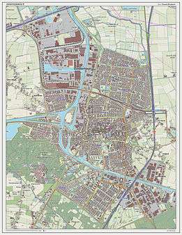
.svg.png) Location in North Brabant | |||
| Coordinates: 51°38′N 4°52′E / 51.633°N 4.867°ECoordinates: 51°38′N 4°52′E / 51.633°N 4.867°E | |||
| Country | Netherlands | ||
| Province | North Brabant | ||
| Government[1] | |||
| • Body | Municipal council | ||
| • Mayor | Stefan Huisman (VVD) | ||
| Area[2] | |||
| • Total | 73.09 km2 (28.22 sq mi) | ||
| • Land | 71.47 km2 (27.59 sq mi) | ||
| • Water | 1.62 km2 (0.63 sq mi) | ||
| Elevation[3] | 5 m (16 ft) | ||
| Population (May 2014)[4] | |||
| • Total | 53,771 | ||
| • Density | 752/km2 (1,950/sq mi) | ||
| Demonym(s) | Oosterhouter | ||
| Time zone | CET (UTC+1) | ||
| • Summer (DST) | CEST (UTC+2) | ||
| Postcode | 4849, 4900–4911 | ||
| Area code | 0162 | ||
| Website |
www | ||


Oosterhout (Dutch pronunciation: [ˈoːstərɦʌut]; from ooster, "eastern", and hout, "woods") is a municipality and a city in the southern Netherlands. The municipality had a population of 53,771 in 2014.
Population centers
The municipality of Oosterhout includes the following places:
|
|
|
History
Oosterhout is mentioned for the first time in 1277, although archaeological excavations showed the existence of human settlements in the area in prehistoric times. The Knights Templar had a temple here dedicated to St. John the Baptist. It was home to a castle which later acquired control over the surrounding area, up to Breda and Bergen op Zoom. The castle was destroyed by Spanish troops during the Eighty Years War, in 1573; only a tower of it survives today.
The city became the seat of a flourishing ceramics industry, which lasted until the 19th century. In 1625 the city was besieged by Frederick Henry, Prince of Orange, and suffered heavy damage.
Despite the rise of Protestantism, it was home to several Catholic monasteries, including that of the Premonstratensians, which is still active. Oosterhout received city rights in 1809, by will of Louis Bonaparte.
Main sights
- Slotjes (Castle)
- Unfinished basilica of St. John. A Romanesque church existed in 1277, but from around 1473 it was rebuilt in the current Gothic style, being finished in 1493. The tower was constructed from 1519 to 1552. It was restored several times in the following centuries.
- Monastery of St. Catherine, once a castle held by the Knights Hospitaller.
- Slotbossetoren, destroyed castle
Sport
Oosterhout is home to several sports clubs, for example volleyball club VOKO, football clubs SCO-Tofs, VV Oosterhout, baseball club Twins and hockey club De Warande.
Sport Clubs:
- VOKO, Volleyball
- ATV Scorpio, Athletics
- SCO-Tofs, Football
- TSC, Football
- VV Oosterhout, Football
- De Warande, Hockey
- OZ&PC De Warande, Swimming and Water polo
- De Voltreffers, Korfball
Notable residents
- Marinus De Jong, composer and pianist
- Extince (Peter Kops), Dutch rapper
- Marlies Dekkers, lingerie designer
References
- ↑ "Burgemeester mr. drs. S.W.Th. Huisman" (in Dutch). Gemeente Oosterhout. Retrieved 2 June 2014.
- ↑ "Kerncijfers wijken en buurten" [Key figures for neighbourhoods]. CBS Statline (in Dutch). CBS. 2 July 2013. Retrieved 12 March 2014.
- ↑ "Postcodetool for 4902ZP". Actueel Hoogtebestand Nederland (in Dutch). Het Waterschapshuis. Retrieved 2 June 2014.
- ↑ "Bevolkingsontwikkeling; regio per maand" [Population growth; regions per month]. CBS Statline (in Dutch). CBS. 26 June 2014. Retrieved 24 July 2014.
External links
 Media related to Oosterhout, North Brabant at Wikimedia Commons
- Official website
 |
Drimmelen | Geertruidenberg | | |
| |
Dongen | |||
| ||||
| | ||||
| Breda | Gilze en Rijen |
