Veldhoven
| Veldhoven | |||
|---|---|---|---|
| Municipality | |||
|
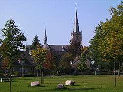
Church in Veldhoven | |||
| |||
.svg.png) Location in North Brabant | |||
| Coordinates: 51°25′N 5°24′E / 51.417°N 5.400°ECoordinates: 51°25′N 5°24′E / 51.417°N 5.400°E | |||
| Country | Netherlands | ||
| Province | North Brabant | ||
| Government[1] | |||
| • Body | Municipal council | ||
| • Mayor | Jack Mikkers (VVD) | ||
| Area[2] | |||
| • Total | 31.93 km2 (12.33 sq mi) | ||
| • Land | 31.73 km2 (12.25 sq mi) | ||
| • Water | 0.20 km2 (0.08 sq mi) | ||
| Elevation[3] | 22 m (72 ft) | ||
| Population (May 2014)[4] | |||
| • Total | 44,173 | ||
| • Density | 1,392/km2 (3,610/sq mi) | ||
| Demonym(s) | Veldhovenaar | ||
| Time zone | CET (UTC+1) | ||
| • Summer (DST) | CEST (UTC+2) | ||
| Postcode | 5500–5509 | ||
| Area code | 040 | ||
| Website |
www | ||


Veldhoven (Dutch pronunciation: [ˈvɛltˌɦoːvə(n)]) is a municipality and a town on the Gender stream in the southern Netherlands, located just southwest of Eindhoven.
Topography

Dutch topographic map of Veldhoven (town), Dec. 2013
Population centres
The modern town of Veldhoven is an agglomeration of formerly rural villages that in the twentieth century grew together to form one large suburban area catering to Eindhoven commuter needs. The villages are Veldhoven proper to the southwest, Meerveldhoven to the southeast, Oerle to the west and Zeelst to the northeast. A new city center was constructed between Zeelst and Veldhoven.
Economy
Veldhoven is home to the headquarters of the manufacturer of high-tech (semiconductor) lithography equipment ASML. ASML occupies the highest building (83 meters) in Veldhoven. The municipality features a large industrial and office area along the Gender, which also includes the second-largest hospital in the Eindhoven urban region, Máxima Medisch Centrum.
Culture
The yearly festival Cult en Tumult offers a varied program of art and culture in the broadest sense. Theatre De Schalm is near the City Centrum.
The spoken language is Kempenlands (an East Brabantian dialect, which is very similar to colloquial Dutch).[5]
Town council
The current town council of Veldhoven was elected at the Dutch 2014 local elections of March 19th, 2014.
| Council seats[6][7][8][9] | |||||
|---|---|---|---|---|---|
| Party | 1998 | 2002 | 2006 | 2010 | 2014 |
| VSA | 5 | 8 | 8 | 7 | 6 |
| GBV | 3 | 5 | 4 | 5 | 6 |
| VVD | 5 | 4 | 4 | 5 | 5 |
| CDA | 7 | 7 | 5 | 4 | 4 |
| D66 | 1 | 0 | 0 | 2 | 3 |
| PvdA | 3 | 3 | 6 | 3 | 2 |
| Samenwerkend Veldhoven | 0 | 0 | 0 | 1 | 1 |
| SP | 3 | 0 | 0 | 0 | 0 |
| Total | 27 | 27 | 27 | 27 | 27 |
Transport
Eindhoven Airport is located nearby Veldhoven on the border with Eindhoven in subdivision Meerhoven and is situated on the A2 and A67 motorways. Veldhoven is not connected to the Dutch railway system; nearby Eindhoven is.
References
- ↑ "Burgemeester" [Mayor] (in Dutch). Gemeente Veldhoven. Retrieved 6 June 2014.
- ↑ "Kerncijfers wijken en buurten" [Key figures for neighbourhoods]. CBS Statline (in Dutch). CBS. 2 July 2013. Retrieved 12 March 2014.
- ↑ "Postcodetool for 5501KA". Actueel Hoogtebestand Nederland (in Dutch). Het Waterschapshuis. Retrieved 6 June 2014.
- ↑ "Bevolkingsontwikkeling; regio per maand" [Population growth; regions per month]. CBS Statline (in Dutch). CBS. 26 June 2014. Retrieved 24 July 2014.
- ↑ Jos & Cor Swanenberg: Taal in stad en land: Oost-Brabants, ISBN 9012090105
- ↑ NRC Handelsblad (2002) Gemeenteraadsverkiezingen 6 maart 2002 Veldhoven
- ↑ Gemeente Veldhoven (2006) Uitslag verkiezingen
- ↑ Volkskrant (2010)Uitslagen verkiezingen Gemeenteraad 2010
- ↑ Website Veldhoven (2014)Uitslagen verkiezingen Gemeenteraad 2014
External links
 Media related to Veldhoven at Wikimedia Commons
- Official website
 |
Eindhoven | | ||
| Eersel | |
Eindhoven Waalre | ||
| ||||
| | ||||
| Bergeijk |
