Beynost
| Beynost | ||
|---|---|---|
|
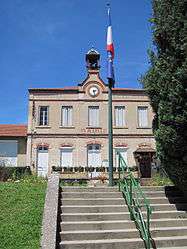
Town hall | ||
| ||
 Beynost | ||
|
Location within Auvergne-Rhône-Alpes region  Beynost | ||
| Coordinates: 45°50′28″N 5°00′07″E / 45.8411°N 5.0019°ECoordinates: 45°50′28″N 5°00′07″E / 45.8411°N 5.0019°E | ||
| Country | France | |
| Region | Auvergne-Rhône-Alpes | |
| Department | Ain | |
| Arrondissement | Bourg-en-Bresse | |
| Canton | Miribel | |
| Government | ||
| • Mayor (2008–2014) | Michel Nicod | |
| Area1 | 10.64 km2 (4.11 sq mi) | |
| Population (2008)2 | 4,305 | |
| • Density | 400/km2 (1,000/sq mi) | |
| Time zone | CET (UTC+1) | |
| • Summer (DST) | CEST (UTC+2) | |
| INSEE/Postal code | 01000 / 01700 | |
| Elevation |
174–322 m (571–1,056 ft) (avg. 150 m or 490 ft) | |
|
1 French Land Register data, which excludes lakes, ponds, glaciers > 1 km² (0.386 sq mi or 247 acres) and river estuaries. 2 Population without double counting: residents of multiple communes (e.g., students and military personnel) only counted once. | ||
.svg.png)
Beynost is a commune in the Ain department in eastern France.
Population
| Historical population | ||
|---|---|---|
| Year | Pop. | ±% |
| 1793 | 770 | — |
| 1800 | 847 | +10.0% |
| 1806 | 862 | +1.8% |
| 1821 | 922 | +7.0% |
| 1831 | 870 | −5.6% |
| 1836 | 852 | −2.1% |
| 1841 | 833 | −2.2% |
| 1846 | 869 | +4.3% |
| 1851 | 909 | +4.6% |
| 1856 | 906 | −0.3% |
| 1861 | 945 | +4.3% |
| 1866 | 960 | +1.6% |
| 1872 | 862 | −10.2% |
| 1876 | 855 | −0.8% |
| 1881 | 869 | +1.6% |
| 1886 | 833 | −4.1% |
| 1891 | 858 | +3.0% |
| 1896 | 902 | +5.1% |
| 1901 | 912 | +1.1% |
| 1906 | 850 | −6.8% |
| 1911 | 865 | +1.8% |
| 1921 | 913 | +5.5% |
| 1926 | 955 | +4.6% |
| 1931 | 1,303 | +36.4% |
| 1936 | 1,117 | −14.3% |
| 1946 | 1,128 | +1.0% |
| 1954 | 1,247 | +10.5% |
| 1962 | 1,386 | +11.1% |
| 1968 | 1,763 | +27.2% |
| 1975 | 2,311 | +31.1% |
| 1982 | 2,714 | +17.4% |
| 1990 | 3,141 | +15.7% |
| 1999 | 3,530 | +12.4% |
| 2008 | 4,305 | +22.0% |
See also
References
| Wikimedia Commons has media related to Beynost. |
This article is issued from Wikipedia - version of the 10/27/2016. The text is available under the Creative Commons Attribution/Share Alike but additional terms may apply for the media files.