Brénod
| Brénod | ||
|---|---|---|
|
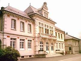
Town hall | ||
| ||
 Brénod | ||
|
Location within Auvergne-Rhône-Alpes region  Brénod | ||
| Coordinates: 46°03′39″N 5°36′22″E / 46.0608°N 5.6061°ECoordinates: 46°03′39″N 5°36′22″E / 46.0608°N 5.6061°E | ||
| Country | France | |
| Region | Auvergne-Rhône-Alpes | |
| Department | Ain | |
| Arrondissement | Nantua | |
| Canton | Brénod | |
| Government | ||
| • Mayor (2008–2014) | Anne Carrier | |
| Area1 | 23.79 km2 (9.19 sq mi) | |
| Population (2008)2 | 531 | |
| • Density | 22/km2 (58/sq mi) | |
| Time zone | CET (UTC+1) | |
| • Summer (DST) | CEST (UTC+2) | |
| INSEE/Postal code | 01060 / 01110 | |
| Elevation |
831–1,136 m (2,726–3,727 ft) (avg. 853 m or 2,799 ft) | |
|
1 French Land Register data, which excludes lakes, ponds, glaciers > 1 km² (0.386 sq mi or 247 acres) and river estuaries. 2 Population without double counting: residents of multiple communes (e.g., students and military personnel) only counted once. | ||
.svg.png)
Brénod is a commune in the Ain department in eastern France
Geography
The commune is located 70 km (43 mi) northeast of Lyon.
The river Albarine rises in the commune's northern part, then flows southward through the commune; the village lies on the right bank of the river.
Population
| Historical population | ||
|---|---|---|
| Year | Pop. | ±% |
| 1793 | 858 | — |
| 1800 | 879 | +2.4% |
| 1806 | 991 | +12.7% |
| 1821 | 941 | −5.0% |
| 1831 | 1,001 | +6.4% |
| 1836 | 987 | −1.4% |
| 1841 | 1,002 | +1.5% |
| 1846 | 1,029 | +2.7% |
| 1851 | 970 | −5.7% |
| 1856 | 943 | −2.8% |
| 1861 | 988 | +4.8% |
| 1866 | 960 | −2.8% |
| 1872 | 885 | −7.8% |
| 1876 | 929 | +5.0% |
| 1881 | 881 | −5.2% |
| 1886 | 872 | −1.0% |
| 1891 | 801 | −8.1% |
| 1896 | 836 | +4.4% |
| 1901 | 755 | −9.7% |
| 1906 | 702 | −7.0% |
| 1911 | 664 | −5.4% |
| 1921 | 627 | −5.6% |
| 1926 | 626 | −0.2% |
| 1931 | 647 | +3.4% |
| 1936 | 602 | −7.0% |
| 1946 | 574 | −4.7% |
| 1954 | 528 | −8.0% |
| 1962 | 509 | −3.6% |
| 1968 | 524 | +2.9% |
| 1975 | 436 | −16.8% |
| 1982 | 431 | −1.1% |
| 1990 | 385 | −10.7% |
| 1999 | 427 | +10.9% |
| 2008 | 531 | +24.4% |
See also
References
| Wikimedia Commons has media related to Brénod. |
This article is issued from Wikipedia - version of the 10/27/2016. The text is available under the Creative Commons Attribution/Share Alike but additional terms may apply for the media files.