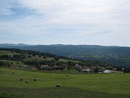
Giron, Ain
| Giron | |
|---|---|
 | |
 Giron | |
|
Location within Auvergne-Rhône-Alpes region  Giron | |
| Coordinates: 46°14′00″N 5°46′00″E / 46.2333°N 5.7667°ECoordinates: 46°14′00″N 5°46′00″E / 46.2333°N 5.7667°E | |
| Country | France |
| Region | Auvergne-Rhône-Alpes |
| Department | Ain |
| Arrondissement | Nantua |
| Canton | Bellegarde-sur-Valserine |
| Government | |
| • Mayor (2008 – 2014) | Irmtraut Pagnier (f) |
| Area1 | 9.39 km2 (3.63 sq mi) |
| Population (2008)2 | 147 |
| • Density | 16/km2 (41/sq mi) |
| Time zone | CET (UTC+1) |
| • Summer (DST) | CEST (UTC+2) |
| INSEE/Postal code | 01174 / 01130 |
| Elevation |
779–1,206 m (2,556–3,957 ft) (avg. 1,000 m or 3,300 ft) |
|
1 French Land Register data, which excludes lakes, ponds, glaciers > 1 km² (0.386 sq mi or 247 acres) and river estuaries. 2 Population without double counting: residents of multiple communes (e.g., students and military personnel) only counted once. | |
Giron is a commune in the Ain department in eastern France.
Population
| Historical population | ||
|---|---|---|
| Year | Pop. | ±% |
| 1793 | 424 | — |
| 1800 | 419 | −1.2% |
| 1806 | 443 | +5.7% |
| 1821 | 424 | −4.3% |
| 1831 | 383 | −9.7% |
| 1836 | 350 | −8.6% |
| 1841 | 325 | −7.1% |
| 1846 | 296 | −8.9% |
| 1851 | 349 | +17.9% |
| 1856 | 320 | −8.3% |
| 1861 | 316 | −1.2% |
| 1866 | 281 | −11.1% |
| 1872 | 312 | +11.0% |
| 1876 | 305 | −2.2% |
| 1881 | 297 | −2.6% |
| 1886 | 298 | +0.3% |
| 1891 | 284 | −4.7% |
| 1896 | 280 | −1.4% |
| 1901 | 265 | −5.4% |
| 1906 | 266 | +0.4% |
| 1911 | 238 | −10.5% |
| 1921 | 235 | −1.3% |
| 1926 | 242 | +3.0% |
| 1931 | 250 | +3.3% |
| 1936 | 231 | −7.6% |
| 1946 | 193 | −16.5% |
| 1954 | 172 | −10.9% |
| 1962 | 140 | −18.6% |
| 1968 | 118 | −15.7% |
| 1975 | 100 | −15.3% |
| 1982 | 99 | −1.0% |
| 1990 | 88 | −11.1% |
| 1999 | 100 | +13.6% |
| 2008 | 147 | +47.0% |
See also
References
| Wikimedia Commons has media related to Giron, Ain. |
This article is issued from Wikipedia - version of the 10/27/2016. The text is available under the Creative Commons Attribution/Share Alike but additional terms may apply for the media files.