Montrevel-en-Bresse
| Montrevel-en-Bresse | ||
|---|---|---|
|
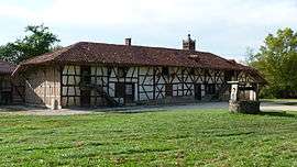
Sougey farm | ||
| ||
 Montrevel-en-Bresse | ||
|
Location within Auvergne-Rhône-Alpes region  Montrevel-en-Bresse | ||
| Coordinates: 46°20′15″N 5°07′44″E / 46.3375°N 5.1289°ECoordinates: 46°20′15″N 5°07′44″E / 46.3375°N 5.1289°E | ||
| Country | France | |
| Region | Auvergne-Rhône-Alpes | |
| Department | Ain | |
| Arrondissement | Bourg-en-Bresse | |
| Canton | Montrevel-en-Bresse | |
| Intercommunality | Montrevel-en-Bresse | |
| Government | ||
| • Mayor (2008–2014) | Jean-Pierre Roche | |
| Area1 | 10.27 km2 (3.97 sq mi) | |
| Population (2008)2 | 2,351 | |
| • Density | 230/km2 (590/sq mi) | |
| Time zone | CET (UTC+1) | |
| • Summer (DST) | CEST (UTC+2) | |
| INSEE/Postal code | 01266 / 01340 | |
| Elevation |
192–220 m (630–722 ft) (avg. 215 m or 705 ft) | |
|
1 French Land Register data, which excludes lakes, ponds, glaciers > 1 km² (0.386 sq mi or 247 acres) and river estuaries. 2 Population without double counting: residents of multiple communes (e.g., students and military personnel) only counted once. | ||
.svg.png)
Montrevel-en-Bresse is a commune in the Ain department in eastern France.
Population
| Historical population | ||
|---|---|---|
| Year | Pop. | ±% |
| 1793 | 1,236 | — |
| 1800 | 1,242 | +0.5% |
| 1806 | 1,118 | −10.0% |
| 1821 | 1,220 | +9.1% |
| 1831 | 1,408 | +15.4% |
| 1836 | 1,390 | −1.3% |
| 1841 | 1,401 | +0.8% |
| 1846 | 1,491 | +6.4% |
| 1851 | 1,464 | −1.8% |
| 1856 | 1,466 | +0.1% |
| 1861 | 1,485 | +1.3% |
| 1866 | 1,496 | +0.7% |
| 1872 | 1,475 | −1.4% |
| 1876 | 1,515 | +2.7% |
| 1881 | 1,545 | +2.0% |
| 1886 | 1,517 | −1.8% |
| 1891 | 1,465 | −3.4% |
| 1896 | 1,483 | +1.2% |
| 1901 | 1,483 | +0.0% |
| 1906 | 1,435 | −3.2% |
| 1911 | 1,468 | +2.3% |
| 1921 | 1,340 | −8.7% |
| 1926 | 1,363 | +1.7% |
| 1931 | 1,340 | −1.7% |
| 1936 | 1,391 | +3.8% |
| 1946 | 1,300 | −6.5% |
| 1954 | 1,343 | +3.3% |
| 1962 | 1,388 | +3.4% |
| 1968 | 1,495 | +7.7% |
| 1975 | 1,653 | +10.6% |
| 1982 | 2,000 | +21.0% |
| 1990 | 1,973 | −1.3% |
| 1999 | 1,994 | +1.1% |
| 2008 | 2,351 | +17.9% |
See also
References
| Wikimedia Commons has media related to Montrevel-en-Bresse. |
This article is issued from Wikipedia - version of the 9/18/2016. The text is available under the Creative Commons Attribution/Share Alike but additional terms may apply for the media files.