Échenevex
| Échenevex | ||
|---|---|---|
 | ||
| ||
 Échenevex | ||
|
Location within Auvergne-Rhône-Alpes region  Échenevex | ||
| Coordinates: 46°18′34″N 6°02′12″E / 46.3094°N 6.0367°ECoordinates: 46°18′34″N 6°02′12″E / 46.3094°N 6.0367°E | ||
| Country | France | |
| Region | Auvergne-Rhône-Alpes | |
| Department | Ain | |
| Arrondissement | Gex | |
| Canton | Gex | |
| Intercommunality | Pays de Gex | |
| Government | ||
| • Mayor (2014) | Pierre Rebeix | |
| Area1 | 16.44 km2 (6.35 sq mi) | |
| Population (2013)2 | 1,988 | |
| • Density | 120/km2 (310/sq mi) | |
| Time zone | CET (UTC+1) | |
| • Summer (DST) | CEST (UTC+2) | |
| INSEE/Postal code | 01153 / 01170 | |
| Elevation |
490–1,682 m (1,608–5,518 ft) (avg. 635 m or 2,083 ft) | |
|
1 French Land Register data, which excludes lakes, ponds, glaciers > 1 km² (0.386 sq mi or 247 acres) and river estuaries. 2 Population without double counting: residents of multiple communes (e.g., students and military personnel) only counted once. | ||
.svg.png)
Échenevex is a commune in the Ain department in eastern France.
Geography
Échenevex is located between the Jura mountains and the Lake Geneva region. It is situated on the slopes of the Jura mountains, just 3 km south of Gex. The Large Hadron Collider passes under Échenevex, about 100m below the surface. Echenevex is situated in the Ain department (01), and in the Rhone Alps Region of France. Echenevex consists partly of the Jura mountains natural park area and is approximately 8 minutes from the Crozet Telecabine Ski Station, and 15 minutes from Geneva International Airport.
Population
| Historical population | ||
|---|---|---|
| Year | Pop. | ±% |
| 1962 | 267 | — |
| 1968 | 282 | +5.6% |
| 1975 | 371 | +31.6% |
| 1982 | 643 | +73.3% |
| 1990 | 997 | +55.1% |
| 1999 | 1,197 | +20.1% |
| 2008 | 1,538 | +28.5% |
| 2013 | 1,988 | +29.3% |
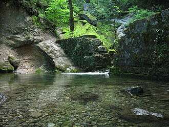
Gallery

.jpg)
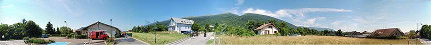
Panoramic view of Echenevex
See also
References
| Wikimedia Commons has media related to Échenevex. |
This article is issued from Wikipedia - version of the 2/11/2016. The text is available under the Creative Commons Attribution/Share Alike but additional terms may apply for the media files.