Monthieux
| Monthieux | |
|---|---|
 | |
 Monthieux | |
|
Location within Auvergne-Rhône-Alpes region  Monthieux | |
| Coordinates: 45°57′28″N 4°56′28″E / 45.9578°N 4.9411°ECoordinates: 45°57′28″N 4°56′28″E / 45.9578°N 4.9411°E | |
| Country | France |
| Region | Auvergne-Rhône-Alpes |
| Department | Ain |
| Arrondissement | Bourg-en-Bresse |
| Canton | Villars-les-Dombes |
| Intercommunality | Centre Dombes |
| Government | |
| • Mayor (2008–2014) | Gisèle Baconnier |
| Area1 | 10.75 km2 (4.15 sq mi) |
| Population (2008)2 | 595 |
| • Density | 55/km2 (140/sq mi) |
| Time zone | CET (UTC+1) |
| • Summer (DST) | CEST (UTC+2) |
| INSEE/Postal code | 01261 / 01390 |
| Elevation |
281–311 m (922–1,020 ft) (avg. 305 m or 1,001 ft) |
|
1 French Land Register data, which excludes lakes, ponds, glaciers > 1 km² (0.386 sq mi or 247 acres) and river estuaries. 2 Population without double counting: residents of multiple communes (e.g., students and military personnel) only counted once. | |
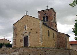
Monthieux is a commune in the Ain department in eastern France.
Population
| Historical population | ||
|---|---|---|
| Year | Pop. | ±% |
| 1793 | 386 | — |
| 1800 | 369 | −4.4% |
| 1806 | 306 | −17.1% |
| 1821 | 301 | −1.6% |
| 1831 | 300 | −0.3% |
| 1836 | 351 | +17.0% |
| 1841 | 337 | −4.0% |
| 1846 | 344 | +2.1% |
| 1851 | 419 | +21.8% |
| 1856 | 386 | −7.9% |
| 1861 | 372 | −3.6% |
| 1866 | 417 | +12.1% |
| 1872 | 402 | −3.6% |
| 1876 | 413 | +2.7% |
| 1881 | 372 | −9.9% |
| 1886 | 401 | +7.8% |
| 1891 | 375 | −6.5% |
| 1896 | 355 | −5.3% |
| 1901 | 325 | −8.5% |
| 1906 | 305 | −6.2% |
| 1911 | 318 | +4.3% |
| 1921 | 305 | −4.1% |
| 1926 | 297 | −2.6% |
| 1931 | 291 | −2.0% |
| 1936 | 271 | −6.9% |
| 1946 | 264 | −2.6% |
| 1954 | 216 | −18.2% |
| 1962 | 192 | −11.1% |
| 1968 | 194 | +1.0% |
| 1975 | 217 | +11.9% |
| 1982 | 247 | +13.8% |
| 1990 | 344 | +39.3% |
| 1999 | 578 | +68.0% |
| 2008 | 595 | +2.9% |
See also
References
External links
| Wikimedia Commons has media related to Monthieux. |
This article is issued from Wikipedia - version of the 2/11/2016. The text is available under the Creative Commons Attribution/Share Alike but additional terms may apply for the media files.