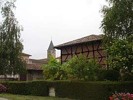
Chavannes-sur-Reyssouze
| Chavannes-sur-Reyssouze | |
|---|---|
 | |
 Chavannes-sur-Reyssouze | |
|
Location within Auvergne-Rhône-Alpes region  Chavannes-sur-Reyssouze | |
| Coordinates: 46°25′54″N 4°59′38″E / 46.4317°N 4.9939°ECoordinates: 46°25′54″N 4°59′38″E / 46.4317°N 4.9939°E | |
| Country | France |
| Region | Auvergne-Rhône-Alpes |
| Department | Ain |
| Arrondissement | Bourg-en-Bresse |
| Canton | Pont-de-Vaux |
| Intercommunality | Pont-de-Vaux |
| Government | |
| • Mayor (2008–2014) | Paul Morel |
| Area1 | 16.55 km2 (6.39 sq mi) |
| Population (2008)2 | 667 |
| • Density | 40/km2 (100/sq mi) |
| Time zone | CET (UTC+1) |
| • Summer (DST) | CEST (UTC+2) |
| INSEE/Postal code | 01094 / 01190 |
| Elevation |
175–218 m (574–715 ft) (avg. 170 m or 560 ft) |
|
1 French Land Register data, which excludes lakes, ponds, glaciers > 1 km² (0.386 sq mi or 247 acres) and river estuaries. 2 Population without double counting: residents of multiple communes (e.g., students and military personnel) only counted once. | |
Chavannes-sur-Reyssouze is a commune in the Ain department in eastern France.
Population
| Historical population | ||
|---|---|---|
| Year | Pop. | ±% |
| 1962 | 499 | — |
| 1968 | 614 | +23.0% |
| 1975 | 573 | −6.7% |
| 1982 | 543 | −5.2% |
| 1990 | 565 | +4.1% |
| 1999 | 580 | +2.7% |
| 2008 | 667 | +15.0% |
See also
References
| Wikimedia Commons has media related to Chavannes-sur-Reyssouze. |
This article is issued from Wikipedia - version of the 2/11/2016. The text is available under the Creative Commons Attribution/Share Alike but additional terms may apply for the media files.