Boissey, Ain
| Boissey | |
|---|---|
|
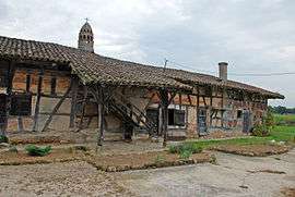
Layat farm | |
 Boissey | |
|
Location within Auvergne-Rhône-Alpes region  Boissey | |
| Coordinates: 46°22′57″N 4°59′48″E / 46.3825°N 4.9967°ECoordinates: 46°22′57″N 4°59′48″E / 46.3825°N 4.9967°E | |
| Country | France |
| Region | Auvergne-Rhône-Alpes |
| Department | Ain |
| Arrondissement | Bourg-en-Bresse |
| Canton | Pont-de-Vaux |
| Intercommunality | Pont-de-Vaux |
| Government | |
| • Mayor (2008–2014) | Andrée Tirreau |
| Area1 | 9.05 km2 (3.49 sq mi) |
| Population (2008)2 | 246 |
| • Density | 27/km2 (70/sq mi) |
| Time zone | CET (UTC+1) |
| • Summer (DST) | CEST (UTC+2) |
| INSEE/Postal code | 01050 / 01190 |
| Elevation |
182–208 m (597–682 ft) (avg. 200 m or 660 ft) |
|
1 French Land Register data, which excludes lakes, ponds, glaciers > 1 km² (0.386 sq mi or 247 acres) and river estuaries. 2 Population without double counting: residents of multiple communes (e.g., students and military personnel) only counted once. | |
Boissey is a commune in the Ain department in eastern France.
Population
| Historical population | ||
|---|---|---|
| Year | Pop. | ±% |
| 1793 | 550 | — |
| 1800 | 552 | +0.4% |
| 1806 | 601 | +8.9% |
| 1821 | 466 | −22.5% |
| 1831 | 461 | −1.1% |
| 1836 | 460 | −0.2% |
| 1841 | 505 | +9.8% |
| 1846 | 529 | +4.8% |
| 1851 | 539 | +1.9% |
| 1856 | 506 | −6.1% |
| 1861 | 506 | +0.0% |
| 1866 | 513 | +1.4% |
| 1872 | 541 | +5.5% |
| 1876 | 545 | +0.7% |
| 1881 | 537 | −1.5% |
| 1886 | 504 | −6.1% |
| 1891 | 511 | +1.4% |
| 1896 | 533 | +4.3% |
| 1901 | 522 | −2.1% |
| 1906 | 502 | −3.8% |
| 1911 | 468 | −6.8% |
| 1921 | 378 | −19.2% |
| 1926 | 369 | −2.4% |
| 1931 | 375 | +1.6% |
| 1936 | 369 | −1.6% |
| 1946 | 323 | −12.5% |
| 1954 | 297 | −8.0% |
| 1962 | 256 | −13.8% |
| 1968 | 238 | −7.0% |
| 1975 | 219 | −8.0% |
| 1982 | 207 | −5.5% |
| 1990 | 206 | −0.5% |
| 1999 | 202 | −1.9% |
| 2008 | 246 | +21.8% |
See also
References
| Wikimedia Commons has media related to Boissey, Ain. |
This article is issued from Wikipedia - version of the 10/27/2016. The text is available under the Creative Commons Attribution/Share Alike but additional terms may apply for the media files.