Pont-de-Veyle
| Pont-de-Veyle | ||
|---|---|---|
|
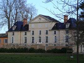
Chateau | ||
| ||
 Pont-de-Veyle | ||
|
Location within Auvergne-Rhône-Alpes region  Pont-de-Veyle | ||
| Coordinates: 46°15′49″N 4°53′19″E / 46.2637°N 4.88870°ECoordinates: 46°15′49″N 4°53′19″E / 46.2637°N 4.88870°E | ||
| Country | France | |
| Region | Auvergne-Rhône-Alpes | |
| Department | Ain | |
| Arrondissement | Bourg-en-Bresse | |
| Canton | Pont-de-Veyle | |
| Intercommunality | Pont-de-Veyle | |
| Government | ||
| • Mayor (2008–2014) | Jean-Paul Moutot | |
| Area1 | 1.94 km2 (0.75 sq mi) | |
| Population (2008)2 | 1,496 | |
| • Density | 770/km2 (2,000/sq mi) | |
| Time zone | CET (UTC+1) | |
| • Summer (DST) | CEST (UTC+2) | |
| INSEE/Postal code | 01306 / 01290 | |
| Elevation |
172–179 m (564–587 ft) (avg. 178 m or 584 ft) | |
|
1 French Land Register data, which excludes lakes, ponds, glaciers > 1 km² (0.386 sq mi or 247 acres) and river estuaries. 2 Population without double counting: residents of multiple communes (e.g., students and military personnel) only counted once. | ||

Pont-de-Veyle is a commune in the Ain department in eastern France.
Geography
The Veyle flows west through the middle of the commune.
Population
| Historical population | ||
|---|---|---|
| Year | Pop. | ±% |
| 1793 | 1,364 | — |
| 1800 | 1,426 | +4.5% |
| 1806 | 1,364 | −4.3% |
| 1821 | 1,319 | −3.3% |
| 1831 | 1,329 | +0.8% |
| 1836 | 1,256 | −5.5% |
| 1841 | 1,321 | +5.2% |
| 1846 | 1,285 | −2.7% |
| 1851 | 1,461 | +13.7% |
| 1856 | 1,458 | −0.2% |
| 1861 | 1,412 | −3.2% |
| 1866 | 1,389 | −1.6% |
| 1872 | 1,491 | +7.3% |
| 1876 | 1,355 | −9.1% |
| 1881 | 1,285 | −5.2% |
| 1886 | 1,240 | −3.5% |
| 1891 | 1,220 | −1.6% |
| 1896 | 1,152 | −5.6% |
| 1901 | 1,167 | +1.3% |
| 1906 | 1,126 | −3.5% |
| 1911 | 1,076 | −4.4% |
| 1921 | 932 | −13.4% |
| 1926 | 945 | +1.4% |
| 1931 | 991 | +4.9% |
| 1936 | 1,023 | +3.2% |
| 1946 | 1,046 | +2.2% |
| 1954 | 969 | −7.4% |
| 1962 | 1,037 | +7.0% |
| 1968 | 1,144 | +10.3% |
| 1975 | 1,177 | +2.9% |
| 1982 | 1,253 | +6.5% |
| 1990 | 1,421 | +13.4% |
| 1999 | 1,484 | +4.4% |
| 2008 | 1,496 | +0.8% |
See also
References
| Wikimedia Commons has media related to Pont-de-Veyle. |
This article is issued from Wikipedia - version of the 10/27/2016. The text is available under the Creative Commons Attribution/Share Alike but additional terms may apply for the media files.