Chapel Rural Historic District
|
Chapel Rural Historic District | |
|
Old Chapel Historic Marker Intersection of Hwy. 340 and Bishop Meade Rd. | |
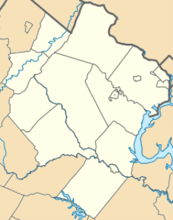   | |
| Location | Generally centered along Lord Fairfax Hwy, Millwood, Virginia |
|---|---|
| Coordinates | 39°6′28″N 78°0′52″W / 39.10778°N 78.01444°WCoordinates: 39°6′28″N 78°0′52″W / 39.10778°N 78.01444°W |
| Area | 11,496 acres (4,652 ha) |
| NRHP Reference # | 08001112[1] |
| Added to NRHP | February 14, 2014 |
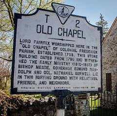
The Chapel Rural Historic District is an expansive rural historic district in Clarke County, Virginia. The district encompasses an area of nearly 11,500 acres (4,700 ha), a rural landscape that extends from Millwood in the south, nearly to Berryville in the north. The district takes its name from the Old Chapel, an 18th-century building that stands prominently at the junction of several roads near the center of the district. The district includes nearly 700 contributing properties.[2]
The district was listed on the National Register of Historic Places in 2014.[1]
- A few of the historic sites within this district:
-
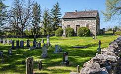
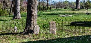
Old Chapel and Cemetery
-
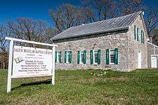
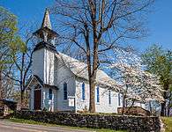
Salem Regular Baptist Church
-
Salem Regular Baptist Church Cemetery
-
Millwood Shiloh Baptist Church
-
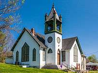
Millwood United Methodist Church
-
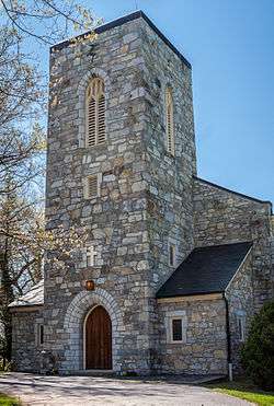
Christ Church, Millwood
-

Old Schoolhouse, now Red Schoolhouse Antiques
-
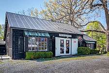
Old Barn, now Black Penny Antiques
References
- 1 2 National Park Service (2010-07-09). "National Register Information System". National Register of Historic Places. National Park Service.
- ↑ "NRHP nomination for Chapel Rural Historic District" (PDF). Virginia DHR. Retrieved 2014-03-08.

