| [3] |
Name on the Register[4] |
Image |
Date listed[5] |
Location |
City or town |
Description |
|---|
| 1 |
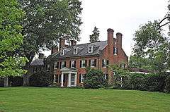
Ashleigh |
|
000000001973-08-14-0000August 14, 1973
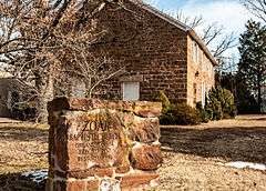
(#73002012) |
South of Delaplane, off U.S. 17
38°54′10″N 77°55′10″W / 38.902778°N 77.919444°W / 38.902778; -77.919444 (Ashleigh) |
Delaplane |
|
| 2 |
Ashville Historic District |
|
000000002004-02-11-0000February 11, 2004
(#04000043) |
Area including 4236-4130 Ashville Rd. and part of Old Ashville Rd.
38°52′00″N 77°55′22″W / 38.866667°N 77.922778°W / 38.866667; -77.922778 (Ashville Historic District) |
Marshall |
|
| 3 |
Atoka Historic District |
|
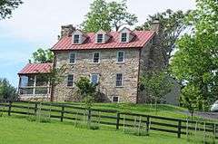
000000002004-11-27-0000November 27, 2004
(#04001266) |
1461, 1466, 1468, 1481 Atoka Rd. & 7258, 7260 Rectors Ln.
38°58′38″N 77°48′33″W / 38.977222°N 77.809167°W / 38.977222; -77.809167 (Atoka Historic District) |
Atoka |
|
| 4 |
Auburn Battlefield |
|
000000002011-12-05-0000December 5, 2011
(#11000873) |
Bounded by Casanova, Auburn Baptist Church, & Catlett
38°42′09″N 77°42′06″W / 38.702609°N 77.70171°W / 38.702609; -77.70171 (Auburn Battlefield) |
Catlett |
part of the Civil War in Virginia Multiple Property Submission (MPS)
|
| 5 |
Belle Grove |
|
000000002006-08-30-0000August 30, 2006
(#06000756) |
1402 Winchester Rd.
38°58′51″N 77°57′14″W / 38.980833°N 77.953889°W / 38.980833; -77.953889 (Belle Grove) |
Delaplane |
|
| 6 |
Beverley Mill |
|
000000001972-02-23-0000February 23, 1972
(#72001411) |
Junction of State Route 55 and Beverleys Mill Road
38°49′28″N 77°42′39″W / 38.824444°N 77.710833°W / 38.824444; -77.710833 (Beverley Mill) |
The Plains |
|
| 7 |
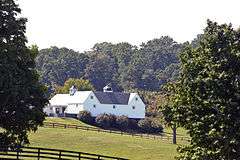
Blue Ridge Farm |
|
000000002006-08-30-0000August 30, 2006
(#06000753) |
1799 Blue Ridge Farm Rd.
38°57′49″N 77°52′42″W / 38.963611°N 77.878333°W / 38.963611; -77.878333 (Blue Ridge Farm) |
Upperville |
|
| 8 |
Brentmoor |
|
000000001978-01-20-0000January 20, 1978
(#78003016) |
173 Main St.
38°42′41″N 77°47′27″W / 38.711389°N 77.790833°W / 38.711389; -77.790833 (Brentmoor) |
Warrenton |
|
| 9 |
Bristersburg Historic District |
|
000000002009-05-21-0000May 21, 2009
(#09000336) |
Area including parts of Elk Run and Bristersburg Roads
38°35′00″N 77°36′50″W / 38.583456°N 77.613878°W / 38.583456; -77.613878 (Bristersburg Historic District) |
Bristersburg |
|
| 10 |
Broad Run-Little Georgetown Rural Historic District |
|
000000002016-04-21-0000April 21, 2016
(#16000205) |
Roughly bounded by The Plains, Bull Run Mountains, John Marshall Hwy., Bust Head Rd., and Hopewell Rd.
38°51′04″N 77°44′17″W / 38.851°N 77.738°W / 38.851; -77.738 (Broad Run-Little Georgetown Rural Historic District) |
Broad Run |
A small portion of this district is in Prince William County.
|
| 11 |
Burrland Farm Historic District |
|
000000001997-11-07-0000November 7, 1997
(#97001406) |
Burrland Ln.
38°56′37″N 77°45′22″W / 38.943592°N 77.755986°W / 38.943592; -77.755986 (Burrland Farm Historic District) |
Middleburg |
|
| 12 |
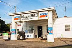
Calverton Historic District |
|
000000002010-08-12-0000August 12, 2010
(#10000542) |
Area including parts of Bristersburg and Catlett Rds.
38°37′35″N 77°40′14″W / 38.626389°N 77.670556°W / 38.626389; -77.670556 (Calverton Historic District) |
Calverton |
|
| 13 |
Carters Run Rural Historic District |
|
000000002014-05-15-0000May 15, 2014
(#14000236) |
Generally centered along Carters Run, Scotts & E. side of Free State Rds.
38°50′01″N 77°51′22″W / 38.8336°N 77.8562°W / 38.8336; -77.8562 (Carters Run Rural Historic District) |
Marshall |
|
| 14 |
Casanova Historic District |
|
000000002005-11-16-0000November 16, 2005
(#05001264) |
Area including parts of Casanova Rd., Rogues Rd. and Weston Rd.
38°39′28″N 77°43′03″W / 38.657803°N 77.717522°W / 38.657803; -77.717522 (Casanova Historic District) |
Casanova |
|
| 15 |
Catlett Historic District |
|
000000002008-02-21-0000February 21, 2008
(#08000069) |
Prospect Ave., & parts of Gaskins Ln., Tenerife, Elk Run, Old Catlett, Catlett, Old Dumfries & Catlett School Rds.
38°39′20″N 77°38′28″W / 38.655539°N 77.641214°W / 38.655539; -77.641214 (Catlett Historic District) |
Catlett |
|
| 16 |
Cromwell's Run Rural Historic District |
|
000000002008-09-19-0000September 19, 2008
(#08000907) |
Along Atoka Rd., roughly bounded on the west by Goose Creek, on the north by US 50, on the east by Cromwell's Run; also bounded by the Fauquier County line on the north and the existing Cromwell's Run Rural Historic District on the east
38°56′35″N 77°49′20″W / 38.943019°N 77.822253°W / 38.943019; -77.822253 (Cromwell's Run Rural Historic District) |
Rectortown |
Second set of boundaries represents a boundary increase of 000000002008-11-12-0000November 12, 2008
|
| 17 |
Crooked Run Valley Rural Historic District |
|
000000002004-05-27-0000May 27, 2004
(#04000550) |
Roughly bounded by Fauquier Cty Line, I-66, VA 712, Naked Mountain, and VA 55
38°57′44″N 77°56′20″W / 38.962222°N 77.938889°W / 38.962222; -77.938889 (Crooked Run Valley Rural Historic District) |
Paris |
|
| 18 |
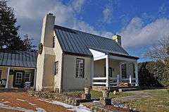
Dakota |
|
000000002005-07-27-0000July 27, 2005
(#05000768) |
8134 Springs Rd.
38°42′19″N 77°48′25″W / 38.705278°N 77.806944°W / 38.705278; -77.806944 (Dakota) |
Warrenton |
|
| 19 |
Delaplane Historic District |
|
000000002004-02-11-0000February 11, 2004
(#04000050) |
Area including parts of Delaplane Grade Rd. and Rokeby Rd.
38°54′57″N 77°55′12″W / 38.915833°N 77.92°W / 38.915833; -77.92 (Delaplane Historic District) |
Delaplane |
|
| 20 |
Galemont |
|
000000002012-09-25-0000September 25, 2012
(#12000824) |
5071 Galemont Ln.
38°50′00″N 77°44′05″W / 38.833457°N 77.734635°W / 38.833457; -77.734635 (Galemont) |
Broad Run |
|
| 21 |
Germantown Archeological Sites |
|
000000001982-09-16-0000September 16, 1982
(#82004555) |
In the Germantown Lake vicinity
38°36′49″N 77°44′30″W / 38.613611°N 77.741667°W / 38.613611; -77.741667 (Germantown Archeological Sites) |
Midland |
|
| 22 |
Green Pastures |
|
000000002002-05-29-0000May 29, 2002
(#02000596) |
2337 Zulla Rd.
38°56′20″N 77°46′00″W / 38.938889°N 77.766667°W / 38.938889; -77.766667 (Green Pastures) |
Middleburg |
|
| 23 |
Heflin's Store |
|
000000002004-02-11-0000February 11, 2004
(#04000046) |
5310 Blantyre Rd.
38°49′33″N 77°43′56″W / 38.825833°N 77.732222°W / 38.825833; -77.732222 (Heflin's Store) |
Little Georgetown |
|
| 24 |
The Hollow |
|
000000002004-01-16-0000January 16, 2004
(#03001442) |
VA 688, Leeds Manor Rd. and north of Marshall School Ln.
38°54′48″N 77°59′43″W / 38.913206°N 77.995222°W / 38.913206; -77.995222 (The Hollow) |
Markham |
Boyhood home of John Marshall, Chief Justice of the United States 1801-1835
|
| 25 |
Hopefield |
|
000000002009-03-10-0000March 10, 2009
(#09000120) |
6763 Airlie Rd.
38°45′10″N 77°47′16″W / 38.752697°N 77.787872°W / 38.752697; -77.787872 (Hopefield) |
Warrenton |
|
| 26 |
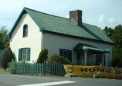
Hume Historic District |
|
000000002008-02-21-0000February 21, 2008
(#08000070) |
Hume & Leeds Manor Rds.
38°49′55″N 77°59′58″W / 38.831994°N 77.999528°W / 38.831994; -77.999528 (Hume Historic District) |
Hume |
|
| 27 |
Little River Rural Historic District |
|
000000002014-02-14-0000February 14, 2014
(#14000011) |
Roughly bounded by VA 629, VA 776 & US 50
38°58′20″N 77°42′10″W / 38.972355°N 77.702793°W / 38.972355; -77.702793 (Little River Rural Historic District) |
The Plains |
|
| 28 |
Loretta |
|
000000001993-12-23-0000December 23, 1993
(#93001442) |
East side of US 17, 3,500 feet (1,100 m) north of Warrenton town limits
38°44′48″N 77°48′35″W / 38.746667°N 77.809722°W / 38.746667; -77.809722 (Loretta) |
Warrenton |
|
| 29 |
Markham Historic District |
|
000000002005-11-17-0000November 17, 2005
(#05001261) |
Parts of E. John Marshall Highway, Farm House Rd., Leeds Manor Rd., Old Markham Rd., Poverty Hollow Lane, Rail Stop Rd. and Stone Church Rd.
38°54′21″N 77°59′52″W / 38.905956°N 77.997675°W / 38.905956; -77.997675 (Markham Historic District) |
Markham |
|
| 30 |
Marshall Historic District |
|
000000002007-03-19-0000March 19, 2007
(#07000191) |
Including parts of Anderson R., Emerald Ln., Frost St., Main St., Rosstown Rd. Wild Aster Ct. and Winchester Rd.
38°51′59″N 77°51′17″W / 38.866267°N 77.854678°W / 38.866267; -77.854678 (Marshall Historic District) |
Marshall |
|
| 31 |
John Marshall's Leeds Manor Rural Historic District |
|
000000002007-11-01-0000November 1, 2007
(#07001138) |
Centered along Leeds Manor Rd. from Leeds Church to Raven Ln.
38°53′50″N 77°59′57″W / 38.897144°N 77.999039°W / 38.897144; -77.999039 (John Marshall's Leeds Manor Rural Historic District) |
Markham |
|
| 32 |
Melrose |
|
000000001983-02-10-0000February 10, 1983
(#83003281) |
North of Casanova on VA 602
38°40′23″N 77°42′37″W / 38.673056°N 77.710278°W / 38.673056; -77.710278 (Melrose) |
Casanova |
|
| 33 |
Mill House |
|
000000001984-01-12-0000January 12, 1984
(#84003527) |
US 50
38°58′11″N 77°47′32″W / 38.969722°N 77.792222°W / 38.969722; -77.792222 (Mill House) |
Middleburg |
|
| 34 |
Gen. William Mitchell House |
|
000000001976-12-08-0000December 8, 1976
(#76002112) |
0.5 miles (0.80 km) south of Middleburg on VA 626
38°57′40″N 77°44′44″W / 38.961111°N 77.745556°W / 38.961111; -77.745556 (Gen. William Mitchell House) |
Middleburg |
|
| 35 |
Monterosa |
|
000000001991-01-25-0000January 25, 1991
(#90002193) |
343 Culpeper St.
38°42′27″N 77°48′02″W / 38.7075°N 77.800556°W / 38.7075; -77.800556 (Monterosa) |
Warrenton |
|
| 36 |
Morgantown Historic District |
|
000000002004-02-11-0000February 11, 2004
(#04000045) |
The area roughly surrounding the junction of Freestate Rd. and Mount Nebo Church Rd., as well as a discontiguous cemetery located approximately 0.2 miles (0.32 km) to the southeast at the end of Mount Nebo Church Rd.
38°50′25″N 77°52′35″W / 38.840278°N 77.876389°W / 38.840278; -77.876389 (Morgantown Historic District) |
Marshall |
|
| 37 |
Morven |
|
000000002002-05-30-0000May 30, 2002
(#02000597) |
3918 Leeds Manor Rd.
38°52′21″N 77°59′51″W / 38.872542°N 77.997525°W / 38.872542; -77.997525 (Morven) |
Markham |
|
| 38 |
Mount Hope |
|
000000002006-02-01-0000February 1, 2006
(#05001625) |
6015 Georgetown Rd.
38°47′36″N 77°43′58″W / 38.793333°N 77.732778°W / 38.793333; -77.732778 (Mount Hope) |
New Baltimore |
|
| 39 |
Mt. Bleak-Skye Farm (030-0283) |
|
000000002004-05-24-0000May 24, 2004
(#04000552) |
11012 Edmonds Ln.
38°59′24″N 77°58′04″W / 38.99°N 77.967778°W / 38.99; -77.967778 (Mt. Bleak-Skye Farm (030-0283)) |
Delaplane |
|
| 40 |
New Baltimore Historic District |
|
000000002004-02-11-0000February 11, 2004
(#04000044) |
Area including parts of Old Alexandria Turnpike, Mason Ln., Georgetown Rd., and Beverley's Mill Rd.
38°46′04″N 77°43′31″W / 38.767778°N 77.725278°W / 38.767778; -77.725278 (New Baltimore Historic District) |
New Baltimore |
|
| 41 |
North Wales |
|
000000001999-06-29-0000June 29, 1999
(#99000726) |
7392 Ironwood Ln.
38°40′36″N 77°49′21″W / 38.676667°N 77.8225°W / 38.676667; -77.8225 (North Wales) |
Warrenton |
|
| 42 |
Number 18 School in Marshall |
|
000000001997-11-07-0000November 7, 1997
(#97001405) |
Junction of VA 55 and VA 622
38°52′10″N 77°49′53″W / 38.869444°N 77.831389°W / 38.869444; -77.831389 (Number 18 School in Marshall) |
Marshall |
|
| 43 |
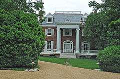
Oak Hill |
|
000000001973-06-18-0000June 18, 1973
(#73002013) |
2.2 miles (3.5 km) south of Delaplane
38°53′19″N 77°54′09″W / 38.888611°N 77.9025°W / 38.888611; -77.9025 (Oak Hill) |
Delaplane |
|
| 44 |
Oakley |
|
000000001983-02-24-0000February 24, 1983
(#83003282) |
East of Upperville on US 50
38°58′40″N 77°51′52″W / 38.977778°N 77.864444°W / 38.977778; -77.864444 (Oakley) |
Upperville |
|
| 45 |
The Oaks |
|
000000002002-05-30-0000May 30, 2002
(#02000585) |
8457 Oaks Rd.
38°41′04″N 77°50′52″W / 38.684444°N 77.847778°W / 38.684444; -77.847778 (The Oaks) |
Warrenton |
|
| 46 |
Oakwood |
|
000000002016-02-02-0000February 2, 2016
(#15001038) |
7433 Oakwood Dr.
38°43′34″N 77°51′03″W / 38.726035°N 77.850745°W / 38.726035; -77.850745 (Oakwood) |
Warrenton |
|
| 47 |
Old Denton |
|
000000002012-03-12-0000March 12, 2012
(#12000123) |
7064 Young Rd.
38°54′55″N 77°47′45″W / 38.915258°N 77.795708°W / 38.915258; -77.795708 (Old Denton) |
The Plains |
|
| 48 |
Old Fauquier County Jail |
|
000000001978-01-20-0000January 20, 1978
(#78003015) |
Fauquier County Courthouse Sq.
38°42′49″N 77°47′46″W / 38.713611°N 77.796111°W / 38.713611; -77.796111 (Old Fauquier County Jail) |
Warrenton |
|
| 49 |
Orlean Historic District |
|
000000002009-08-14-0000August 14, 2009
(#09000615) |
Area including parts of John Barnton Payne and Leeds Manor Rds.
38°45′10″N 77°47′50″W / 38.752658°N 77.797208°W / 38.752658; -77.797208 (Orlean Historic District) |
Orlean |
|
| 50 |
Paradise |
|
000000002014-04-11-0000April 11, 2014
(#14000147) |
158 Winchester Street
38°43′02″N 77°47′56″W / 38.7173°N 77.7988°W / 38.7173; -77.7988 (Paradise) |
Warrenton |
|
| 51 |
Paris Historic District |
|
000000002007-03-21-0000March 21, 2007
(#07000192) |
Area including Federal St. and parts of Republican St. and Gap Run Rd.
39°00′16″N 77°57′06″W / 39.004561°N 77.951619°W / 39.004561; -77.951619 (Paris Historic District) |
Paris |
|
| 52 |
The Plains Historic District |
|
000000002014-05-21-0000May 21, 2014
(#14000232) |
Parts of Main, Mosby, Lee, Bragg, Stuart, Jackson, Pickett & Broad Sts., Fauquier & Loudoun Aves., Hopewell Rd.
38°51′46″N 77°46′32″W / 38.862778°N 77.775556°W / 38.862778; -77.775556 (The Plains Historic District) |
The Plains |
|
| 53 |
Rectortown Historic District |
|
000000002004-11-27-0000November 27, 2004
(#04001267) |
Roughly bounded by Maidstone, Rectortown, Atoka, Lost Corner and Crenshae Rds.
38°55′12″N 77°51′38″W / 38.92°N 77.860556°W / 38.92; -77.860556 (Rectortown Historic District) |
Rectortown |
|
| 54 |
Remington Historic District |
|
000000002005-05-05-0000May 5, 2005
(#05000395) |
Area including parts of E. Bowen St., W. Bowen St., N. Church St., N. Franklin St., N. John Stone St., E. Main St., W. Main St., South Mill St., Sumerduck Rd., Tinpot Run Lane, E. Washington St., and W. Washington St.
38°32′12″N 77°48′26″W / 38.536667°N 77.807222°W / 38.536667; -77.807222 (Remington Historic District) |
Remington |
|
| 55 |
Rose Hill Farm |
|
000000001994-08-25-0000August 25, 1994
(#94000986) |
North side of US 50, 1.5 miles (2.4 km) west of the junction with SR 713
38°59′01″N 77°49′49″W / 38.983611°N 77.830278°W / 38.983611; -77.830278 (Rose Hill Farm) |
Upperville |
|
| 56 |
Sumerduck Historic District |
|
000000002009-05-21-0000May 21, 2009
(#09000337) |
Area including parts of Sumerduck Rd.
38°27′36″N 77°43′41″W / 38.460125°N 77.728047°W / 38.460125; -77.728047 (Sumerduck Historic District) |
Sumerduck |
|
| 57 |
Upperville Historic District |
|
000000001972-10-18-0000October 18, 1972
(#72001394) |
Including the entire village extending approximately 1 mile (1.6 km) along US 50
38°59′31″N 77°52′56″W / 38.991944°N 77.882222°W / 38.991944; -77.882222 (Upperville Historic District) |
Upperville |
|
| 58 |
Warrenton Historic District |
|
000000001983-10-13-0000October 13, 1983
(#83004243) |
Roughly Main, Waterloo, Alexandria, Winchester, Culpeper, High, Falmouth, Lee, and Horner Sts.
38°42′40″N 77°47′35″W / 38.711111°N 77.793056°W / 38.711111; -77.793056 (Warrenton Historic District) |
Warrenton |
|
| 59 |
Waveland |
|
000000002004-08-20-0000August 20, 2004
(#04000888) |
VA 691, Carter's Run Rd.
38°50′00″N 77°51′48″W / 38.833333°N 77.863333°W / 38.833333; -77.863333 (Waveland) |
Marshall |
|
| 60 |
Waverly |
|
000000001979-03-26-0000March 26, 1979
(#79003040) |
South of Middleburg on VA 626
38°55′50″N 77°44′40″W / 38.930556°N 77.744444°W / 38.930556; -77.744444 (Waverly) |
Middleburg |
|
| 61 |
Weston |
|
000000001996-12-06-0000December 6, 1996
(#96001447) |
4477 Weston Rd.
38°39′47″N 77°41′55″W / 38.663056°N 77.698611°W / 38.663056; -77.698611 (Weston) |
Casanova |
|
| 62 |
Woodside |
|
000000002009-08-12-0000August 12, 2009
(#09000616) |
9525 Maidstone Rd.
38°54′13″N 77°54′06″W / 38.903733°N 77.901719°W / 38.903733; -77.901719 (Woodside) |
Delaplane |
|
| 63 |
Yew Hill-Robert Ashby's Tavern-Shacklett's Tavern |
|
000000002005-01-20-0000January 20, 2005
(#04001535) |
10030 John Marshall Hwy.
38°54′14″N 77°55′28″W / 38.903889°N 77.924444°W / 38.903889; -77.924444 (Yew Hill-Robert Ashby's Tavern-Shacklett's Tavern) |
Delaplane |
|
| 64 |
Yorkshire House |
|
000000002005-06-01-0000June 1, 2005
(#05000522) |
405 Winchester St.
38°43′30″N 77°47′57″W / 38.725°N 77.799167°W / 38.725; -77.799167 (Yorkshire House) |
Warrenton |
|

.jpg)

.jpg)