National Register of Historic Places listings in Spotsylvania County, Virginia
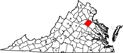
Location of Spotsylvania County in Virginia
This is a list of the National Register of Historic Places listings in Spotsylvania County, Virginia.
This is intended to be a complete list of the properties and districts on the National Register of Historic Places in Spotsylvania County, Virginia, United States. The locations of National Register properties and districts for which the latitude and longitude coordinates are included below, may be seen in a Google map.[1]
There are 16 properties and districts listed on the National Register in the county.
- This National Park Service list is complete through NPS recent listings posted December 2, 2016.[2]
Current listings
| [3] | Name on the Register[4] | Image | Date listed[5] | Location | City or town | Description |
|---|---|---|---|---|---|---|
| 1 | Andrews Tavern | .png) |
(#76002121) |
2.6 miles (4.2 km) northeast of Glenora on VA 601 38°07′17″N 77°46′13″W / 38.121389°N 77.770278°W |
Glenora | Federal provincial home constructed for Samuel Andrews in 1815. Around 1848, a frame wing was added to the brick structure for a tavern. |
| 2 | Bloomsbury Farm | .png) |
(#00000479) |
9736 Courthouse Rd. 38°14′07″N 77°33′58″W / 38.235278°N 77.566111°W |
Spotsylvania Courthouse | Also known as Harris Farm. One of the oldest surviving houses in Spotsylvania County. Site of the Harris Farm Engagement during the American Civil War.[6][7] Demolished in 2014.[8] |
| 3 | Fairview | .png) |
(#93001460) |
2020 Whitelake Dr. 38°14′25″N 77°30′53″W / 38.240278°N 77.514722°W |
Fredericksburg | Federal-style home built in 1837 by Samuel Alsop, Jr., architect and builder who designed a number of buildings in Spotsylvania |
| 4 | Kenmore | .JPG) |
(#93000569) |
8300 Courthouse Road, Spotsylvania, Virginia 38°11′06″N 77°35′47″W / 38.185°N 77.596389°W |
Spotsylvania Courthouse | Also known as Kenmore Woods - not to be confused with Kenmore (Fredericksburg, Virginia) |
| 5 | La Vista | .png) |
(#97001508) |
4420 Guinea Station Rd. 38°10′04″N 77°29′28″W / 38.167778°N 77.491111°W |
Guinea | Federal / Greek revival house built in 1838. |
| 6 | La Vue | .png) |
(#93001459) |
US 17 Bypass, south side at the junction with the Richmond, Fredericksburg and Potomac Railroad tracks 38°13′11″N 77°26′35″W / 38.219722°N 77.443056°W |
Fredericksburg | Formerly known as Prospect Vue. The home was built in 1848 for John Alsop. |
| 7 | Lansdowne | Upload image | (#12001270) |
4919 Lansdowne Rd. 38°15′18″N 77°28′23″W / 38.254931°N 77.473002°W |
Fredericksburg | |
| 8 | Massaponax Baptist Church | .png) |
(#90002137) |
Junction of US 1 and County Route 608 38°11′36″N 77°30′37″W / 38.193333°N 77.510278°W |
Massaponax | Built in 1859 and site of council of war with Grant, Meade, and other Union generals |
| 9 | Oakley | .png) |
(#02000533) |
10,000 Corbin Ln. 38°15′25″N 77°42′31″W / 38.256944°N 77.708611°W |
Spotsylvania | Built in 1828 by Samuel Alsop, Jr. |
| 10 | Prospect Hill | .png) |
(#82004597) |
1507 Monrovia Rd. (VA 612) 38°07′34″N 77°52′42″W / 38.126111°N 77.878333°W |
Mineral | Built in 1811/1812 for local politician Waller Holladay. Plantation was the site of the 1st Post Office in Spotsylvania County (1809) |
| 11 | Rapidan Dam Canal of the Rappahannock Navigation | Upload image | (#73002063) |
Extending from the mouth of the Rapidan River down the Rappahannock River for 1.5 miles (2.4 km) 38°21′28″N 77°36′40″W / 38.357778°N 77.611111°W |
Spotsylvania | Best preserved section of the Rappahannock Navigation, a 19th Century effort to open 50 miles of the Rappahannock River to navigation. Virginia Landmarks Register: 088-0137 |
| 12 | St. Julien | .png) |
(#75002038) |
South of Fredericksburg between VA 609 and VA 2 38°13′20″N 77°24′56″W / 38.222222°N 77.415556°W |
Fredericksburg | Home of prominent Virginia republican Francis Taliaferro Brooke[9] |
| 13 | Spotsylvania Court House Historic District | %2C_Spotsylvania_Virginia.jpg) |
(#83003317) |
VA 208 38°12′12″N 77°35′06″W / 38.203333°N 77.585°W |
Spotsylvania | |
| 14 | Stirling | Upload image | (#89000366) |
County Route 607 at I-95 38°10′51″N 77°30′20″W / 38.180833°N 77.505556°W |
Massaponax | |
| 15 | Tubal Furnace Archeological Site | Upload image | (#82001825) |
Address Restricted 38°19′56″N 77°36′41″W / 38.33221°N 77.611456°W |
Chancellor | Oldest iron furnace in Virginia, one of the oldest in the United States |
| 16 | Walnut Grove | .png) |
(#04000889) |
Belmont Rd., west of Spotsylvania[10] 38°09′53″N 77°51′47″W / 38.1647°N 77.8631°W |
Spotsylvania | Built in 1840 by William A. Jennings for Jonathan Johnson |
See also
| Wikimedia Commons has media related to National Register of Historic Places in Spotsylvania County, Virginia. |
- List of National Historic Landmarks in Virginia
- National Register of Historic Places listings in Virginia
- National Register of Historic Places listings in Fredericksburg, Virginia
References
- ↑ The latitude and longitude information provided in this table was derived originally from the National Register Information System, which has been found to be fairly accurate for about 99% of listings. For about 1% of NRIS original coordinates, experience has shown that one or both coordinates are typos or otherwise extremely far off; some corrections may have been made. A more subtle problem causes many locations to be off by up to 150 yards, depending on location in the country: most NRIS coordinates were derived from tracing out latitude and longitudes off of USGS topographical quadrant maps created under the North American Datum of 1927, which differs from the current, highly accurate WGS84 GPS system used by most on-line maps. Chicago is about right, but NRIS longitudes in Washington are higher by about 4.5 seconds, and are lower by about 2.0 seconds in Maine. Latitudes differ by about 1.0 second in Florida. Some locations in this table may have been corrected to current GPS standards.
- ↑ "National Register of Historic Places: Weekly List Actions". National Park Service, United States Department of the Interior. Retrieved on December 2, 2016.
- ↑ Numbers represent an ordering by significant words. Various colorings, defined here, differentiate National Historic Landmarks and historic districts from other NRHP buildings, structures, sites or objects.
- ↑ National Park Service (2008-04-24). "National Register Information System". National Register of Historic Places. National Park Service.
- ↑ The eight-digit number below each date is the number assigned to each location in the National Register Information System database, which can be viewed by clicking the number.
- ↑ National Park Service (2010-07-09). "National Register Information System". National Register of Historic Places. National Park Service.
- ↑ "Bloomsbury Farm" (PDF). National Register of Historic Places Nomination Form. Virginia Department of Historic Resources. Retrieved 29 May 2012.
- ↑ Branscome, Jeff (24 December 2014). "Historic Spotsylvania Farm House Demolished". Fredericksburg.com. Retrieved 24 July 2016.
- ↑ "National Register of Historic Places Nomination Form: St. Julien" (PDF). Virginia Department of Historic Resources. 1975. Retrieved January 21, 2009.
- ↑ Location derived from its coordinates; the NRIS lists the site as "Address Restricted" but provides coordinates


This article is issued from Wikipedia - version of the 11/29/2016. The text is available under the Creative Commons Attribution/Share Alike but additional terms may apply for the media files.