Floris Historic District
|
Floris Historic District | |
|
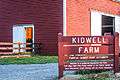
Kidwell Farm | |
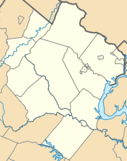   | |
| Location | Bounded by Centreville Rd., W. Ox Rd., Monroe St., and Frying Pan Branch, near Herndon, Virginia |
|---|---|
| Coordinates | 38°56′17″N 77°24′27″W / 38.93806°N 77.40750°WCoordinates: 38°56′17″N 77°24′27″W / 38.93806°N 77.40750°W |
| NRHP Reference # | 10000543[1] |
| VLR # | 029-5179 |
| Significant dates | |
| Added to NRHP | August 12, 2010 |
| Designated VLR | September 17, 2009[2] |
Floris Historic District is a historic district that is listed on the U.S. National Register of Historic Places (NRHP).
It's located in the vicinity of the city of Herndon, Virginia, and just about one mile east of Dulles International Airport.[3]
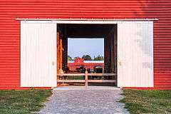
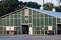
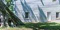
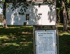
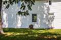
It includes the last remaining working farm in Fairfax County, Virginia, the Frying Pan Farm, which is now also a park. Within that park contributing resources are the Ellmore Farm, Kidwell Farm, the Floris Vocational Technical High School Shop, the Floris School, Lee Farm Site, Frying Pan Meetinghouse. Contributing resources outside the park, nearby, are: Higgins House, Fox House, Cherok House/Cockerill-McFarland House Site, Floris Methodist Church and Stover House.
Gallery

See also
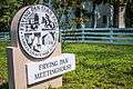
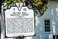
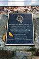
- Frying Pan Meetinghouse, nearby, also NRHP-listed
References
- ↑ "National Register of Historic Places Listings". Weekly List of Actions Taken on Properties: 8/09/10 through 8/13/10. National Park Service. 2010-08-20.
- ↑ "Virginia Landmarks Register". Virginia Department of Historic Resources. Retrieved 5 June 2013.
- ↑ Darrell E. Cook and Helen P. Ross (January 22, 2009). "National Register of Historic Places Inventory/Nomination: Floris Historic District" (PDF). Virginia Department of Historic Resources. and accompanying four photos and accompanying map


This article is issued from Wikipedia - version of the 11/29/2016. The text is available under the Creative Commons Attribution/Share Alike but additional terms may apply for the media files.