Jacksboro, Texas
| Jacksboro, Texas | |
|---|---|
| City | |
|
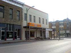
Businesses in downtown Jacksboro | |
 Location of Jacksboro, Texas | |
 | |
| Coordinates: 33°13′24″N 98°9′39″W / 33.22333°N 98.16083°WCoordinates: 33°13′24″N 98°9′39″W / 33.22333°N 98.16083°W | |
| Country | United States |
| State | Texas |
| County | Jack |
| Area | |
| • Total | 6.8 sq mi (17.6 km2) |
| • Land | 5.8 sq mi (15.1 km2) |
| • Water | 1.0 sq mi (2.6 km2) |
| Elevation | 1,083 ft (330 m) |
| Population (2010) | |
| • Total | 4,511 |
| • Density | 778.7/sq mi (300.6/km2) |
| Time zone | Central (CST) (UTC-6) |
| • Summer (DST) | CDT (UTC-5) |
| ZIP code | 76458 |
| Area code(s) | 940 |
| FIPS code | 48-37168[1] |
| GNIS feature ID | 1338568[2] |
Jacksboro is a city in Jack County, Texas, in the United States. The population was 4,511 at the 2010 census. Jacksboro is located at the junction of U.S. Highways 281 and 380, and it is the county seat of Jack County.[3]
Geography
Jacksboro is located at 33°13′24″N 98°09′39″W / 33.223355°N 98.160845°W (33.223355, -98.160845).[4]
According to the United States Census Bureau, the city has a total area of 6.8 square miles (18 km2), of which, 5.8 square miles (15 km2) of it is land and 1.0 square mile (2.6 km2) of it (14.54%) is water.
History
Jacksboro was first settled in the 1850s, attracted by land offers from the Texas Emigration and Land Office. Originally called Mesquiteville, the community grew up along the banks of Lost Creek and spread out over the pastureland between Lost Creek and the waters of the West Fork of Keechi Creek. It was renamed Jacksboro in 1858 when it became the county seat, in honor of brothers William and Patrick Jack, veterans of the Texas Revolution.[5][6][7] Regular postal service began in 1859.
The county was one of the few to vote against secession before the Civil War . It was devastated by Native American raids until Fort Richardson was built south of Jacksboro in 1870. The population quickly bounced back into the thousands, and the town gained national attention in 1871 when two Kiowa chiefs, Satanta and Big Tree, were tried for murder there.
The Chicago and Rock Island Railroad arrived in 1898, and increased the town's commercial importance to the surrounding region, as did the completion of highways and other roads later on.
It is near Fort Richardson State Historical Park. Jacksboro stakes a claim to having the first state 4-H club, formed in the 1910s in Jacksboro.
Demographics
At the census[1] of 2000, there were 4,533 people, 1,382 households, and 954 families residing in the city. The population density was 778.7 people per square mile (300.7/km2). There were 1,559 housing units at an average density of 267.8 per square mile (103.4/km2). The racial makeup of the city was 81.95% White, 10.46% African American, 0.57% Native American, 0.31% Asian, 0.02% Pacific Islander, 5.56% from other races, and 1.13% from two or more races. Hispanic or Latino of any race were 10.74% of the population.
There were 1,382 households out of which 33.7% had children under the age of 18 living with them, 53.7% were married couples living together, 11.7% had a female householder with no husband present, and 30.9% were non-families. 28.4% of all households were made up of individuals and 16.3% had someone living alone who was 65 years of age or older. The average household size was 2.50 and the average family size was 3.06.
| Historical population | |||
|---|---|---|---|
| Census | Pop. | %± | |
| 1880 | 387 | — | |
| 1890 | 751 | 94.1% | |
| 1900 | 1,311 | 74.6% | |
| 1910 | 1,480 | 12.9% | |
| 1920 | 1,373 | −7.2% | |
| 1930 | 1,837 | 33.8% | |
| 1940 | 2,368 | 28.9% | |
| 1950 | 2,951 | 24.6% | |
| 1960 | 3,816 | 29.3% | |
| 1970 | 3,554 | −6.9% | |
| 1980 | 4,000 | 12.5% | |
| 1990 | 3,350 | −16.2% | |
| 2000 | 4,533 | 35.3% | |
| 2010 | 4,511 | −0.5% | |
| Est. 2015 | 4,424 | [8] | −1.9% |
In the city the population was spread out with 21.7% under the age of 18, 13.0% from 18 to 24, 33.1% from 25 to 44, 17.9% from 45 to 64, and 14.3% who were 65 years of age or older. The median age was 35 years. For every 100 females there were 139.0 males. For every 100 females age 18 and over, there were 156.5 males.
The median income for a household in the city was $30,833, and the median income for a family was $36,759. Males had a median income of $26,716 versus $20,592 for females. The per capita income for the city was $13,595. About 12.2% of families and 15.0% of the population were below the poverty line, including 16.0% of those under age 18 and 14.4% of those age 65 or over.
Education
The City of Jacksboro is served by the Jacksboro Independent School District.
Notable people
- Darrell Lester, former All-American football player at Texas Christian University
- Abe Martin, former head coach and athletic director at Texas Christian University
- Don Massengale, former professional golfer on the PGA Tour
- Rik Massengale, former professional golfer on the PGA Tour
Climate
The climate in this area is characterized by hot, humid summers and generally mild to cool winters. According to the Köppen Climate Classification system, Jacksboro has a humid subtropical climate, abbreviated "Cfa" on climate maps.[10]
References
- 1 2 "American FactFinder". United States Census Bureau. Archived from the original on September 11, 2013. Retrieved 2008-01-31.
- ↑ "US Board on Geographic Names". United States Geological Survey. 2007-10-25. Retrieved 2008-01-31.
- ↑ "Find a County". National Association of Counties. Archived from the original on May 31, 2011. Retrieved 2011-06-07.
- ↑ "US Gazetteer files: 2010, 2000, and 1990". United States Census Bureau. 2011-02-12. Retrieved 2011-04-23.
- ↑ "Jack, Patrick Churchill". The Handbook of Texas Online. The Texas State Historical Association. Retrieved 2009-05-27.
- ↑ "Jack, William Houston". The Handbook of Texas Online. The Texas State Historical Association. Retrieved 2009-05-27.
- ↑ Gannett, Henry (1905). The Origin of Certain Place Names in the United States. Govt. Print. Off. p. 167.
- ↑ "Annual Estimates of the Resident Population for Incorporated Places: April 1, 2010 to July 1, 2015". Retrieved July 2, 2016.
- ↑ "Census of Population and Housing". Census.gov. Archived from the original on May 11, 2015. Retrieved June 4, 2015.
- ↑ Climate Summary for Jacksboro, Texas
External links
Municipalities and communities of Jack County, Texas, United States | ||
|---|---|---|
| Cities | 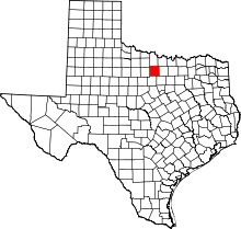 | |
| CDP | ||
| Other unincorporated communities | ||
| Ghost town |
| |
