Bonham, Texas
| Bonham, Texas | |
|---|---|
| City | |
|
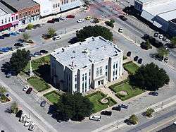
Fannin County Courthouse, Bonham, Texas, built in 1889 | |
| Motto: "The Star of North Texas"[1] | |
|
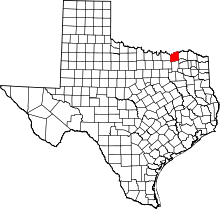
Location of Bonham, Texas | |
 | |
| Coordinates: 33°35′2″N 96°10′54″W / 33.58389°N 96.18167°WCoordinates: 33°35′2″N 96°10′54″W / 33.58389°N 96.18167°W | |
| Country | United States |
| State | Texas |
| County | Fannin |
| Area | |
| • Total | 9.8 sq mi (25.3 km2) |
| • Land | 9.8 sq mi (25.3 km2) |
| • Water | 0.0 sq mi (0.0 km2) |
| Elevation | 610 ft (186 m) |
| Population (2010) | |
| • Total | 10,127 |
| • Density | 1,035/sq mi (399.7/km2) |
| Time zone | Central (CST) (UTC-6) |
| • Summer (DST) | CDT (UTC-5) |
| ZIP code | 75418 |
| Area code(s) | 430, 903 |
| FIPS code | 48-09328[2] |
| GNIS feature ID | 1352653[3] |
| Website |
www |
Bonham is a city in Fannin County, Texas, United States. The population was 10,127 at the 2010 census.[4] It is the county seat of Fannin County.[5] James Bonham (the city's namesake) sought the aid of James Fannin (the county's namesake) at the Battle of the Alamo.
Bonham is part of the Texoma region.
Geography
Bonham is located slightly west of the center of Fannin County in northeastern Texas. U.S. Route 82, a two-lane bypass, crosses the northern part of the city, leading east 37 miles (60 km) to Paris and west 27 miles (43 km) to Sherman. Texas State Highway 78 passes through the center of Bonham, leading north 12 miles (19 km) to the Oklahoma border at the Red River and south 10 miles (16 km) to Bailey. Texas State Highway 56, following an old routing of US 82, crosses Highway 78 in the center of Bonham, leading east 6 miles (10 km) to Dodd City and west 6 miles to Ector. Texas State Highway 121 leads southwest from Bonham 41 miles (66 km) to McKinney. Dallas is 72 miles (116 km) to the southwest via McKinney.
According to the U.S. Census Bureau, Bonham has a total area of 9.8 square miles (25.3 km2), all of it land.[4]
History
Bonham, one of the oldest cities in Texas, dates back to 1837 when Bailey Inglish built a two-story blockhouse named Fort Inglish. It was located about 2 miles (3 km) from the current downtown. Inglish and other acquaintances settled there in the summer of 1837, and the settlement was named "Bois D'Arc". In 1843, the Congress of the Republic of Texas assigned the name "Bloomington" to the city, but finally renamed it "Bonham", in honor of James Butler Bonham, a hero and defender of the Alamo. On February 2, 1848, Bonham was incorporated as a city. A 1936 statue of Bonham by Texas sculptor Allie Tennant graces the courthouse grounds.[6]
After the connection to the Texas and Pacific Railway the city began to grow, and in 1885 there were six churches, three colleges, two public schools, three weekly newspapers, a saw mill, two grain mills, a power plant, and about 2,300 inhabitants. 1890 saw the addition of streetcars, an ice plant, and the opening of the Texas Power and Light Company, the utility provider to the area. In 1925, the city was connected to natural gas lines.
During the Second World War, there was a training camp and an aviation school for the United States Army Air Forces in the vicinity of Bonham, as well as a prisoner-of-war camp for captured German soldiers. Parts of the camp, located approximately 0.5 miles north of US 82, can still be visited today.
Demographics
| Historical population | |||
|---|---|---|---|
| Census | Pop. | %± | |
| 1850 | 211 | — | |
| 1860 | 477 | 126.1% | |
| 1870 | 928 | 94.5% | |
| 1880 | 1,889 | 103.6% | |
| 1890 | 3,361 | 77.9% | |
| 1900 | 5,042 | 50.0% | |
| 1910 | 4,844 | −3.9% | |
| 1920 | 6,008 | 24.0% | |
| 1930 | 5,655 | −5.9% | |
| 1940 | 6,349 | 12.3% | |
| 1950 | 7,049 | 11.0% | |
| 1960 | 7,357 | 4.4% | |
| 1970 | 7,698 | 4.6% | |
| 1980 | 7,338 | −4.7% | |
| 1990 | 6,686 | −8.9% | |
| 2000 | 9,990 | 49.4% | |
| 2010 | 10,127 | 1.4% | |
| Est. 2015 | 10,079 | [7] | −0.5% |
As of the census[2] of 2010, there were 10,127 people, 2,959 households, and 1,861 families residing in the city. The population density was 1,067.1 people per square mile (412.1/km²). There were 2,959 housing units. The racial makeup of the city was 75.4% White, 14.8% African American, 1% Native American, .4% Asian, 0.1% Pacific Islander, 6.7% from other races, and 1.8% from two or more races. Hispanic or Latino of any race were 15.4% of the population.
There were 2,884 households out of which 28.8% had children under the age of 18 living with them, 41.3% were married couples living together, 15.2% had a female householder with no husband present, and 37% were non-families. 32.1% of all households were made up of individuals and 32.3% had someone who was 65 years of age or older. The average household size was 2.4 and the average family size was 3.05.
In the city the population was spread out with 21% under the age of 19, 9% from 20 to 24, 31% from 25 to 44, 23.5% from 45 to 64, and 15.2% who were 65 years of age or older. The median age was 36 years.
The median income for a household in the city was $27,277, and the median income for a family was $35,721. Males had a median income of $26,035 versus $21,897 for females. The per capita income for the city was $16,301. About 22.5% of the population were below the poverty line.
Education
The city is served by the Bonham Independent School District. The city's high school is Bonham High School.
In addition, Grayson County College serves Bonham. It once operated a branch campus in Bonham, its only campus outside its namesake county; however, Grayson College ceased operations in Bonham after 2012 due to small enrollment numbers.[9] Also Texas A&M University-Commerce, a major university of over 12,000 students is located in the neighboring city of Commerce, just 35 minutes southeast of Bonham.
Notable people
- Homer Blankenship, Major League Baseball pitcher of 1920s
- Charlie Christian, pioneering jazz guitarist
- Roberta Dodd Crawford, lyric soprano and voice instructor
- Danny Darwin, Major League Baseball pitcher
- Stephen Flowers, expert on the occult
- John Wesley Hardin, well-known outlaw and gunfighter in late 19th-century Texas
- Durwood Keeton, American football player
- Kenny Marchant, congressman, Texas 24th District
- Tom McBride, Major League Baseball outfielder
- Roy McMillan, Cincinnati Reds All-Star shortstop
- Jerry Moore, head coach of Appalachian State Mountaineers football team
- Joe Morgan, Baseball Hall of Fame second baseman
- Sam Rayburn, American politician, former Speaker of the U.S. House of Representatives
- James Tague, writer and a key witness to the assassination of President John F. Kennedy
- B. A. Wilson, NASCAR driver
Climate
The climate in this area is characterized by hot, humid summers and generally mild to cool winters. According to the Köppen Climate Classification system, Bonham has a humid subtropical climate, abbreviated "Cfa" on climate maps.[10]
References
- ↑ City of Bonham official website
- 1 2 "American FactFinder". United States Census Bureau. Archived from the original on 2013-09-11. Retrieved 2008-01-31.
- ↑ "US Board on Geographic Names". United States Geological Survey. 2007-10-25. Retrieved 2008-01-31.
- 1 2 "Geographic Identifiers: 2010 Demographic Profile Data (G001): Bonham city, Texas". U.S. Census Bureau, American Factfinder. Retrieved August 22, 2016.
- ↑ "Find a County". National Association of Counties. Archived from the original on 2011-05-31. Retrieved 2011-06-07.
- ↑ Little, Carol Morris, A Comprehensive Guide to Outdoor Sculpture in Texas, University of Texas Press, Austin, 1996 p. 100
- ↑ "Annual Estimates of the Resident Population for Incorporated Places: April 1, 2010 to July 1, 2015". Retrieved July 2, 2016.
- ↑ "Census of Population and Housing". Census.gov. Archived from the original on May 11, 2015. Retrieved June 4, 2015.
- ↑ Staff, KXII-TV. "Fannin County's only college campus to close". www.kxii.com. Retrieved 2016-06-10.
- ↑ Climate Summary for Bonham, Texas
External links
- City of Bonham official website
 Chisholm, Hugh, ed. (1911). "Bonham". Encyclopædia Britannica (11th ed.). Cambridge University Press.

.jpg)

