Lower Basin Historic District
|
Lower Basin Historic District | |
|
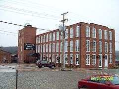
Craddock Terry Hotel, December 2008 | |
  | |
| Location | 700-1300 blks. of Jefferson St., 600--1300 blks. of Commerce St., and 1200--1300 Blks. of Main St., 1307 Main St., 103-109 Sixth St. Lynchburg, Virginia |
|---|---|
| Coordinates | 37°24′52″N 79°8′21″W / 37.41444°N 79.13917°WCoordinates: 37°24′52″N 79°8′21″W / 37.41444°N 79.13917°W |
| Area | 52 acres (21 ha) |
| Architect | Davis, B.H.; Johnson, Stanhope; Et al. |
| Architectural style | Late 19th And 20th Century Revivals, Italianate, Romanesque |
| NRHP Reference # | 87000601; 02000620 [1] |
| VLR # | 118-0211 |
| Significant dates | |
| Added to NRHP | April 24, 1987, boundary increase June 06, 2002 |
| Designated VLR | October 14, 1986, June 13, 2001, April 30, 2008[2] |
The Lower Basin Historic District is a national historic district located in Lynchburg, Virginia. The district defines a commercial and industrial warehouse area located between the downtown commercial area to the south and the James River waterfront to the north. The district contains a variety of mostly late 19th- and early 20th-century, multi-story, brick warehouses and factories, two-to-three-story brick commercial buildings, and a number of structures associated with the James River and Kanawha Canal and the Norfolk and Western and Chesapeake and Ohio Railways. The district is named for a wide basin of the canal that once extended between Ninth Street and Horseford Road, and contains 60 contributing buildings, two contributing structures (a viaduct and a stone bridge), and one contributing object-a monument commemorating the site of 18th-century Lynch's Ferry.[3]
It was listed on the National Register of Historic Places in 1987, with the boundary increased in 2002, and two additional resources added in 2008.[1]
References
- 1 2 National Park Service (2008-04-15). "National Register Information System". National Register of Historic Places. National Park Service.
- ↑ "Virginia Landmarks Register". Virginia Department of Historic Resources. Retrieved 19 March 2013.
- ↑ Division of Historic Landmarks Staff (1986). "National Register of Historic Places Inventory/Nomination: Lower Basin Historic District" (PDF). Virginia Department of Historic Resources. and Accompanying photo and Accompanying map, 2002 Boundary Increase, 2008 Amendment
![]() Media related to Lower Basin Historic District at Wikimedia Commons
Media related to Lower Basin Historic District at Wikimedia Commons

