Jackson County, Oregon
| Jackson County, Oregon | ||
|---|---|---|
_(jacDA0008).jpg) Jackson County Courthouse in Medford | ||
| ||
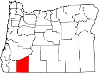 Location in the U.S. state of Oregon | ||
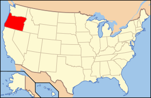 Oregon's location in the U.S. | ||
| Founded | January 12, 1852 | |
| Seat | Medford | |
| Largest city | Medford | |
| Area | ||
| • Total | 2,802 sq mi (7,257 km2) | |
| • Land | 2,784 sq mi (7,211 km2) | |
| • Water | 18 sq mi (47 km2), 0.6% | |
| Population (est.) | ||
| • (2015) | 212,567 | |
| • Density | 73/sq mi (28/km²) | |
| Congressional district | 2nd | |
| Time zone | Pacific: UTC-8/-7 | |
| Website |
jacksoncountyor | |
_Seal.png)
Jackson County is a county located in the U.S. state of Oregon. As of the 2010 census, the population was 203,206.[1] The county seat is Medford.[2][3] The county is named for Andrew Jackson, the seventh president of the United States.[4]
Jackson County comprises the Medford, OR Metropolitan Statistical Area.
There are 11 incorporated cities and 34 unincorporated communities in Jackson County; the largest is Medford, which has been the county seat since 1927.[5]
History
Modoc, Shasta, Takelma, Latgawa, and Umpqua Indian tribes are all native to the region of present Jackson County. In the early 1850s, both the Klickitats from the north and the Deschutes from the south raided and settled the area.
The Territorial Legislature created Jackson County on January 12, 1852, from the southwestern portion of Lane County and the unorganized area south of Douglas and Umpqua Counties. It included lands which now lie in Coos, Curry, Josephine, Klamath and Lake Counties. Gold discoveries in the Illinois River valley and the Rogue River valley near Jacksonville in 1852, and the completion of a wagon road connecting the county with California to the south and Douglas County to the north led to an influx of non-native settlers.
Conflict between the miners and Native Americans led to war in 1853, which continued intermittently until the final defeat of the last band under chiefs John and George by a combined force of regular army and civilians May 29, 1856 at Big Bend on the Illinois River. The Native Americans had received the worse of the fighting throughout this conflict, and as they began to surrender, they were herded to existing reservations, beginning in January 1856 when one group was marched to the Grand Ronde Indian Reservation west of Salem. Over the following months, other groups were forced to leave until by May 1857 almost all of the Shasta, Takelma, and Latgawas tribes had been relocated to the Siletz Reservation, where they remained.
Jacksonville was designated as the first county seat in 1853. However, Jacksonville declined due to diminishing returns in the local goldfields and the construction in the 1880s of the Oregon and California Railroad. This railroad bypassed Jacksonville and instead went through Medford, located five miles (8 km) east of Jacksonville. Medford's prospects improved because of the location of the railroad and the accompanying commerce and development as Jacksonville continued its steady decline. Jacksonville fended off suggestions to move the county seat until 1927 when Medford was finally selected as the county seat.
In March 2004, Jackson County became the first of an eventual 35 counties in Oregon to implement a voluntary plan of fireproofing homes situated on properties zoned as part of the forestland-urban interface. This requires homeowners to maintain a 30' or greater firebreak around their structures, and affects 12,000 homeowners. In 2007 this plan becomes mandatory for many landowners, under threat of liability if their property is involved in a fire.
On May 15, 2007, residents voted not to reopen the county's 15 libraries, which had been closed since April 6 due to a shortage of funds.[6] This was the largest library closure in the history of the United States.[7] The libraries were reopened, with reduced hours, on October 24, 2007.[8]
Geography
According to the U.S. Census Bureau, the county has a total area of 2,802 square miles (7,260 km2), of which 2,784 square miles (7,210 km2) is land and 18 square miles (47 km2) (0.6%) is water.[10] A portion of the Umpqua National Forest is in Jackson County.
Located entirely within Jackson County is Bear Creek and its watershed, a tributary of the Rogue River.[11] The population centers of Medford, Ashland, Phoenix, Talent, and Central Point are located along the stream. It connects with the Rogue River near the Upper and Lower Table Rock lava formations.
Adjacent counties
- Josephine County (west)
- Klamath County (east)
- Douglas County (north)
- Siskiyou County, California (south)
National protected areas
- Cascade–Siskiyou National Monument
- Crater Lake National Park (part)
- Klamath National Forest (part)
- Rogue River-Siskiyou National Forest (part)
- Umpqua National Forest (part)
Demographics
| Historical population | |||
|---|---|---|---|
| Census | Pop. | %± | |
| 1860 | 3,736 | — | |
| 1870 | 4,778 | 27.9% | |
| 1880 | 8,154 | 70.7% | |
| 1890 | 11,455 | 40.5% | |
| 1900 | 13,698 | 19.6% | |
| 1910 | 25,756 | 88.0% | |
| 1920 | 20,405 | −20.8% | |
| 1930 | 32,918 | 61.3% | |
| 1940 | 36,213 | 10.0% | |
| 1950 | 58,510 | 61.6% | |
| 1960 | 73,962 | 26.4% | |
| 1970 | 94,533 | 27.8% | |
| 1980 | 132,456 | 40.1% | |
| 1990 | 146,389 | 10.5% | |
| 2000 | 181,269 | 23.8% | |
| 2010 | 203,206 | 12.1% | |
| Est. 2015 | 212,567 | [12] | 4.6% |
| U.S. Decennial Census[13] 1790-1960[14] 1900-1990[15] 1990-2000[16] 2010-2015[1] | |||
2000 census
As of the census[17] of 2000, there were 181,269 people, 71,532 households, and 48,427 families residing in the county. The population density was 65 people per square mile (25/km²). There were 75,737 housing units at an average density of 27 per square mile (10/km²). The racial makeup of the county was 91.65% White, 0.40% Black or African American, 1.09% Native American, 0.90% Asian, 0.18% Pacific Islander, 2.88% from other races, and 2.91% from two or more races. 6.69% of the population were Hispanic or Latino of any race. 17.4% were of German, 12.9% English, 10.2% Irish and 8.8% United States or American ancestry. 92.7% spoke only English at home, while 5.6% spoke Spanish.
Of the 71,532 households, 30.30% had children under the age of 18 living with them, 53.20% were married couples living together, 10.50% had a female householder with no husband present, and 32.30% were non-families. 25.10% of all households were made up of one individual, 11.00% being a person who was 65 years of age or older. The average household size was 2.48 and the average family size was 2.95.
The age distribution of the county's population was 24.40% under the age of 18, 8.70% from 18 to 24, 25.50% from 25 to 44, 25.40% from 45 to 64, and 16.00% 65 years of age or older. The median age was 39 years. For every 100 females there were 94.60 males. For every 100 females age 18 and over, there were 91.70 males.
The median income for a household in the county was $36,461, and the median income for a family was $43,675. Males had a median income of $32,720 compared to $23,690 for females. The per capita income for the county was $19,498. 8.90% of families and 12.50% of the population were below the poverty line, including 16.30% of those under age 18 and 6.90% of those age 65 or over.
2010 census
As of the 2010 United States Census, there were 203,206 people, 83,076 households, and 53,460 families residing in the county.[18] The population density was 73.0 inhabitants per square mile (28.2/km2). There were 90,937 housing units at an average density of 32.7 per square mile (12.6/km2).[19] The racial makeup of the county was 88.7% white, 1.2% Asian, 1.2% American Indian, 0.7% black or African American, 0.3% Pacific islander, 4.5% from other races, and 3.5% from two or more races. Those of Hispanic or Latino origin made up 10.7% of the population.[18] In terms of ancestry, 19.9% were German, 14.4% were English, 14.1% were Irish, and 5.3% were American.[20]
Of the 83,076 households, 28.7% had children under the age of 18 living with them, 48.4% were married couples living together, 11.0% had a female householder with no husband present, 35.6% were non-families, and 27.7% of all households were made up of individuals. The average household size was 2.40 and the average family size was 2.91. The median age was 42.1 years.[18]
The median income for a household in the county was $44,142 and the median income for a family was $53,739. Males had a median income of $40,435 versus $30,632 for females. The per capita income for the county was $24,410. About 9.9% of families and 14.0% of the population were below the poverty line, including 19.0% of those under age 18 and 7.4% of those age 65 or over.[21]
Economy
The county's principal industries are healthcare, agriculture, lumber, manufacturing, and tourism.
Jackson County has over 10,000 acres (40 km2) of orchards and shares with Josephine County the Rogue Valley and Applegate wine appellations.
Soapstone, a substance used in art sculpture, is mined in Jackson County.[22]
Points of interest
Bear Creek Greenway
The Bear Creek Greenway is the area on both side of Bear Creek running from Ashland to Central Point. The Greenway's most popular feature is the bike path which runs from Ashland north towards Medford. Eventually it will be a 21-mile long paved link between Ashland and Central Point. The bike path is very popular with cyclists and skaters, especially during the warmer spring and summer months.[23]
Oregon Vortex
Jackson County is home to the Oregon Vortex, a roadside attraction located in Gold Hill. It is an example of a gravity hill; the attraction contains several demonstrations of what are claimed to be phenomenons relating to the surrounding area, but skeptics would argue to be optical illusions.[24][25]
Communities
Cities
Census-designated places
Unincorporated communities
- Applegate
- Beagle
- Bitter Lick
- Brownsboro
- Buckhorn Springs
- Buncom
- Bybee Corner
- Cascade Gorge
- Climax
- Colestin
- Dardanelles
- Four Corners
- Lake Creek
- Lincoln
- McKee Bridge
- McLeod
- Mountain View
- Persist
- Pinehurst
- Provolt
- Rock Point
- Rogue Elk
- Sams Valley
- Seven Oaks
- Starvation Heights
- Steamboat
- Table Rock
- Tolo
- Union Creek
Former communities
See also
- Beekman Native Plant Arboretum
- Bigfoot trap
- Britt Festival
- Jackson County Sheriff's Office (Oregon)
- Mail Tribune
- National Fish and Wildlife Forensics Laboratory
- National Register of Historic Places listings in Jackson County, Oregon
- Oregon Shakespeare Festival
- Southern Oregon Land Conservancy
- Southern Oregon University
- Southern Oregon Speedway
- Medford School District
- Ashland School District
References
- 1 2 "State & County QuickFacts". United States Census Bureau. Retrieved November 15, 2013.
- ↑ "Find a County". National Association of Counties. Archived from the original on May 31, 2011. Retrieved 2011-06-07.
- ↑ "About Jackson County". Jackson County, Oregon. Retrieved April 29, 2009. External link in
|publisher=(help) - ↑ Gannett, Henry (1905). The Origin of Certain Place Names in the United States. Govt. Print. Off. p. 167.
- ↑ "About Medford". Mail Tribune. Retrieved April 29, 2009.
- ↑ Mann, Damian; County library levy fails handily at the Mail Tribune; written May 16, 2007; retrieved February 4, 2008
- ↑ May, Meredith; Largest library closure in U.S. looms at the San Francisco Chronicle; written March 4, 2007; retrieved February 4, 2008
- ↑ Mann, Damian; Libraries will start to open Oct. 24 at the Mail Tribune; written October 9, 2007; retrieved February 4, 2008
- ↑ Gumprecht Bannan, Jan (2002). Oregon State Parks. The Mountaineers Books. p. 150. ISBN 0-89886-794-0.
- ↑ "2010 Census Gazetteer Files". United States Census Bureau. August 22, 2012. Retrieved February 26, 2015.
- ↑ "Bear Creek Watershed Assessment - Phase 2" (PDF). Rogue Valley Council of Governments. December 2001. p. 9. Retrieved April 21, 2009. External link in
|publisher=(help) - ↑ "County Totals Dataset: Population, Population Change and Estimated Components of Population Change: April 1, 2010 to July 1, 2015". Retrieved July 2, 2016.
- ↑ "U.S. Decennial Census". United States Census Bureau. Archived from the original on May 11, 2015. Retrieved February 26, 2015.
- ↑ "Historical Census Browser". University of Virginia Library. Retrieved February 26, 2015.
- ↑ Forstall, Richard L., ed. (March 27, 1995). "Population of Counties by Decennial Census: 1900 to 1990". United States Census Bureau. Retrieved February 26, 2015.
- ↑ "Census 2000 PHC-T-4. Ranking Tables for Counties: 1990 and 2000" (PDF). United States Census Bureau. April 2, 2001. Retrieved February 26, 2015.
- ↑ "American FactFinder". United States Census Bureau. Archived from the original on September 11, 2013. Retrieved January 31, 2008.
- 1 2 3 "DP-1 Profile of General Population and Housing Characteristics: 2010 Demographic Profile Data". United States Census Bureau. Retrieved 2016-02-23.
- ↑ "Population, Housing Units, Area, and Density: 2010 - County". United States Census Bureau. Retrieved 2016-02-23.
- ↑ "DP02 SELECTED SOCIAL CHARACTERISTICS IN THE UNITED STATES – 2006-2010 American Community Survey 5-Year Estimates". United States Census Bureau. Retrieved 2016-02-23.
- ↑ "DP03 SELECTED ECONOMIC CHARACTERISTICS – 2006-2010 American Community Survey 5-Year Estimates". United States Census Bureau. Retrieved 2016-02-23.
- ↑ St. John, James; Soapstone at the Oregon State University; retrieved February 4, 2008
- ↑ http://www.bearcreekgreenway.com/index.asp
- ↑ Oregon Vortex official website. Retrieved December 2008.
- ↑ Oregon No-Vortex. Retrieved December 2008.
External links
 |
Douglas County | | ||
| Josephine County | |
Klamath County | ||
| ||||
| | ||||
| Siskiyou County, California |
Municipalities and communities of Jackson County, Oregon, United States | ||
|---|---|---|
| Cities | | |
| CDPs | ||
| Other unincorporated communities | ||
| Ghost towns | ||
Coordinates: 42°25′N 122°44′W / 42.42°N 122.74°W