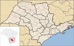
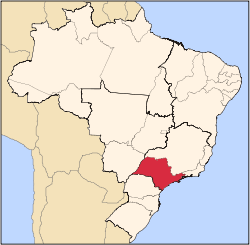
Bady Bassitt
Bady Bassitt is a municipality in the state of São Paulo, Brazil. The population is 16,359 (2015 est.) in an area of 110 km².[1] The town is located 7 km from São José do Rio Preto. The municipality belongs to the Microregion of São José do Rio Preto.
History
In 1908, Bady Bassitt was a village named Borboleta (butterfly). In this year, a road coming from Rio Preto was open. Camilo de Morais opened the first store in Borboleta, in 1912.
In February 13, 1914, the village of Borboleta was officially established and in December 12, 1926, the village is elevated to district of Rio Preto.
In February 18, 1959, the municipality of Borboleta is officially established and in 1963, the name was changed to the current form, an homage to Bady Bassitt, a politician from São José do Rio Preto.[2]
Geography
Neighbouring places
Hydrography
The municipality features several streams:
- Córrego Borá
- Córrego dos Macacos
- Córrego Borboleta (Main stream)
Demographics
Population history
| Year | Population |
|---|
| 2000 | 11,550 |
| 2010 | 14,603 |
| 2015 | 16,359 |
Statistics
- Area: 108.5 km²
- Population density: 134.54/km² (IBGE/2010) - 222.90/km² (SEADE/2011)
- Urbanization: 93.5% (2010)
- Sex ratio (Males to Females): 98.2 (2011)
- Birth rate: 11.8/1,000 inhabitants (2009)
- Infant mortality: 5.95/1,000 births (2009)
- Homicide rate: 0.0/100 thousand ppl (2008)
- HDI: 0.812 (UNDP/2000)
All statistics are from SEADE[3] and IBGE.[4]
Economy
The Tertiary sector is the economic basis of Bady. Commerce, services and administration corresponds to 60.5% of the city GDP. Industry is 35.2% of the GDP, and the Primary sector corresponds to 4.1%.[3]
Transportation
The city is linked with the BR-153 (Transbrasiliana), the SP-310 (in Rio Preto) and the SP-355 (Maurício Goulart) highways.
External links
References
|
|---|
|
|
|
|
|
| |
|---|
| Capital | |
|---|
| 1,000,000+ | |
|---|
| 500,000+ | |
|---|
| 200,000+ | |
|---|
| 100,000+ | |
|---|
|
|
|
| |
|---|
| São José do Rio Preto |
|---|
| Auriflama | |
|---|
| Catanduva | |
|---|
| Fernandópolis | |
|---|
| Jales | |
|---|
| Nhandeara | |
|---|
| Novo Horizonte | |
|---|
| São José do Rio Preto | |
|---|
| Votuporanga | |
|---|
|
|
|
|
|
|---|
|
|
|
| Araçatuba |
|---|
| Andradina | |
|---|
| Araçatuba | |
|---|
| Birigui | |
|---|
|
| |
|
|
|
|
|
| Bauru |
|---|
| Avaré | |
|---|
| Bauru | |
|---|
| Botucatu | |
|---|
| Jaú | |
|---|
| Lins | |
|---|
|
|
|
| Campinas |
|---|
| Amparo | |
|---|
| Campinas | |
|---|
| Mogi Mirim | |
|---|
| Pirassununga | |
|---|
| São João da Boa Vista | |
|---|
|
|
|
| Itapetininga |
|---|
| Capão Bonito | |
|---|
| Itapetininga | |
|---|
| Itapeva | |
|---|
| Tatuí | |
|---|
|
|
|
|
|
| Macro Metropolitana Paulista |
|---|
| Bragança Paulista | |
|---|
| Jundiaí | |
|---|
| Piedade | |
|---|
| Sorocaba | |
|---|
|
|
|
|
|
| Metropolitana de São Paulo |
|---|
| Franco da Rocha | |
|---|
| Guarulhos | |
|---|
| Itapecerica da Serra | |
|---|
| Mogi das Cruzes | |
|---|
| Osasco | |
|---|
| Santos | |
|---|
| São Paulo | |
|---|
|
|
|
| Piracicaba |
|---|
| Limeira | |
|---|
| Piracicaba | |
|---|
| Rio Claro | |
|---|
|
|
|
| Presidente Prudente |
|---|
| Adamantina | |
|---|
| Dracena | |
|---|
| Presidente Prudente | |
|---|
|
|
|
| Ribeirão Preto |
|---|
| Barretos | |
|---|
| Batatais | |
|---|
| Franca | |
|---|
| Ituverava | |
|---|
| Jaboticabal | |
|---|
| Ribeirão Preto | |
|---|
| São Joaquim da Barra | |
|---|
|
|
|
| São José do Rio Preto |
|---|
| Auriflama | |
|---|
| Catanduva | |
|---|
| Fernandópolis | |
|---|
| Jales | |
|---|
| Nhandeara | |
|---|
| Novo Horizonte | |
|---|
| São José do Rio Preto | |
|---|
| Votuporanga | |
|---|
|
|
|
| Vale do Paraíba Paulista |
|---|
| Bananal | |
|---|
| Campos do Jordão | |
|---|
| Caraguatatuba | |
|---|
| Guaratinguetá | |
|---|
| Paraibuna/Paraitinga | |
|---|
| São José dos Campos | |
|---|
|
|