List of the most prominent summits of North America
The following sortable table comprises the 200 most topographically prominent mountain peaks of greater North America.[1]
The summit of a mountain or hill may be measured in three principal ways:
- The topographic elevation of a summit measures the height of the summit above a geodetic sea level.[2][3]
- The topographic prominence of a summit is a measure of how high the summit rises above its surroundings.[4][3]
- The topographic isolation (or radius of dominance) of a summit measures how far the summit lies from its nearest point of equal elevation.[5]
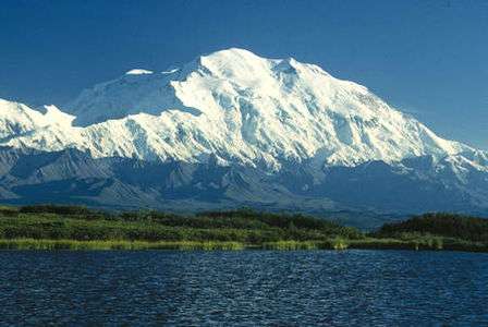
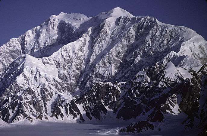
Denali is one of only three summits on Earth with more than 6000 meters (19,685 feet) of topographic prominence. Mount Logan exceeds 5000 meters (16,404 feet) of prominence. Four peaks of greater North America exceed 4000 meters (13,123 feet), ten exceed 3500 meters (11,483 feet), 17 exceed 3000 meters (9843 feet), 34 exceed 2500 meters (8202 feet), 100 exceed 2000 meters (6562 feet), and 353 ultra-prominent summits exceed 1500 meters (4921 feet) of topographic prominence.
Most prominent summits
Of these 200 most prominent summits of North America, 81 are located in the United States (excluding four in Hawaiʻi), 74 in Canada, 16 in Greenland, 14 in México, six in Guatemala, three in Honduras, two in Costa Rica, two in the Dominican Republic, two in Haiti, and one each in Jamaica, Cuba, El Salvador, and Panamá. Four of these peaks lie on the Canada-United States border.
Gallery
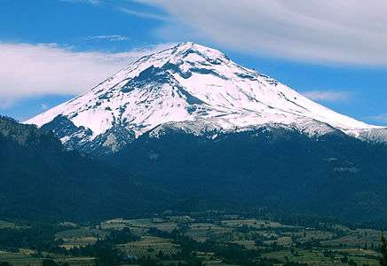
 3. Pico de Orizaba is the highest summit of México.
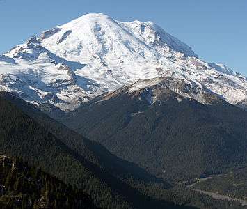


 7. Chirripó Grande is the highest summit of Costa Rica.

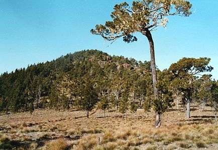
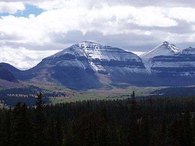
 10. Mount Hayes is the highest summit of the eastern Alaska Range.
 17. Popocatépetl is the second highest summit of México.
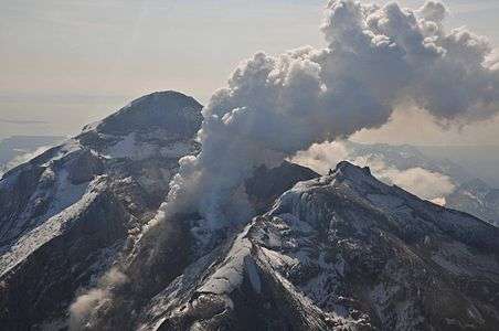 22. Redoubt Volcano is the highest summit of the Aleutian Range.

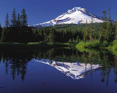 49. Mount Hood is the highest summit of Oregon.
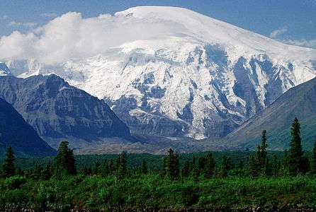
 61. Nevado de Toluca is the fourth highest summit of México.
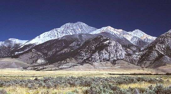
 64. Mount Foraker is the second highest major summit of the Alaska Range.


See also
- North America
- Geography of North America
- Geology of North America
- Lists of mountain peaks of North America
- List of mountain peaks of North America
- List of the highest major summits of North America
- List of the most prominent summits of North America
- List of the most isolated major summits of North America
- List of extreme summits of North America
- List of mountain peaks of Greenland
- List of mountain peaks of Canada
- List of mountain peaks of the Rocky Mountains
- List of mountain peaks of the United States
- List of mountain peaks of México
- List of mountain peaks of Central America
- List of mountain peaks of the Caribbean
- Category:Mountains of North America
- List of mountain peaks of North America
- Physical geography
References
- ↑ This article defines greater North America as the portion of the continental landmass of the Americas extending westward and northward from the Isthmus of Panama plus the ocean islands surrounding that landmass. This article defines the ocean islands of greater North America to include the coastal islands of North America, the islands of the Caribbean Sea, the Lucayan Archipelago, the islands of Greenland (Kalaallit Nunaat), the islands of Canada, and the islands of Alaska. The Hawaiian Islands are not included because they are considered part of Oceania.
- ↑ All elevations in the 48 states of the contiguous United States include an elevation adjustment from the National Geodetic Vertical Datum of 1929 (NGVD 29) to the North American Vertical Datum of 1988 (NAVD 88). For further information, please see this United States National Geodetic Survey note.
- 1 2 If the elevation or prominence of a summit is calculated as a range of values, the arithmetic mean is shown.
- ↑ The topographic prominence of a summit is the topographic elevation difference between the summit and its highest or key col to a higher summit. The summit may be near its key col or quite far away. The key col for Denali in Alaska is the Isthmus of Rivas in Nicaragua, 7642 kilometers (4749 miles) away.
- ↑ The topographic isolation of a summit is the great-circle distance to its nearest point of equal elevation.
- ↑ The summit of Denali is the highest point of the Alaska Range, the State of Alaska, the United States of America, and greater North America. Denali is the third most topographically prominent and third most topographically isolated summit on Earth after Mount Everest and Aconcagua.
- ↑ "Denali". Peakbagger.com. Retrieved 4 May 2016.
- ↑ "Denali". Bivouac.com. Retrieved 4 May 2016.
- ↑ The summit of Mount Logan is the highest point of the Saint Elias Mountains, Yukon, and all of Canada.
- ↑ "Mount Logan". Peakbagger.com. Retrieved 4 May 2016.
- ↑ "Mount Logan". Bivouac.com. Retrieved 4 May 2016.
- ↑ The summit of Pico de Orizaba is the highest point of Estado Libre y Soberano de Puebla, Estado Libre y Soberano de Veracruz de Ignacio de la Llave, and all of México.
- ↑ "Pico de Orizaba". Peakbagger.com. Retrieved 4 May 2016.
- ↑ "Pico de Orizaba". Bivouac.com. Retrieved 4 May 2016.
- ↑ The summit of Mount Rainier is the highest point of the Cascade Range and the U.S. State of Washington. Mount Rainier is the most prominent summit in the contiguous United States and the fourth most prominent in North America.
- ↑ The elevation of Mount Rainier includes an adjustment of +1.914 m (+6.28 ft) from NGVD 29 to NAVD 88.
- ↑ "Mount Rainier". Peakbagger.com. Retrieved 4 May 2016.
- ↑ "Mount Rainier". Bivouac.com. Retrieved 4 May 2016.
- ↑ The summit of Volcán Tajumulco is the highest point of the Sierra de las Nubes, the Republic of Guatemala, and all of Central America.
- ↑ Volcán Tajumulco is the southernmost and easternmost 4000-meter (13,123-foot) summit of greater North America.
- ↑ "Volcán Tajumulco". Peakbagger.com. Retrieved 4 May 2016.
- ↑ Mount Fairweather lies on the international border between Alaska and British Columbia. The peak is the highest point of the Canadian Province of British Columbia and the southernmost and easternmost summit of its elevation in both Canada and the United States.
- ↑ "Mount Fairweather". Peakbagger.com. Retrieved 4 May 2016.
- ↑ "Mount Fairweather". Bivouac.com. Retrieved 4 May 2016.
- ↑ The summit of Chirripó Grande is the highest point of the Republic of Costa Rica.
- ↑ Chirripó Grande is the southernmost and easternmost summit of its elevation in Central America and greater North America.
- ↑ "Chirripó Grande". Peakbagger.com. Retrieved 4 May 2016.
- ↑ The summit of Gunnbjørn Fjeld is the highest point of the Island of Greenland, Kalaallit Nunaat, the Kingdom of Denmark, and the entire Arctic.
- ↑ Gunnbjørn Fjeld is the easternmost summit of its elevation in greater North America.
- ↑ "Gunnbjørn Fjeld". Peakbagger.com. Retrieved 4 May 2016.
- ↑ "Gunnbjørn Fjeld". Bivouac.com. Retrieved 4 May 2016.
- ↑ The summit of Mount Blackburn is the highest point of the Wrangell Mountains.
- ↑ "MT BLACKBURN". Datasheet for NGS Station UV4136. United States National Geodetic Survey. Retrieved 4 May 2016.
- ↑ "Mount Blackburn". Peakbagger.com. Retrieved 4 May 2016.
- ↑ "Mount Blackburn". Bivouac.com. Retrieved 4 May 2016.
- ↑ The summit of Mount Hayes is the highest point of the Hayes Range.
- ↑ Mount Hayes is the northernmost 4000-meter (13,123-foot) summit of Alaska, the United States, and greater North America.
- ↑ "Mount Hayes". Peakbagger.com. Retrieved 4 May 2016.
- ↑ "Mount Hayes". Bivouac.com. Retrieved 4 May 2016.
- ↑ Mount Saint Elias is the second highest major summit of both Canada and the United States.
- ↑ "Mount Saint Elias". Peakbagger.com. Retrieved 4 May 2016.
- ↑ "Mount Saint Elias". Bivouac.com. Retrieved 4 May 2016.
- ↑ The summit of Mount Waddington is the highest point of the Coast Mountains.
- ↑ Mount Waddington is the southernmost and easternmost 4000-meter (13,123-foot) summit of Canada.
- ↑ "Mount Waddington". Peakbagger.com. Retrieved 4 May 2016.
- ↑ "Mount Waddington". Bivouac.com. Retrieved 4 May 2016.
- ↑ The summit of Mount Marcus Baker is the highest point of the Chugach Mountains.
- ↑ "Mount Marcus Baker". Peakbagger.com. Retrieved 4 May 2016.
- ↑ "Mount Marcus Baker". Bivouac.com. Retrieved 4 May 2016.
- ↑ The summit of Pico Duarte is the highest point of the Dominican Republic, the Island of Hispaniola, and all islands of the Caribbean Sea.
- ↑ "Pico Duarte". Peakbagger.com. Retrieved 4 May 2016.
- ↑ The summit of Mount Lucania is the highest point of the northern Saint Elias Mountains.
- ↑ Mount Lucania is the northernmost summit of its elevation in Canada.
- ↑ "Mount Lucania". Peakbagger.com. Retrieved 4 May 2016.
- ↑ "Mount Lucania". Bivouac.com. Retrieved 4 May 2016.
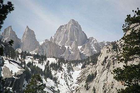
- ↑ The summit of Mount Whitney is the highest point of the Sierra Nevada, the State of California, and the contiguous United States.
- ↑ Mount Whitney is the southernmost and easternmost summit of its elevation in United States.
- ↑ "WHITNEY". Datasheet for NGS Station GT1811. United States National Geodetic Survey. Retrieved 4 May 2016.
- ↑ "Mount Whitney". Peakbagger.com. Retrieved 4 May 2016.
- ↑ "Mount Whitney". Bivouac.com. Retrieved 4 May 2016.
- ↑ Popocatépetl on the border of Puebla is the highest point of both Estado Libre y Soberano de México and Estado Libre y Soberano de Morelos.
- ↑ Popocatépetl is the southernmost 5000-meter (16,404-foot) summit of México and greater North America.
- ↑ "Popocatépetl". Peakbagger.com. Retrieved 4 May 2016.
- ↑ "Popocatépetl". Bivouac.com. Retrieved 4 May 2016.
- ↑ The summit of Mount Shasta is the highest point of the southern Cascade Range.
- ↑ "MT SHASTA". Datasheet for NGS Station MX1016. United States National Geodetic Survey. Retrieved 4 May 2016.
- ↑ "Mount Shasta". Peakbagger.com. Retrieved 4 May 2016.
- ↑ "Mount Shasta". Bivouac.com. Retrieved 4 May 2016.
- ↑ The summit of Monarch Mountain is the highest point of the Monarch Icefield.
- ↑ "Monarch Mountain". Peakbagger.com. Retrieved 4 May 2016.
- ↑ "Monarch Mountain". Bivouac.com. Retrieved 4 May 2016.
- ↑ The summit of Shishaldin Volcano is the highest point of Unimak Island and the Aleutian Islands.
- ↑ Shishaldin Volcano is the westernmost summit of its elevation in Alaska, the United States, and greater North America.
- ↑ "Shishaldin Volcano". Peakbagger.com. Retrieved 4 May 2016.
- ↑ "Shishaldin Volcano". Bivouac.com. Retrieved 4 May 2016.
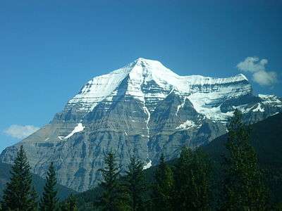
- ↑ The summit of Mount Robson is the highest point of the Canadian Rockies.
- ↑ Mount Robson is the easternmost summit of its elevation in Canada and the northernmost and westernmost summit of its elevation in the Rocky Mountains.
- ↑ "Mount Robson". Peakbagger.com. Retrieved 4 May 2016.
- ↑ "Mount Robson". Bivouac.com. Retrieved 4 May 2016.
- ↑ The summit of Redoubt Volcano is the highest point of the Chigmit Mountains.
- ↑ Redoubt Volcano is the westernmost summit of its elevation in Alaska and greater North America.
- ↑ "Redoubt Volcano". Peakbagger.com. Retrieved 4 May 2016.
- ↑ "Redoubt Volcano". Bivouac.com. Retrieved 4 May 2016.
- ↑ The summit of Mount Elbert is the highest point of the U.S. State of Colorado, the Rocky Mountains of North America, and the entire Mississippi River drainage basin.
- ↑ "MOUNT ELBERT". Datasheet for NGS Station KL0637. United States National Geodetic Survey. Retrieved 4 May 2016.
- ↑ "Mount Elbert". Peakbagger.com. Retrieved 4 May 2016.
- ↑ "Mount Elbert". Bivouac.com. Retrieved 4 May 2016.
- ↑ The summit of Mount Sir Wilfrid Laurier is the highest point of the Cariboo Mountains.
- ↑ "Mount Sir Wilfrid Laurier". Peakbagger.com. Retrieved 4 May 2016.
- ↑ "Mount Sir Wilfrid Laurier". Bivouac.com. Retrieved 4 May 2016.
- ↑ The summit of Nevado de Colima is the highest point of Estado Libre y Soberano de Jalisco.
- ↑ Nevado de Colima is the northernmost and westernmost 4000-meter (13,123-foot) summit of México.
- ↑ "Nevado de Colima". Peakbagger.com. Retrieved 4 May 2016.
- ↑ "Nevado de Colima". Bivouac.com. Retrieved 4 May 2016.
- ↑ Mount Vancouver is the easternmost summit of its elevation in Canada.
- ↑ "Mount Vancouver". Peakbagger.com. Retrieved 4 May 2016.
- ↑ "Mount Vancouver". Bivouac.com. Retrieved 4 May 2016.
- ↑ The summit of Mount Sir Sandford is the highest point of the Columbia Mountains.
- ↑ "Mount Sir Sandford". Peakbagger.com. Retrieved 4 May 2016.
- ↑ The summit of Mount Baker is the highest point of the northern Cascade Range.
- ↑ The elevation of Mount Baker includes an adjustment of +1.430 m (+4.69 ft) from NGVD 29 to NAVD 88.
- ↑ "Mount Baker". Peakbagger.com. Retrieved 4 May 2016.
- ↑ "Mount Baker". Bivouac.com. Retrieved 4 May 2016.
- ↑ The summit of Mount Torbert is the highest point of the Tordrillo Mountains.
- ↑ Mount Torbert is the westernmost summit of its elevation in Alaska and greater North America.
- ↑ "Mount Torbert". Peakbagger.com. Retrieved 4 May 2016.
- ↑ "Mount Torbert". Bivouac.com. Retrieved 4 May 2016.
- ↑ The summit of Pic la Selle is the highest point of the Republic of Haiti.
- ↑ Pic la Selle is the southernmost and westernmost summit of its elevation in the Caribbean.
- ↑ "Pic la Selle". Peakbagger.com. Retrieved 4 May 2016.
- ↑ The summit of Barbeau Peak is the highest point of Ellesmere Island and Nunavut of Canada.
- ↑ Barbeau Peak is the northernmost ultra-prominent summit of Canada and greater North America.
- ↑ "Barbeau Peak". Peakbagger.com. Retrieved 4 May 2016.
- ↑ "Barbeau Peak". Bivouac.com. Retrieved 4 May 2016.
- ↑ The summit of San Jacinto Peak is the highest point of the San Jacinto Mountains.
- ↑ "SAN JACINTO". Datasheet for NGS Station DX5119. United States National Geodetic Survey. Retrieved 4 May 2016.
- ↑ "San Jacinto Peak". Peakbagger.com. Retrieved 4 May 2016.
- ↑ "San Jacinto Peak". Bivouac.com. Retrieved 4 May 2016.
- ↑ The summit of San Gorgonio Mountain is the highest point of the San Bernardino Mountains.
- ↑ The elevation of San Gorgonio Mountain includes an adjustment of +1.303 m (+4.27 ft) from NGVD 29 to NAVD 88.
- ↑ "San Gorgonio Mountain". Peakbagger.com. Retrieved 4 May 2016.
- ↑ "San Gorgonio Mountain". Bivouac.com. Retrieved 4 May 2016.
- ↑ The summit of Charleston Peak is the highest point of the Spring Mountains.
- ↑ "CHARLESTON". Datasheet for NGS Station GR1965. United States National Geodetic Survey. Retrieved 4 May 2016.
- ↑ "Charleston Peak". Peakbagger.com. Retrieved 4 May 2016.
- ↑ "Charleston Peak". Bivouac.com. Retrieved 4 May 2016.
- ↑ The summit of Mount Pavlof is the highest point of the Alaska Peninsula.
- ↑ "Mount Pavlof". Peakbagger.com. Retrieved 4 May 2016.
- ↑ "Mount Pavlof". Bivouac.com. Retrieved 4 May 2016.
- ↑ The summit of Mount Veniaminof is the highest point of the Alaska Pennisula.
- ↑ "Mount Veniaminof". Peakbagger.com. Retrieved 4 May 2016.
- ↑ "Mount Veniaminof". Bivouac.com. Retrieved 4 May 2016.
- ↑ "MOUNT ADAMS". Datasheet for NGS Station SB1004. United States National Geodetic Survey. Retrieved 4 May 2016.
- ↑ "Mount Adams". Peakbagger.com. Retrieved 4 May 2016.
- ↑ "Mount Adams". Bivouac.com. Retrieved 4 May 2016.
- ↑ The summit of Skihist Mountain is the highest point of the Lillooet Range.
- ↑ "Skihist Mountain". Peakbagger.com. Retrieved 4 May 2016.
- ↑ "Skihist Mountain". Bivouac.com. Retrieved 4 May 2016.
- ↑ "Mount Hubbard". Peakbagger.com. Retrieved 4 May 2016.
- ↑ "Mount Hubbard". Bivouac.com. Retrieved 4 May 2016.
- ↑ The summit of Mount Ratz is the highest point of the Boundary Ranges.
- ↑ "Mount Ratz". Peakbagger.com. Retrieved 4 May 2016.
- ↑ "Mount Ratz". Bivouac.com. Retrieved 4 May 2016.
- ↑ The summit of Mount Odin is the highest point of the Gold Range.
- ↑ "Mount Odin". Peakbagger.com. Retrieved 4 May 2016.
- ↑ "Mount Odin". Bivouac.com. Retrieved 4 May 2016.
- ↑ The summit of Mount Isto is the highest point of the Brooks Range.
- ↑ Mount Isto is the northernmost ultra-prominent summit of Alaska and the United States.
- ↑ "Mount Isto". Peakbagger.com. Retrieved 4 May 2016.
- ↑ "Mount Isto". Bivouac.com. Retrieved 4 May 2016.
- ↑ The summit of Mount Monashee is the highest point of the Monashee Mountains.
- ↑ "Mount Monashee". Peakbagger.com. Retrieved 4 May 2016.
- ↑ "Mount Monashee". Bivouac.com. Retrieved 4 May 2016.
- ↑ Iliamna Volcano is the westernmost 3000-meter (9843-foot) summit of Alaska and greater North America.
- ↑ "Iliamna Volcano". Peakbagger.com. Retrieved 4 May 2016.
- ↑ "Iliamna Volcano". Bivouac.com. Retrieved 4 May 2016.
- ↑ The summit of Mount Olympus is the highest point of the Olympic Mountains.
- ↑ "MT OLYMPUS". Datasheet for NGS Station SY1857. United States National Geodetic Survey. Retrieved 4 May 2016.
- ↑ "Mount Olympus". Peakbagger.com. Retrieved 4 May 2016.
- ↑ "Mount Olympus". Bivouac.com. Retrieved 4 May 2016.
- ↑ Mount Columbia on the Great Divide between British Columbia and Alberta is the highest point of the Columbia Icefield, the Province of Alberta, and the entire Beaufort Sea Drainage basin.
- ↑ "Mount Columbia". Peakbagger.com. Retrieved 4 May 2016.
- ↑ "Mount Columbia". Bivouac.com. Retrieved 4 May 2016.
- ↑ The summit of Mount Queen Bess is the highest point of the Homathko Icefield.
- ↑ "Mount Queen Bess". Peakbagger.com. Retrieved 4 May 2016.
- ↑ "Mount Queen Bess". Bivouac.com. Retrieved 4 May 2016.
- ↑ "Mount Cook". Peakbagger.com. Retrieved 4 May 2016.
- ↑ "Mount Cook". Bivouac.com. Retrieved 4 May 2016.
- ↑ The summit of Mount Hood is the highest point of the Oregon Cascades and the U.S. State of Oregon.
- ↑ "MOUNT HOOD HIGHEST POINT". Datasheet for NGS Station RC2244. United States National Geodetic Survey. Retrieved 4 May 2016.
- ↑ "Mount Hood". Peakbagger.com. Retrieved 4 May 2016.
- ↑ "Mount Hood". Bivouac.com. Retrieved 4 May 2016.
- ↑ "Mount Sanford". Peakbagger.com. Retrieved 4 May 2016.
- ↑ "Mount Sanford". Bivouac.com. Retrieved 4 May 2016.
- ↑ "Mount Tom White". Peakbagger.com. Retrieved 4 May 2016.
- ↑ "Mount Tom White". Bivouac.com. Retrieved 4 May 2016.
- ↑ The summit of Mount Cooper is the highest point of the Goat Range.
- ↑ "Mount Cooper". Peakbagger.com. Retrieved 4 May 2016.
- ↑ "Mount Cooper". Bivouac.com. Retrieved 4 May 2016.
- ↑ The summit of Wheeler Peak is the highest point of the Snake Range.
- ↑ "WHEELER PEAK". Datasheet for NGS Station JP0339. United States National Geodetic Survey. Retrieved 4 May 2016.
- ↑ "Wheeler Peak". Peakbagger.com. Retrieved 4 May 2016.
- ↑ "Wheeler Peak". Bivouac.com. Retrieved 4 May 2016.
- ↑ The summit of Ulysses Mountain is the highest point of the Far Northern Rockies.
- ↑ Ulysses Mountain is the northernmost 3000-metre (9843-foot) summit of the Rocky Mountains.
- ↑ "Ulysses Mountain". Peakbagger.com. Retrieved 4 May 2016.
- ↑ "Ulysses Mountain". Bivouac.com. Retrieved 4 May 2016.
- ↑ "GLACIER PEAK". Datasheet for NGS Station TQ0506. United States National Geodetic Survey. Retrieved 4 May 2016.
- ↑ The elevation of Glacier Peak includes an adjustment of +1.492 m (+4.90 ft) from NGVD 29 to NAVD 88.
- ↑ "Glacier Peak". Peakbagger.com. Retrieved 4 May 2016.
- ↑ "Glacier Peak". Bivouac.com. Retrieved 4 May 2016.
- ↑ The summit of Mount Kimball is the highest point of the Delta Range.
- ↑ "Mount Kimball". Peakbagger.com. Retrieved 4 May 2016.
- ↑ "Mount Kimball". Bivouac.com. Retrieved 4 May 2016.
- ↑ The summit of Blue Mountain Peak is the highest point of the island and the nation of Jamaica.
- ↑ Blue Mountain Peak is the southernmost and westernmost 2000-meter (6562-foot) summit and ultra-prominent summit of the Caribbean.
- ↑ "Blue Mountain Peak". Peakbagger.com. Retrieved 4 May 2016.
- ↑ "Wedge Mountain". Peakbagger.com. Retrieved 4 May 2016.
- ↑ "Wedge Mountain". Bivouac.com. Retrieved 4 May 2016.
- ↑ "Otter Mountain". Peakbagger.com. Retrieved 4 May 2016.
- ↑ "Otter Mountain". Bivouac.com. Retrieved 4 May 2016.
- ↑ "Mount Griggs". Peakbagger.com. Retrieved 4 May 2016.
- ↑ "Mount Griggs". Bivouac.com. Retrieved 4 May 2016.
- ↑ Nevado de Toluca is the westernmost summit of its elevation in México.
- ↑ "Nevado de Toluca". Peakbagger.com. Retrieved 4 May 2016.
- ↑ "Nevado de Toluca". Bivouac.com. Retrieved 4 May 2016.
- ↑ "Kwatna Peak". Peakbagger.com. Retrieved 4 May 2016.
- ↑ "Kwatna Peak". Bivouac.com. Retrieved 4 May 2016.
- ↑ The summit of Outlook Peak is the highest point of Axel Heiberg Island.
- ↑ "Outlook Peak". Peakbagger.com. Retrieved 4 May 2016.
- ↑ "Outlook Peak". Bivouac.com. Retrieved 4 May 2016.
- ↑ Mount Foraker is the westernmost 5000-meter (16,404-foot) summit of Alaska, the United States, and greater North America.
- ↑ "Mount Foraker". Peakbagger.com. Retrieved 4 May 2016.
- ↑ "Mount Foraker". Bivouac.com. Retrieved 4 May 2016.
- ↑ The summit of Golden Hinde is the highest point of Vancouver Island.
- ↑ "Golden Hinde". Peakbagger.com. Retrieved 4 May 2016.
- ↑ "Golden Hinde". Bivouac.com. Retrieved 4 May 2016.
- ↑ The summit of White Mountain Peak is the highest point of the White Mountains.
- ↑ "WHITE MOUNTAIN PEAK". Datasheet for NGS Station HR2559. United States National Geodetic Survey. Retrieved 4 May 2016.
- ↑ "White Mountain Peak". Peakbagger.com. Retrieved 4 May 2016.
- ↑ "White Mountain Peak". Bivouac.com. Retrieved 4 May 2016.
- ↑ "Mount Crillon". Peakbagger.com. Retrieved 4 May 2016.
- ↑ "Mount Crillon". Bivouac.com. Retrieved 4 May 2016.
- ↑ Stauning Alper is the easternmost summit of its elevation of Greenland and greater North America.
- ↑ "Stauning Alper". Peakbagger.com. Retrieved 4 May 2016.
- ↑ The summit of Cerro Teotepec is the highest point of Estado Libre y Soberano de Guerrero.
- ↑ "Cerro Teotepec". Peakbagger.com. Retrieved 4 May 2016.
- ↑ "Scud Peak". Peakbagger.com. Retrieved 4 May 2016.
- ↑ "Scud Peak". Bivouac.com. Retrieved 4 May 2016.
- ↑ The summit of Keele Peak is the highest point of the Mackenzie Mountains.
- ↑ Keele Peak is the northernmost summit of its elevation in Canada.
- ↑ "Keele Peak". Peakbagger.com. Retrieved 4 May 2016.
- ↑ "Keele Peak". Bivouac.com. Retrieved 4 May 2016.
- ↑ The summit of Cloud Peak is the highest point of the Bighorn Mountains.
- ↑ Cloud Peak is the northernmost 4000-meter (13,123-foot) summit of the Rocky Mountains.
- ↑ "CLOUD PEAK". Datasheet for NGS Station PW0524. United States National Geodetic Survey. Retrieved 4 May 2016.
- ↑ "Cloud Peak". Peakbagger.com. Retrieved 4 May 2016.
- ↑ "Cloud Peak". Bivouac.com. Retrieved 4 May 2016.
- ↑ The summit of Gannett Peak is the highest point of the Wind River Range, the U.S. State of Wyoming, and the central Rocky Mountains.
- ↑ Gannett Peak is the northernmost and westernmost summit of its elevation in the Rocky Mountains.
- ↑ "GANNETT PEAK CAIRN". Datasheet for NGS Station OW0356. United States National Geodetic Survey. Retrieved 4 May 2016.
- ↑ "Gannett Peak". Peakbagger.com. Retrieved 4 May 2016.
- ↑ "Gannett Peak". Bivouac.com. Retrieved 4 May 2016.
- ↑ The summit of Razorback Mountain is the highest point of the Niut Range.
- ↑ "Razorback Mountain". Peakbagger.com. Retrieved 4 May 2016.
- ↑ "Razorback Mountain". Bivouac.com. Retrieved 4 May 2016.
- ↑ The summit of Mount Vsevidof is the highest point of Umnak Island.
- ↑ Mount Vsevidof is the westernmost 2000-meter (6562-foot) summit of Alaska, the United States, and greater North America.
- ↑ "Mount Vsevidof". Peakbagger.com. Retrieved 4 May 2016.
- ↑ "Mount Vsevidof". Bivouac.com. Retrieved 4 May 2016.
- ↑ The summit of Mount Odin is the highest point of Baffin Island.
- ↑ Mount Odin is the easternmost summit of its elevation in Canada.
- ↑ "Mount Odin". Peakbagger.com. Retrieved 4 May 2016.
- ↑ "Mount Odin". Bivouac.com. Retrieved 4 May 2016.
- ↑ The summit of Cerro el Nacimiento is the highest point of Sierra Madre del Sur and Estado Libre y Soberano de Oaxaca.
- ↑ "Cerro el Nacimiento". Peakbagger.com. Retrieved 4 May 2016.
- ↑ "Cerro el Nacimiento". Bivouac.com. Retrieved 4 May 2016.
- ↑ The summit of Mount Hesperus is the highest point of the western Alaska Range.
- ↑ Mount Hesperus is the westernmost summit of its elevation in Alaska and greater North America.
- ↑ "Mount Hesperus". Peakbagger.com. Retrieved 4 May 2016.
- ↑ "Mount Hesperus". Bivouac.com. Retrieved 4 May 2016.
- ↑ The summit of Picacho del Diablo is the highest point of Sierra de San Pedro Mártir and the Baja California Peninsula.
- ↑ Picacho del Diablo is the northernmost and westernmost 3000-meter (9843-foot) summit and ultra-prominent summit of México.
- ↑ "Picacho del Diablo". Peakbagger.com. Retrieved 4 May 2016.
- ↑ "Picacho del Diablo". Bivouac.com. Retrieved 4 May 2016.
- ↑ The summit of Mount Farnham is the highest point of the Purcell Mountains.
- ↑ Mount Farnham is the southernmost summit of its elevation in Canada.
- ↑ "Mount Farnham". Peakbagger.com. Retrieved 4 May 2016.
- ↑ "Mount Farnham". Bivouac.com. Retrieved 4 May 2016.
- ↑ "Palup Qaqa High Point". Peakbagger.com. Retrieved 4 May 2016.
- ↑ The summit of Mount Bona is the highest point of the northwest Saint Elias Mountains.
- ↑ "Mount Bona". Peakbagger.com. Retrieved 4 May 2016.
- ↑ "Mount Bona". Bivouac.com. Retrieved 4 May 2016.
- ↑ "Oscar Peak". Peakbagger.com. Retrieved 4 May 2016.
- ↑ "Oscar Peak". Bivouac.com. Retrieved 4 May 2016.
- ↑ Pic Macaya is the westernmost summit of its elevation in the Caribbean.
- ↑ "Pic Macaya". Peakbagger.com. Retrieved 4 May 2016.
- ↑ "Montaña de Santa Bárbara". Peakbagger.com. Retrieved 4 May 2016.
- ↑ Mount Assiniboine is the southernmost and easternmost summit of its elevation in Canada.
- ↑ "Mount Assiniboine". Peakbagger.com. Retrieved 4 May 2016.
- ↑ "Mount Assiniboine". Bivouac.com. Retrieved 4 May 2016.
- ↑ "Mount Jancowski". Peakbagger.com. Retrieved 4 May 2016.
- ↑ "Mount Jancowski". Bivouac.com. Retrieved 4 May 2016.
- ↑ The summit of Cerro Las Minas is the highest point of the Republic of Honduras.
- ↑ "Cerro Las Minas". Peakbagger.com. Retrieved 4 May 2016.
- ↑ "Mount Drum". Peakbagger.com. Retrieved 4 May 2016.
- ↑ "Mount Drum". Bivouac.com. Retrieved 4 May 2016.
- ↑ Gladsheim Peak is the southernmost summit of its elevation in Canada.
- ↑ "Gladsheim Peak". Peakbagger.com. Retrieved 4 May 2016.
- ↑ "Gladsheim Peak". Bivouac.com. Retrieved 4 May 2016.
- ↑ "Milne Land High Point". Peakbagger.com. Retrieved 4 May 2016.
- ↑ "Mount Dawson". Peakbagger.com. Retrieved 4 May 2016.
- ↑ "Mount Dawson". Bivouac.com. Retrieved 4 May 2016.
- ↑ "Payers Tinde". Peakbagger.com. Retrieved 4 May 2016.
- ↑ "Beitstad Peak". Peakbagger.com. Retrieved 4 May 2016.
- ↑ "Beitstad Peak". Bivouac.com. Retrieved 4 May 2016.
- ↑ "Mount Chiginagak". Peakbagger.com. Retrieved 4 May 2016.
- ↑ "Mount Chiginagak". Bivouac.com. Retrieved 4 May 2016.
- ↑ "Mount Edith Cavell". Peakbagger.com. Retrieved 4 May 2016.
- ↑ "Mount Edith Cavell". Bivouac.com. Retrieved 4 May 2016.
- ↑ "Alsek Peak". Peakbagger.com. Retrieved 4 May 2016.
- ↑ "Alsek Peak". Bivouac.com. Retrieved 4 May 2016.
- ↑ "Mount Valpy". Peakbagger.com. Retrieved 4 May 2016.
- ↑ "Mount Valpy". Bivouac.com. Retrieved 4 May 2016.
- ↑ "Perserajoq". Peakbagger.com. Retrieved 4 May 2016.
- ↑ "Mount Cairnes". Peakbagger.com. Retrieved 4 May 2016.
- ↑ "Mount Cairnes". Bivouac.com. Retrieved 4 May 2016.
- ↑ The summit of Grand Teton is the highest point of the Teton Range.
- ↑ Grand Teton is the northernmost and westernmost 4000-meter (13,123-foot) summit of the Rocky Mountains.
- ↑ "GRAND TETON". Datasheet for NGS Station OX0838. United States National Geodetic Survey. Retrieved 4 May 2016.
- ↑ "Grand Teton". Peakbagger.com. Retrieved 4 May 2016.
- ↑ "Grand Teton". Bivouac.com. Retrieved 4 May 2016.
- ↑ "Volcán de Agua". Peakbagger.com. Retrieved 4 May 2016.
- ↑ "Chatsquot Mountain". Peakbagger.com. Retrieved 4 May 2016.
- ↑ "Chatsquot Mountain". Bivouac.com. Retrieved 4 May 2016.
- ↑ The summit of Pico Turquino is the highest point of the island and Republic of Cuba.
- ↑ Pico Turquino is the northernmost and westernmost ultra-prominent summit of the Caribbean.
- ↑ "Pico Turquino". Peakbagger.com. Retrieved 4 May 2016.
- ↑ "Buckwell Peak". Peakbagger.com. Retrieved 4 May 2016.
- ↑ "Buckwell Peak". Bivouac.com. Retrieved 4 May 2016.
- ↑ "Cerro Tia Chena". Peakbagger.com. Retrieved 4 May 2016.
- ↑ "Cerro Las Conchas". Peakbagger.com. Retrieved 4 May 2016.
- ↑ "Cerro Las Conchas". Bivouac.com. Retrieved 4 May 2016.
- ↑ "Renland High Point". Peakbagger.com. Retrieved 4 May 2016.
- ↑ The summit of Sacajawea Peak is the highest point of the Wallowa Mountains and the Columbia Plateau.
- ↑ The elevation of Sacajawea Peak includes an adjustment of +1.560 m (+5.12 ft) from NGVD 29 to NAVD 88.
- ↑ "Sacajawea Peak". Peakbagger.com. Retrieved 4 May 2016.
- ↑ "Sacajawea Peak". Bivouac.com. Retrieved 4 May 2016.
- ↑ "Mount Priestley". Peakbagger.com. Retrieved 4 May 2016.
- ↑ "Mount Priestley". Bivouac.com. Retrieved 4 May 2016.
- ↑ The summit of Angilaaq Mountain is the highest point of Bylot Island.
- ↑ "Angilaaq Mountain". Peakbagger.com. Retrieved 4 May 2016.
- ↑ "Angilaaq Mountain". Bivouac.com. Retrieved 4 May 2016.
- ↑ The summit of Mount Neacola is the highest point of the Neacola Mountains.
- ↑ "Mount Neacola". Peakbagger.com. Retrieved 4 May 2016.
- ↑ "Mount Neacola". Bivouac.com. Retrieved 4 May 2016.
- ↑ The summit of Kings Peak is the highest point of the Uinta Mountains, the U.S. State of Utah, and the western Rocky Mountains.
- ↑ The elevation of Kings Peak includes an adjustment of +1.807 m (+5.93 ft) from NGVD 29 to NAVD 88.
- ↑ "Kings Peak". Peakbagger.com. Retrieved 4 May 2016.
- ↑ "Kings Peak". Bivouac.com. Retrieved 4 May 2016.
- ↑ The summit of Mount Graham is the highest point of the Pinaleño Mountains.
- ↑ "GRAHAM". Datasheet for NGS Station CY1235. United States National Geodetic Survey. Retrieved 4 May 2016.
- ↑ "Mount Graham". Peakbagger.com. Retrieved 4 May 2016.
- ↑ "Mount Graham". Bivouac.com. Retrieved 4 May 2016.
- ↑ "Mount Douglas". Peakbagger.com. Retrieved 4 May 2016.
- ↑ "Mount Douglas". Bivouac.com. Retrieved 4 May 2016.
- ↑ The summit of Devon Ice Cap High Point is the highest point of Devon Island.
- ↑ "Devon Ice Cap High Point". Peakbagger.com. Retrieved 4 May 2016.
- ↑ "Devon Ice Cap High Point". Bivouac.com. Retrieved 4 May 2016.
- ↑ La Malintzin on the border of Puebla is the highest point of Estado Libre y Soberano de Tlaxcala.
- ↑ La Malintzin is the northernmost summit of its elevation in México.
- ↑ "La Malintzin". Peakbagger.com. Retrieved 4 May 2016.
- ↑ "La Malintzin". Bivouac.com. Retrieved 4 May 2016.
- ↑ The summit of Pico La Laguna is the highest point of Sierra San Lazaro and Estado Libre y Soberano de Baja California Sur.
- ↑ "Pico La Laguna". Peakbagger.com. Retrieved 4 May 2016.
- ↑ "Pico La Laguna". Bivouac.com. Retrieved 4 May 2016.
- ↑ The summit of Mount Goodsir is the highest point of the Ottertail Range.
- ↑ "Mount Goodsir". Peakbagger.com. Retrieved 4 May 2016.
- ↑ "Mount Goodsir". Bivouac.com. Retrieved 4 May 2016.
- ↑ "Sharks Teeth Peaks". Peakbagger.com. Retrieved 4 May 2016.
- ↑ "Sharks Teeth Peaks". Bivouac.com. Retrieved 4 May 2016.
- ↑ "Detour Peak". Peakbagger.com. Retrieved 4 May 2016.
- ↑ "Detour Peak". Bivouac.com. Retrieved 4 May 2016.
- ↑ "Sierra la Madera". Peakbagger.com. Retrieved 4 May 2016.
- ↑ The summit of Pyramiden is the highest point of Disko Island.
- ↑ Pyramiden is the westernmost summit of its elevation in the Greenland.
- ↑ "Pyramiden". Peakbagger.com. Retrieved 4 May 2016.
- ↑ The summit of Mount San Antonio is the highest point of the San Gabriel Mountains.
- ↑ The elevation of Mount San Antonio includes an adjustment of +1.214 m (+3.98 ft) from NGVD 29 to NAVD 88.
- ↑ "Mount San Antonio". Peakbagger.com. Retrieved 4 May 2016.
- ↑ "Mount San Antonio". Bivouac.com. Retrieved 4 May 2016.
- ↑ "Kichatna Spire". Peakbagger.com. Retrieved 4 May 2016.
- ↑ "Kichatna Spire". Bivouac.com. Retrieved 4 May 2016.
- ↑ "De Long Peak". Peakbagger.com. Retrieved 4 May 2016.
- ↑ "Cerro la Joya". Peakbagger.com. Retrieved 4 May 2016.
- ↑ The summit of Angelin Bjerg is the highest point of Ymer Island.
- ↑ "Angelin Bjerg". Peakbagger.com. Retrieved 4 May 2016.
- ↑ "Volcán Irazú". Peakbagger.com. Retrieved 4 May 2016.
- ↑ The summit of Telescope Peak is the highest point of the Panamint Range.
- ↑ "TELESCOPE". Datasheet for NGS Station GS0799. United States National Geodetic Survey. Retrieved 4 May 2016.
- ↑ "Telescope Peak". Peakbagger.com. Retrieved 4 May 2016.
- ↑ "Telescope Peak". Bivouac.com. Retrieved 4 May 2016.
- ↑ "Traill Island High Point". Peakbagger.com. Retrieved 4 May 2016.
- ↑ The summit of Mount Peale is the highest point of the La Sal Mountains and the Colorado Plateau.
- ↑ "MOUNT PEALE". Datasheet for NGS Station JM0496. United States National Geodetic Survey. Retrieved 4 May 2016.
- ↑ "Mount Peale". Peakbagger.com. Retrieved 4 May 2016.
- ↑ "Mount Peale". Bivouac.com. Retrieved 4 May 2016.
- ↑ "POGROMNI VOLCANO". Datasheet for NGS Station UV9965. United States National Geodetic Survey. Retrieved 4 May 2016.
- ↑ "Pogromni Volcano". Peakbagger.com. Retrieved 4 May 2016.
- ↑ "Pogromni Volcano". Bivouac.com. Retrieved 4 May 2016.
- ↑ "Dewey Peak". Peakbagger.com. Retrieved 4 May 2016.
- ↑ "Dewey Peak". Bivouac.com. Retrieved 4 May 2016.
- ↑ Alto Cuchumatanes is the northernmost 3000-meter (9843-foot) summit of Central America.
- ↑ "Alto Cuchumatanes". Peakbagger.com. Retrieved 4 May 2016.
- ↑ The summit of Mount Washington is the highest point of the White Mountains, the State of New Hampshire, and the northeastern United States.
- ↑ Mount Washington is the easternmost ultra-prominent summit of the United States.
- ↑ "MT WASH". Datasheet for NGS Station PF0951. United States National Geodetic Survey. Retrieved 4 May 2016.
- ↑ The elevation of Mount Washington includes an adjustment of +0.020 m (+0.07 ft) from NGVD 29 to NAVD 88.
- ↑ "Mount Washington". Peakbagger.com. Retrieved 4 May 2016.
- ↑ "Mount Washington". Bivouac.com. Retrieved 4 May 2016.
- ↑ The summit of Cerro El Potosí is the highest point of Estado Libre y Soberano de Nuevo León.
- ↑ "Cerro El Potosí". Peakbagger.com. Retrieved 4 May 2016.
- ↑ "Cerro El Potosí". Bivouac.com. Retrieved 4 May 2016.
- ↑ The summit of Mount Igikpak is the highest point of the Schwatka Mountains.
- ↑ "Mount Igikpak". Peakbagger.com. Retrieved 4 May 2016.
- ↑ "Mount Igikpak". Bivouac.com. Retrieved 4 May 2016.
- ↑ The summit of Silvertip Mountain is the highest point of the Hope Mountains.
- ↑ Silvertip Mountain is the southernmost ultra-prominent summit of Canada.
- ↑ "Silvertip Mountain". Peakbagger.com. Retrieved 4 May 2016.
- ↑ "Silvertip Mountain". Bivouac.com. Retrieved 4 May 2016.
- ↑ "Snow Tower". Peakbagger.com. Retrieved 4 May 2016.
- ↑ "Snow Tower". Bivouac.com. Retrieved 4 May 2016.
- ↑ "Seven Sisters Peaks". Peakbagger.com. Retrieved 4 May 2016.
- ↑ "Seven Sisters Peaks". Bivouac.com. Retrieved 4 May 2016.
- ↑ "Montañas Peña Blanca". Peakbagger.com. Retrieved 4 May 2016.
- ↑ The summit of Mount Mitchell is the highest point of the Appalachian Mountains, the State of North Carolina, and the eastern United States.
- ↑ Mount Mitchell is the easternmost 2000-meter (6562-foot) summit of the United States.
- ↑ The elevation of Mount Mitchell includes an adjustment of +0.025 m (+0.08 ft) from NGVD 29 to NAVD 88.
- ↑ "Mount Mitchell". Peakbagger.com. Retrieved 4 May 2016.
- ↑ "Mount Mitchell". Bivouac.com. Retrieved 4 May 2016.
- ↑ "Mount Saugstad". Peakbagger.com. Retrieved 4 May 2016.
- ↑ "Mount Saugstad". Bivouac.com. Retrieved 4 May 2016.
- ↑ The summit of Truuli Peak is the highest point of the Kenai Mountains.
- ↑ "Truuli Peak". Peakbagger.com. Retrieved 4 May 2016.
- ↑ "Truuli Peak". Bivouac.com. Retrieved 4 May 2016.
- ↑ "Victoria Peak". Peakbagger.com. Retrieved 4 May 2016.
- ↑ "Victoria Peak". Bivouac.com. Retrieved 4 May 2016.
- ↑ The summit of Humphreys Peak is the highest point of the San Francisco Peaks and the U.S. State of Arizona.
- ↑ The elevation of Humphreys Peak includes an adjustment of +1.345 m (+4.41 ft) from NGVD 29 to NAVD 88.
- ↑ "Humphreys Peak". Peakbagger.com. Retrieved 4 May 2016.
- ↑ "Humphreys Peak". Bivouac.com. Retrieved 4 May 2016.
- ↑ Volcán Acatenango is the southernmost and easternmost summit of its elevation in Central America and greater North America.
- ↑ "Volcán Acatenango". Peakbagger.com. Retrieved 4 May 2016.
- ↑ "Brian Boru Peak". Peakbagger.com. Retrieved 4 May 2016.
- ↑ "Brian Boru Peak". Bivouac.com. Retrieved 4 May 2016.
- ↑ "Volcán San Miguel". Peakbagger.com. Retrieved 4 May 2016.
- ↑ The summit of Borah Peak is the highest point of the Lost River Range and the U.S. State of Idaho.
- ↑ "BEAUTY RESET". Datasheet for NGS Station PZ0770. United States National Geodetic Survey. Retrieved 4 May 2016.
- ↑ "Borah Peak". Peakbagger.com. Retrieved 4 May 2016.
- ↑ "Borah Peak". Bivouac.com. Retrieved 4 May 2016.
- ↑ The summit of Howson Peak is the highest point of the Hazleton Mountains.
- ↑ "Howson Peak". Peakbagger.com. Retrieved 4 May 2016.
- ↑ "Howson Peak". Bivouac.com. Retrieved 4 May 2016.
- ↑ "Atna Peak". Peakbagger.com. Retrieved 4 May 2016.
- ↑ "Atna Peak". Bivouac.com. Retrieved 4 May 2016.
- ↑ "Tsaydaychuz Peak". Peakbagger.com. Retrieved 4 May 2016.
- ↑ "Tsaydaychuz Peak". Bivouac.com. Retrieved 4 May 2016.
- ↑ "Mount Natazhat". Peakbagger.com. Retrieved 4 May 2016.
- ↑ "Mount Natazhat". Bivouac.com. Retrieved 4 May 2016.
- ↑ "Parnaqussuit Qavaat High Point". Peakbagger.com. Retrieved 4 May 2016.
- ↑ "HANAGITA PEAK". Datasheet for NGS Station UV3837. United States National Geodetic Survey. Retrieved 4 May 2016.
- ↑ "Hanagita Peak". Peakbagger.com. Retrieved 4 May 2016.
- ↑ "Hanagita Peak". Bivouac.com. Retrieved 4 May 2016.
- ↑ The summit of Tanaga Volcano is the highest point of Tanaga Island and the Andreanof Islands.
- ↑ Tanaga Volcano is the westernmost summit of its elevation in Alaska, the United States, and greater North America.
- ↑ "Tanaga Volcano". Peakbagger.com. Retrieved 4 May 2016.
- ↑ "Tanaga Volcano". Bivouac.com. Retrieved 4 May 2016.
- ↑ The summit of Kootenay Mountain is the highest point of the Nelson Range.
- ↑ "Kootenay Mountain". Peakbagger.com. Retrieved 4 May 2016.
- ↑ "Kootenay Mountain". Bivouac.com. Retrieved 4 May 2016.
- ↑ The summit of Makushin Volcano is the highest point of Unalaska Island.
- ↑ "Makushin Volcano". Peakbagger.com. Retrieved 4 May 2016.
- ↑ "Makushin Volcano". Bivouac.com. Retrieved 4 May 2016.
- ↑ The summit of Shedin Peak is the highest point of the Skeena Mountains.
- ↑ "Shedin Peak". Peakbagger.com. Retrieved 4 May 2016.
- ↑ "Shedin Peak". Bivouac.com. Retrieved 4 May 2016.
- ↑ "Mount Martha Black". Peakbagger.com. Retrieved 4 May 2016.
- ↑ "Mount Martha Black". Bivouac.com. Retrieved 4 May 2016.
- ↑ The summit of Sovereign Mountain is the highest point of the Talkeetna Mountains.
- ↑ "Sovereign Mountain". Peakbagger.com. Retrieved 4 May 2016.
- ↑ "Sovereign Mountain". Bivouac.com. Retrieved 4 May 2016.
- ↑ The summit of Mount Jefferson is the highest point of the Toquima Range.
- ↑ The elevation of Mount Jefferson includes an adjustment of +1.666 m (+5.47 ft) from NGVD 29 to NAVD 88.
- ↑ "Mount Jefferson". Peakbagger.com. Retrieved 4 May 2016.
- ↑ "Mount Jefferson". Bivouac.com. Retrieved 4 May 2016.
- ↑ The summit of Mount Ellen is the highest point of the Henry Mountains.
- ↑ The elevation of Mount Ellen includes an adjustment of +1.486 m (+4.88 ft) from NGVD 29 to NAVD 88.
- ↑ "Mount Ellen". Peakbagger.com. Retrieved 4 May 2016.
- ↑ "Mount Ellen". Bivouac.com. Retrieved 4 May 2016.
- ↑ "Isanotski Peaks". Peakbagger.com. Retrieved 4 May 2016.
- ↑ "Isanotski Peaks". Bivouac.com. Retrieved 4 May 2016.
- ↑ "Birkenhead Peak". Peakbagger.com. Retrieved 4 May 2016.
- ↑ "Birkenhead Peak". Bivouac.com. Retrieved 4 May 2016.
- ↑ "Loma Gajo en Medio". Peakbagger.com. Retrieved 4 May 2016.
- ↑ The summit of Deseret Peak is the highest point of the Stansbury Mountains.
- ↑ "Deseret Peak". Peakbagger.com. Retrieved 4 May 2016.
- ↑ "Deseret Peak". Bivouac.com. Retrieved 4 May 2016.
- ↑ Mount Harrison is the southernmost and easternmost 3000-meter (9843-foot) summit of Canada.
- ↑ "Mount Harrison". Peakbagger.com. Retrieved 4 May 2016.
- ↑ "Mount Harrison". Bivouac.com. Retrieved 4 May 2016.
- ↑ Cerro Tacarcuna is the southernmost ultra-prominent summit of Central America and greater North America.
- ↑ "Cerro Tacarcuna". Peakbagger.com. Retrieved 4 May 2016.
- ↑ "Storo High Point". Peakbagger.com. Retrieved 4 May 2016.
- ↑ "MOUNT JEFFERSON". Datasheet for NGS Station QD1739. United States National Geodetic Survey. Retrieved 4 May 2016.
- ↑ The elevation of Mount Jefferson includes an adjustment of +1.388 m (+4.55 ft) from NGVD 29 to NAVD 88.
- ↑ "Mount Jefferson". Peakbagger.com. Retrieved 4 May 2016.
- ↑ "Mount Jefferson". Bivouac.com. Retrieved 4 May 2016.
- ↑ The summit of Snehaetten is the highest point of the Qeqertaq Island.
- ↑ "Snehaetten". Peakbagger.com. Retrieved 4 May 2016.
- ↑ "Mount Edziza". Peakbagger.com. Retrieved 4 May 2016.
- ↑ "Mount Edziza". Bivouac.com. Retrieved 4 May 2016.
- ↑ "Isthmus Peak". Peakbagger.com. Retrieved 4 May 2016.
- ↑ "Isthmus Peak". Bivouac.com. Retrieved 4 May 2016.
- ↑ Mount Sir Alexander is the northernmost and westernmost 3000-meter (9843-foot) summit and ultra-prominent summit of the Rocky Mountains.
- ↑ "Mount Sir Alexander". Peakbagger.com. Retrieved 4 May 2016.
- ↑ "Mount Sir Alexander". Bivouac.com. Retrieved 4 May 2016.
- ↑ "Mount Hector". Peakbagger.com. Retrieved 4 May 2016.
- ↑ "Mount Hector". Bivouac.com. Retrieved 4 May 2016.
- ↑ "Chutine Peak". Peakbagger.com. Retrieved 4 May 2016.
- ↑ "Chutine Peak". Bivouac.com. Retrieved 4 May 2016.
- ↑ "Volcán Atitlán". Peakbagger.com. Retrieved 4 May 2016.
- ↑ "Frosty Peak". Peakbagger.com. Retrieved 4 May 2016.
- ↑ "Frosty Peak". Bivouac.com. Retrieved 4 May 2016.
- ↑ Whitehorn Mountain is the northernmost and westernmost summit of its elevation in the Rocky Mountains.
- ↑ "Whitehorn Mountain". Peakbagger.com. Retrieved 4 May 2016.
- ↑ "Whitehorn Mountain". Bivouac.com. Retrieved 4 May 2016.
- ↑ The summit of Pilot Peak is the highest point of the Pilot Range.
- ↑ "PILOT PEAK". Datasheet for NGS Station MT0738. United States National Geodetic Survey. Retrieved 4 May 2016.
- ↑ "Pilot Peak". Peakbagger.com. Retrieved 4 May 2016.
- ↑ "Pilot Peak". Bivouac.com. Retrieved 4 May 2016.
- ↑ Mount Chown is the northernmost and westernmost summit of its elevation in the Rocky Mountains.
- ↑ "Mount Chown". Peakbagger.com. Retrieved 4 May 2016.
- ↑ "Mount Chown". Bivouac.com. Retrieved 4 May 2016.
- ↑ "Peak 08-46". Peakbagger.com. Retrieved 4 May 2016.
- ↑ The summit of Crazy Peak is the highest point of the Crazy Mountains.
- ↑ The elevation of Crazy Peak includes an adjustment of +1.421 m (+4.66 ft) from NGVD 29 to NAVD 88.
- ↑ "Crazy Peak". Peakbagger.com. Retrieved 4 May 2016.
- ↑ "Crazy Peak". Bivouac.com. Retrieved 4 May 2016.
- ↑ The summit of Great Sitkin Volcano is the highest point of Great Sitkin Island.
- ↑ "Great Sitkin Volcano". Peakbagger.com. Retrieved 4 May 2016.
- ↑ "Great Sitkin Volcano". Bivouac.com. Retrieved 4 May 2016.
- ↑ The summit of Thudaka Mountain is the highest point of Cassiar Mountains.
- ↑ "Thudaka Mountain". Peakbagger.com. Retrieved 4 May 2016.
- ↑ "Thudaka Mountain". Bivouac.com. Retrieved 4 May 2016.
- ↑ The summit of Azimuthbjerg is the highest point of the island of Skjoldungen.
- ↑ "Azimuthbjerg". Peakbagger.com. Retrieved 4 May 2016.
- ↑ The summit of Svedenborg Bjerg is the highest point of Geographical Society Island.
- ↑ "Svedenborg Bjerg". Peakbagger.com. Retrieved 4 May 2016.
- ↑ The summit of Mount Cleveland is the highest point of Chuginadak Island.
- ↑ "MOUNT CLEVELAND". Datasheet for NGS Station UV9122. United States National Geodetic Survey. Retrieved 4 May 2016.
- ↑ "Mount Cleveland". Peakbagger.com. Retrieved 4 May 2016.
- ↑ "Mount Cleveland". Bivouac.com. Retrieved 4 May 2016.
- ↑ "Qiajivik Mountain". Peakbagger.com. Retrieved 4 May 2016.
- ↑ "Qiajivik Mountain". Bivouac.com. Retrieved 4 May 2016.
- ↑ "Unuk Peak". Peakbagger.com. Retrieved 4 May 2016.
- ↑ "Unuk Peak". Bivouac.com. Retrieved 4 May 2016.
- ↑ The summit of McDonald Peak is the highest point of the Mission Range.
- ↑ The elevation of McDonald Peak includes an adjustment of +1.318 m (+4.32 ft) from NGVD 29 to NAVD 88.
- ↑ "McDonald Peak". Peakbagger.com. Retrieved 4 May 2016.
- ↑ "McDonald Peak". Bivouac.com. Retrieved 4 May 2016.
- ↑ The summit of Cond Peak is the highest point of the Kokanee Range.
- ↑ Cond Peak is the southernmost summit of its elevation in Canada.
- ↑ "Cond Peak". Peakbagger.com. Retrieved 4 May 2016.
- ↑ "Cond Peak". Bivouac.com. Retrieved 4 May 2016.
- ↑ The summit of Appaalik is the highest point of Agpat Island.
- ↑ "Appaalik". Peakbagger.com. Retrieved 4 May 2016.
- ↑ "Mount Wrangell". Peakbagger.com. Retrieved 4 May 2016.
- ↑ "Mount Wrangell". Bivouac.com. Retrieved 4 May 2016.
- ↑ Pico Bonito is the northernmost 2000-meter (6562-foot) summit of Central America.
- ↑ "Pico Bonito". Peakbagger.com. Retrieved 4 May 2016.
- ↑ "Sittakanay Peak". Peakbagger.com. Retrieved 4 May 2016.
- ↑ "Sittakanay Peak". Bivouac.com. Retrieved 4 May 2016.
- ↑ "SOUTH SISTER". Datasheet for NGS Station QD1872. United States National Geodetic Survey. Retrieved 4 May 2016.
- ↑ "South Sister". Peakbagger.com. Retrieved 4 May 2016.
- ↑ "South Sister". Bivouac.com. Retrieved 4 May 2016.
External links
- Natural Resources Canada (NRC)
- United States Geological Survey (USGS)
- United States National Geodetic Survey (NGS)
- Instituto Nacional de Estadística, Geografía e Informática (INEGI)
- Bivouac.com
- Peakbagger.com
- Peaklist.org
- Peakware.com
- Summitpost.org
Coordinates: 63°04′08″N 151°00′23″W / 63.0690°N 151.0063°W