| [3] |
Name on the Register[4] |
Image |
Date listed[5] |
Location |
City or town |
Description |
|---|
| 1 |
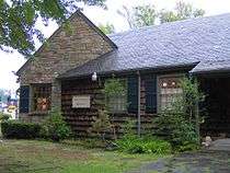
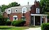
Riley H. Andes House |
|
000000001980-07-08-0000July 8, 1980
(#80003854) |
Douglas Dam Rd.
35°53′01″N 83°34′18″W / 35.883611°N 83.571667°W / 35.883611; -83.571667 (Riley H. Andes House) |
Sevierville |
|
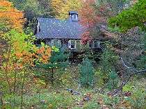
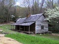
| 2 |
Mayna Treanor Avent Studio |
|
000000001994-02-07-0000February 7, 1994
(#93001575) |
Jake's Creek Trail, 1 mile (1.6 km) south of Elkton
35°38′21″N 83°35′15″W / 35.639167°N 83.5875°W / 35.639167; -83.5875 (Mayna Treanor Avent Studio) |
Elkmont |
|
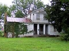
| 3 |
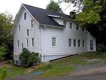
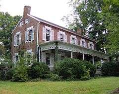
Brabson's Ferry Plantation |
|
000000001975-06-25-0000June 25, 1975
(#75001780) |
Northwest of Sevierville off Sevierville Pike in the area of Boyd's Creek
35°55′45″N 83°39′03″W / 35.929167°N 83.650833°W / 35.929167; -83.650833 (Brabson's Ferry Plantation) |
Sevierville |
|
| 4 |
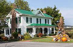
Buckingham House |
|
000000001971-03-18-0000March 18, 1971
(#71000831) |
West of Sevierville on Sevierville Pike
35°54′58″N 83°37′56″W / 35.916111°N 83.632222°W / 35.916111; -83.632222 (Buckingham House) |
Sevierville |
|
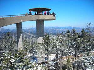
| 5 |
Clingmans Dome Observation Tower |
|
000000002012-08-15-0000August 15, 2012
(#12000515) |
Terminus of Clingmans Dome Rd.
35°33′46″N 83°29′55″W / 35.562766°N 83.498493°W / 35.562766; -83.498493 (Clingmans Dome Observation Tower) |
Gatlinburg |
also listed in Swain County, North Carolina
|
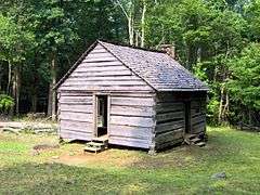
| 6 |
Alex Cole Cabin |
|
000000001976-01-02-0000January 2, 1976
(#76000165) |
5 miles (8.0 km) south of Gatlinburg off U.S. Route 441 in Great Smoky Mountains National Park
35°39′59″N 83°31′22″W / 35.666389°N 83.522778°W / 35.666389; -83.522778 (Alex Cole Cabin) |
Gatlinburg |
|
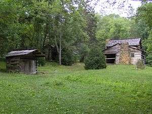
| 7 |
Elkmont Historic District, Great Smoky Mountains NP |
|
000000001994-03-22-0000March 22, 1994
(#94000166) |
Off State Route 72 southwest of Gatlinburg
35°39′20″N 83°35′04″W / 35.655556°N 83.584444°W / 35.655556; -83.584444 (Elkmont Historic District, Great Smoky Mountains NP) |
Gatlinburg |
|
| 8 |
First Methodist Church, Gatlinburg |
|
000000002007-07-03-0000July 3, 2007
(#07000661) |
742 Parkway
35°42′41″N 83°31′02″W / 35.711389°N 83.517222°W / 35.711389; -83.517222 (First Methodist Church, Gatlinburg) |
Gatlinburg |
|
| 9 |
Harrisburg Covered Bridge |
|
000000001975-06-10-0000June 10, 1975
(#75001777) |
South of Harrisburg off U.S. Route 411 over East Fork of the Little Pigeon River
35°51′39″N 83°28′58″W / 35.860833°N 83.482778°W / 35.860833; -83.482778 (Harrisburg Covered Bridge) |
Harrisburg |
|
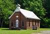
| 10 |
Headrick's Chapel |
|
000000002001-07-19-0000July 19, 2001
(#01000756) |
Wears Valley Rd.
35°42′00″N 83°40′47″W / 35.699969°N 83.67967°W / 35.699969; -83.67967 (Headrick's Chapel) |
Harchertown |
|
| 11 |
Keener-Johnson Farm |
Upload image |
000000001999-03-18-0000March 18, 1999
(#99000367) |
1112 Boyd's Creek Highway
35°53′16″N 83°43′47″W / 35.887659°N 83.729759°W / 35.887659; -83.729759 (Keener-Johnson Farm) |
Seymour |
|
| 12 |
King-Walker Place |
|
000000001976-03-16-0000March 16, 1976
(#76000169) |
West of Gatlinburg off State Route 73 in Great Smoky Mountains National Park
35°41′39″N 83°37′45″W / 35.694167°N 83.629167°W / 35.694167; -83.629167 (King-Walker Place) |
Gatlinburg |
|
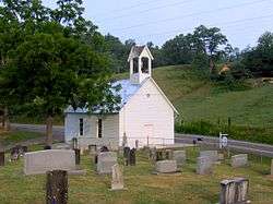
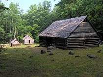
| 13 |
Little Greenbrier School-Church |
|
000000001976-01-11-0000January 11, 1976
(#76000168) |
About 9 miles (14 km) west of Gatlinburg off State Route 73 in Great Smoky Mountains National Park
35°41′01″N 83°38′17″W / 35.683611°N 83.638056°W / 35.683611; -83.638056 (Little Greenbrier School-Church) |
Gatlinburg |
|
| 14 |
Tyson McCarter Place |
|
000000001976-03-16-0000March 16, 1976
(#76000204) |
10 miles (16 km) east of Gatlinburg on State Route 73 in Great Smoky Mountains National Park
35°46′N 83°18′W / 35.76°N 83.3°W / 35.76; -83.3 (Tyson McCarter Place) |
Gatlinburg |
|
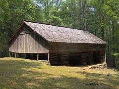
| 15 |
Messer Barn |
|
000000001976-01-01-0000January 1, 1976
(#76000166) |
Southeast of Gatlinburg near Greenbrier Cove in Great Smoky Mountains National Park
35°41′13″N 83°23′54″W / 35.686944°N 83.398333°W / 35.686944; -83.398333 (Messer Barn) |
Gatlinburg |
|
| 16 |
New Salem Baptist Church |
|
000000002003-07-24-0000July 24, 2003
(#03000696) |
601 Eastgate Rd.
35°51′32″N 83°33′14″W / 35.858889°N 83.553889°W / 35.858889; -83.553889 (New Salem Baptist Church) |
Sevierville |
Built in 1886 by African-American brick mason Isaac Dockery; part of the Rural African-American Churches in Tennessee Multiple Property Submission (MPS)
|
| 17 |
Bud Ogle Farm |
|
000000001977-11-23-0000November 23, 1977
(#77000158) |
3 miles (4.8 km) southeast of Gatlinburg
35°40′50″N 83°29′28″W / 35.680556°N 83.491111°W / 35.680556; -83.491111 (Bud Ogle Farm) |
Gatlinburg |
|
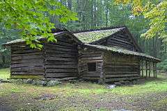
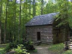
| 18 |
John Ownby Cabin |
|
000000001976-01-01-0000January 1, 1976
(#76000167) |
3 miles (4.8 km) south of Gatlinburg off State Route 73 in Great Smoky Mountains National Park
35°41′22″N 83°32′50″W / 35.689444°N 83.547222°W / 35.689444; -83.547222 (John Ownby Cabin) |
Gatlinburg |
|
| 19 |
Perry's Camp |
|
000000001992-10-30-0000October 30, 1992
(#92000369) |
101 Flat Branch Rd.
35°43′31″N 83°31′40″W / 35.725278°N 83.527778°W / 35.725278; -83.527778 (Perry's Camp) |
Gatlinburg |
|
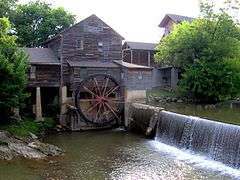
| 20 |
Pigeon Forge Mill |
|
000000001975-06-10-0000June 10, 1975
(#75001778) |
Off U.S. Route 441
35°47′18″N 83°33′15″W / 35.788333°N 83.554167°W / 35.788333; -83.554167 (Pigeon Forge Mill) |
Pigeon Forge |
|
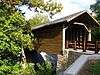
| 21 |
Pittman Community Center Home Economics Building |
|
000000001996-11-29-0000November 29, 1996
(#96001406) |
2839 Webb Creek Rd.
35°45′30″N 83°23′44″W / 35.758333°N 83.395556°W / 35.758333; -83.395556 (Pittman Community Center Home Economics Building) |
Pittman Center |
|
| 22 |
Roaring Fork Historic District |
|
000000001976-03-16-0000March 16, 1976
(#76000170) |
5 miles (8.0 km) southeast of Gatlinburg off State Route 73 in Great Smoky Mountains National Park
35°41′54″N 83°28′04″W / 35.698333°N 83.467778°W / 35.698333; -83.467778 (Roaring Fork Historic District) |
Gatlinburg |
|
| 23 |
Rocky Springs Presbyterian Church |
Upload image |
000000002013-12-18-0000December 18, 2013
(#13000953) |
2656 Boyds Creek Hwy.
Coordinates missing |
Sevierville vicinity |
|
| 24 |
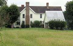
Rose Glen |
|
000000001975-07-18-0000July 18, 1975
(#75001781) |
4 miles (6.4 km) east of Sevierville on the Newport Highway
35°51′34″N 83°29′58″W / 35.859444°N 83.499444°W / 35.859444; -83.499444 (Rose Glen) |
Sevierville |
|
| 25 |
Settlement School Community Outreach Historic District |
|
000000002007-07-11-0000July 11, 2007
(#07000686) |
556 Parkway
35°42′46″N 83°30′45″W / 35.712778°N 83.5125°W / 35.712778; -83.5125 (Settlement School Community Outreach Historic District) |
Gatlinburg |
Comprises publicly accessible parts of the campus of the settlement school established by Pi Beta Phi that now houses the Arrowmont School of Arts and Crafts.[6] Part of the Pi Beta Phi Settlement School MPS
|
| 26 |
Settlement School Dormitories and Dwellings Historic District |
|
000000002007-03-20-0000March 20, 2007
(#07000185) |
556 Parkway
35°42′45″N 83°30′37″W / 35.7125°N 83.510278°W / 35.7125; -83.510278 (Settlement School Dormitories and Dwellings Historic District) |
Gatlinburg |
Comprises residential portions of the campus of the settlement school established by Pi Beta Phi that now houses the Arrowmont School of Arts and Crafts.[7] Part of the Pi Beta Phi Settlement School MPS
|
| 27 |
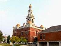
Sevier County Courthouse |
|
000000001971-03-24-0000March 24, 1971
(#71000832) |
Court Ave.
35°52′04″N 83°33′58″W / 35.867778°N 83.566111°W / 35.867778; -83.566111 (Sevier County Courthouse) |
Sevierville |
|
| 28 |
Sevierville Commercial Historic District |
|
000000001986-10-23-0000October 23, 1986
(#86002910) |
Sections of Bruce St., Court Ave., and Commerce St.
35°52′05″N 83°33′57″W / 35.868056°N 83.565833°W / 35.868056; -83.565833 (Sevierville Commercial Historic District) |
Sevierville |
|
| 29 |
Sevierville Masonic Lodge |
Upload image |
000000001980-02-07-0000February 7, 1980
(#80003855) |
119 Main St.
35°52′06″N 83°33′50″W / 35.868333°N 83.563889°W / 35.868333; -83.563889 (Sevierville Masonic Lodge) |
Sevierville |
|
| 30 |
Thomas Addition Historic District |
Upload image |
000000001994-03-17-0000March 17, 1994
(#94000197) |
Roughly bounded by Park Rd., Belle Ave., Cedar St., Grace Ave., and Prince St.
35°51′39″N 83°33′38″W / 35.860935°N 83.560511°W / 35.860935; -83.560511 (Thomas Addition Historic District) |
Sevierville |
|
| 31 |
Trotter-McMahan House |
Upload image |
000000001975-10-10-0000October 10, 1975
(#75001783) |
South of Sevierville on Middle Creek Rd.
• Boundary increase (listed 000000002001-11-21-0000November 21, 2001, refnum 01001262): 1605 Middle Creek Rd.
35°49′49″N 83°32′22″W / 35.830278°N 83.539444°W / 35.830278; -83.539444 (Trotter-McMahan House) |
Sevierville |
|
| 32 |
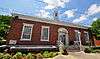
US Post Office-Sevierville |
|
000000001997-03-14-0000March 14, 1997
(#97000240) |
167 Bruce St.
35°52′01″N 83°33′51″W / 35.866944°N 83.564167°W / 35.866944; -83.564167 (US Post Office-Sevierville) |
Sevierville |
|
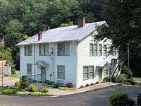
| 33 |
Dwight and Kate Wade House |
|
000000001997-12-15-0000December 15, 1997
(#97001502) |
114 Joy St.
35°51′59″N 83°33′55″W / 35.866389°N 83.565278°W / 35.866389; -83.565278 (Dwight and Kate Wade House) |
Sevierville |
Built in 1940 by Fred McMahan, designed by New York architect Verna Cooke-Salomonsky
|
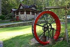
| 34 |
Walker Mill Hydroelectric Station |
|
000000001990-11-20-0000November 20, 1990
(#90001751) |
West Prong of the Little Pigeon River just off U.S. Route 441
35°50′44″N 83°34′08″W / 35.845556°N 83.568889°W / 35.845556; -83.568889 (Walker Mill Hydroelectric Station) |
Sevierville |
part of the Pre-TVA Hydroelectric Power Development in Tennessee MPS
|
| 35 |
Waters House |
|
000000001975-06-18-0000June 18, 1975
(#75001784) |
217 Cedar St.
35°51′56″N 83°33′46″W / 35.865556°N 83.562778°W / 35.865556; -83.562778 (Waters House) |
Sevierville |
|
| 36 |
Wheatlands |
|
000000001975-07-07-0000July 7, 1975
(#75001785) |
Northwest of Sevierville on the Old Knoxville Highway
35°55′07″N 83°40′06″W / 35.918611°N 83.668333°W / 35.918611; -83.668333 (Wheatlands) |
Sevierville |
|

.jpg)