Plomeur
| Plomeur Ploveur | ||
|---|---|---|
|
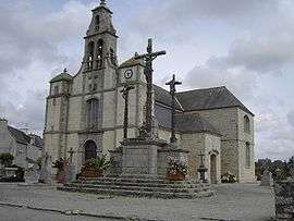
The church and the calvary in Plomeur | ||
| ||
 Plomeur | ||
|
Location within Brittany region  Plomeur | ||
| Coordinates: 47°50′28″N 4°17′00″W / 47.8411°N 4.2833°WCoordinates: 47°50′28″N 4°17′00″W / 47.8411°N 4.2833°W | ||
| Country | France | |
| Region | Brittany | |
| Department | Finistère | |
| Arrondissement | Quimper | |
| Canton | Pont-l'Abbé | |
| Intercommunality | Pays Bigouden Sud | |
| Government | ||
| • Mayor (2014–2020) | Ronan Crédou | |
| Area1 | 29.69 km2 (11.46 sq mi) | |
| Population (2008)2 | 3,579 | |
| • Density | 120/km2 (310/sq mi) | |
| Time zone | CET (UTC+1) | |
| • Summer (DST) | CEST (UTC+2) | |
| INSEE/Postal code | 29171 / 29120 | |
| Elevation | 0–37 m (0–121 ft) | |
|
1 French Land Register data, which excludes lakes, ponds, glaciers > 1 km² (0.386 sq mi or 247 acres) and river estuaries. 2 Population without double counting: residents of multiple communes (e.g., students and military personnel) only counted once. | ||
.svg.png)
Plomeur (Breton: Ploveur) is a commune in the Finistère department of Brittany in north-western France.
Population
Inhabitants of Plomeur are called in French Plomeurois.
Breton language
The municipality launched a linguistic plan through Ya d'ar brezhoneg on April 28, 2006.
In 2009, 30.71% of primary-school children attended bilingual schools.[1]
See also
References
- ↑ (French) Ofis ar Brezhoneg: Enseignement bilingue
- Mayors of Finistère Association (French)
External links
- Official website (French)
- French Ministry of Culture list for Plomeur (French)
- Staying in Plomeur
| Wikimedia Commons has media related to Plomeur. |
This article is issued from Wikipedia - version of the 2/12/2016. The text is available under the Creative Commons Attribution/Share Alike but additional terms may apply for the media files.