La Forêt-Fouesnant
| La Forêt-Fouesnant Ar Forest Fouenant | ||
|---|---|---|
|
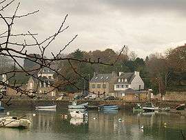
Old port | ||
| ||
 La Forêt-Fouesnant | ||
|
Location within Brittany region  La Forêt-Fouesnant | ||
| Coordinates: 47°54′36″N 3°58′40″W / 47.9100°N 3.9778°WCoordinates: 47°54′36″N 3°58′40″W / 47.9100°N 3.9778°W | ||
| Country | France | |
| Region | Brittany | |
| Department | Finistère | |
| Arrondissement | Quimper | |
| Canton | Fouesnant | |
| Intercommunality | Pays Fouesnantais | |
| Government | ||
| • Mayor (2014–2020) | Patrice Valadou | |
| Area1 | 18.53 km2 (7.15 sq mi) | |
| Population (2013)2 | 3,252 | |
| • Density | 180/km2 (450/sq mi) | |
| Time zone | CET (UTC+1) | |
| • Summer (DST) | CEST (UTC+2) | |
| INSEE/Postal code | 29057 / 29940 | |
| Elevation | 0–98 m (0–322 ft) | |
|
1 French Land Register data, which excludes lakes, ponds, glaciers > 1 km² (0.386 sq mi or 247 acres) and river estuaries. 2 Population without double counting: residents of multiple communes (e.g., students and military personnel) only counted once. | ||

La Forêt-Fouesnant (Breton: Ar Forest Fouenant or simply Ar Forest) is a commune in the Finistère department in Brittany in northwestern France. La Forêt-Fouesnant is bordered to the south by the Baie de La Forêt.
Population
Inhabitants of La Forêt-Fouesnant are called Forestois.
See also
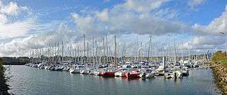
Port-la-Forêt
- Port-la-Forêt
- Communes of the Finistère department
References
- Mayors of Finistère Association (French);
External links
| Wikimedia Commons has media related to La Forêt-Fouesnant. |
- Official website (French)
- French Ministry of Culture list for La Forêt-Fouesnant (French)
This article is issued from Wikipedia - version of the 6/26/2016. The text is available under the Creative Commons Attribution/Share Alike but additional terms may apply for the media files.