Le Cloître-Saint-Thégonnec
| Le Cloître-Saint-Thégonnec Ar C'hloastr-Plourin | |
|---|---|
|
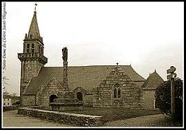
Notre-Dame of the Cloître Saint-Thégonnec | |
 Le Cloître-Saint-Thégonnec | |
|
Location within Brittany region  Le Cloître-Saint-Thégonnec | |
| Coordinates: 48°28′51″N 3°47′36″W / 48.4808°N 3.7933°WCoordinates: 48°28′51″N 3°47′36″W / 48.4808°N 3.7933°W | |
| Country | France |
| Region | Brittany |
| Department | Finistère |
| Arrondissement | Morlaix |
| Canton | Saint-Thégonnec |
| Intercommunality | Morlaix |
| Government | |
| • Mayor (2014–2020) | Véronique Péreira |
| Area1 | 28.48 km2 (11.00 sq mi) |
| Population (2008)2 | 599 |
| • Density | 21/km2 (54/sq mi) |
| Time zone | CET (UTC+1) |
| • Summer (DST) | CEST (UTC+2) |
| INSEE/Postal code | 29034 / 29410 |
| Elevation | 100–300 m (330–980 ft) |
|
1 French Land Register data, which excludes lakes, ponds, glaciers > 1 km² (0.386 sq mi or 247 acres) and river estuaries. 2 Population without double counting: residents of multiple communes (e.g., students and military personnel) only counted once. | |
Le Cloître-Saint-Thégonnec (Breton: Ar C'hloastr-Plourin) is a commune in the Finistère department of Brittany in north-western France.
Population
Inhabitants of Le Cloître-Saint-Thégonnec are called in French Cloîtriens.
| Historical population | ||
|---|---|---|
| Year | Pop. | ±% |
| 1793 | 927 | — |
| 1800 | 957 | +3.2% |
| 1806 | 1,029 | +7.5% |
| 1821 | 1,276 | +24.0% |
| 1831 | 1,353 | +6.0% |
| 1836 | 1,417 | +4.7% |
| 1841 | 1,449 | +2.3% |
| 1846 | 1,529 | +5.5% |
| 1851 | 1,518 | −0.7% |
| 1856 | 1,353 | −10.9% |
| 1861 | 1,359 | +0.4% |
| 1866 | 1,323 | −2.6% |
| 1872 | 1,354 | +2.3% |
| 1876 | 1,307 | −3.5% |
| 1881 | 1,330 | +1.8% |
| 1886 | 1,325 | −0.4% |
| 1891 | 1,236 | −6.7% |
| 1896 | 1,320 | +6.8% |
| 1901 | 1,345 | +1.9% |
| 1906 | 1,365 | +1.5% |
| 1911 | 1,332 | −2.4% |
| 1921 | 1,177 | −11.6% |
| 1926 | 1,203 | +2.2% |
| 1931 | 1,097 | −8.8% |
| 1936 | 1,050 | −4.3% |
| 1946 | 883 | −15.9% |
| 1954 | 747 | −15.4% |
| 1962 | 647 | −13.4% |
| 1968 | 566 | −12.5% |
| 1975 | 518 | −8.5% |
| 1982 | 561 | +8.3% |
| 1990 | 566 | +0.9% |
| 1999 | 569 | +0.5% |
| 2008 | 599 | +5.3% |
See also
References
- Mayors of Finistère Association (French);
External links
| Wikimedia Commons has media related to Le Cloître-Saint-Thégonnec. |
This article is issued from Wikipedia - version of the 11/2/2014. The text is available under the Creative Commons Attribution/Share Alike but additional terms may apply for the media files.