Cléden-Poher
| Cléden-Poher Kledenn-Poc'hêr | |
|---|---|
|
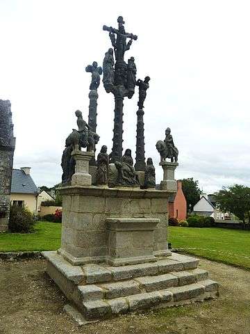
The calvary in Cléden-Poher | |
 Cléden-Poher | |
|
Location within Brittany region  Cléden-Poher | |
| Coordinates: 48°14′11″N 3°40′02″W / 48.2364°N 3.6672°WCoordinates: 48°14′11″N 3°40′02″W / 48.2364°N 3.6672°W | |
| Country | France |
| Region | Brittany |
| Department | Finistère |
| Arrondissement | Châteaulin |
| Canton | Carhaix-Plouguer |
| Intercommunality | Poher |
| Government | |
| • Mayor (2014–2020) | Jacques Quiltu |
| Area1 | 29.81 km2 (11.51 sq mi) |
| Population (2008)2 | 1,062 |
| • Density | 36/km2 (92/sq mi) |
| Time zone | CET (UTC+1) |
| • Summer (DST) | CEST (UTC+2) |
| INSEE/Postal code | 29029 / 29270 |
| Elevation | 53–155 m (174–509 ft) |
|
1 French Land Register data, which excludes lakes, ponds, glaciers > 1 km² (0.386 sq mi or 247 acres) and river estuaries. 2 Population without double counting: residents of multiple communes (e.g., students and military personnel) only counted once. | |
Cléden-Poher (Breton: Kledenn-Poc'hêr) is a commune in the Finistère department of Brittany in north-western France.
Population
Inhabitants of Cléden-Poher are called in French Clédinois.
| Historical population | ||
|---|---|---|
| Year | Pop. | ±% |
| 1793 | 1,054 | — |
| 1800 | 1,055 | +0.1% |
| 1806 | 1,111 | +5.3% |
| 1821 | 1,158 | +4.2% |
| 1831 | 1,397 | +20.6% |
| 1836 | 1,469 | +5.2% |
| 1841 | 1,497 | +1.9% |
| 1846 | 1,521 | +1.6% |
| 1851 | 1,607 | +5.7% |
| 1856 | 1,537 | −4.4% |
| 1861 | 1,569 | +2.1% |
| 1866 | 1,520 | −3.1% |
| 1872 | 1,444 | −5.0% |
| 1876 | 1,566 | +8.4% |
| 1881 | 1,684 | +7.5% |
| 1886 | 1,756 | +4.3% |
| 1891 | 1,716 | −2.3% |
| 1896 | 1,775 | +3.4% |
| 1901 | 1,747 | −1.6% |
| 1906 | 1,899 | +8.7% |
| 1911 | 1,807 | −4.8% |
| 1921 | 1,793 | −0.8% |
| 1926 | 1,734 | −3.3% |
| 1931 | 1,629 | −6.1% |
| 1936 | 1,486 | −8.8% |
| 1946 | 1,451 | −2.4% |
| 1954 | 1,161 | −20.0% |
| 1962 | 1,125 | −3.1% |
| 1968 | 1,064 | −5.4% |
| 1975 | 1,011 | −5.0% |
| 1982 | 1,118 | +10.6% |
| 1990 | 1,130 | +1.1% |
| 1999 | 1,047 | −7.3% |
| 2008 | 1,062 | +1.4% |
See also
References
- Mayors of Finistère Association (French);
External links
| Wikimedia Commons has media related to Cléden-Poher. |
This article is issued from Wikipedia - version of the 2/23/2015. The text is available under the Creative Commons Attribution/Share Alike but additional terms may apply for the media files.