Saint-Rivoal
| Saint-Rivoal Sant-Riwal | |
|---|---|
|
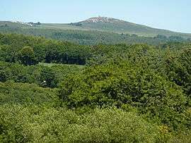
Mont Saint-Michel-de-Brasparts, seen from Glujeau Ty Riou to the west | |
 Saint-Rivoal | |
|
Location within Brittany region  Saint-Rivoal | |
| Coordinates: 48°20′59″N 3°59′40″W / 48.3497°N 3.9944°WCoordinates: 48°20′59″N 3°59′40″W / 48.3497°N 3.9944°W | |
| Country | France |
| Region | Brittany |
| Department | Finistère |
| Arrondissement | Châteaulin |
| Canton | Pleyben |
| Intercommunality | Yeun Elez |
| Government | |
| • Mayor (2014–2020) | Yves-Claude Guillou |
| Area1 | 18.69 km2 (7.22 sq mi) |
| Population (2008)2 | 171 |
| • Density | 9.1/km2 (24/sq mi) |
| Time zone | CET (UTC+1) |
| • Summer (DST) | CEST (UTC+2) |
| INSEE/Postal code | 29261 / 29190 |
| Elevation | 110–381 m (361–1,250 ft) |
|
1 French Land Register data, which excludes lakes, ponds, glaciers > 1 km² (0.386 sq mi or 247 acres) and river estuaries. 2 Population without double counting: residents of multiple communes (e.g., students and military personnel) only counted once. | |
Saint-Rivoal (Breton: Sant-Riwal) is a commune in the Finistère department of Brittany in north-western France.
Population
Inhabitants of Saint-Rivoal are called in French Saint-Rivoaliens.
| Historical population | ||
|---|---|---|
| Year | Pop. | ±% |
| 1926 | 579 | — |
| 1931 | 509 | −12.1% |
| 1936 | 490 | −3.7% |
| 1946 | 424 | −13.5% |
| 1954 | 358 | −15.6% |
| 1962 | 311 | −13.1% |
| 1968 | 257 | −17.4% |
| 1975 | 225 | −12.5% |
| 1982 | 208 | −7.6% |
| 1990 | 172 | −17.3% |
| 1999 | 164 | −4.7% |
| 2008 | 171 | +4.3% |
Breton language
As of 2010 and previous years, all primary-school children (numbering about 30), attended the bilingual public school.[1][2]
See also
References
- ↑ (French) Ofis ar Brezhoneg: Enseignement bilingue
- ↑ (Breton) (French) Ecole publique bilingue de Saint-Rivoal
- Mayors of Finistère Association (French)
External links
| Wikimedia Commons has media related to Saint-Rivoal. |
- Official website (French)
- French Ministry of Culture list for Saint-Rivoal (French)
This article is issued from Wikipedia - version of the 2/24/2015. The text is available under the Creative Commons Attribution/Share Alike but additional terms may apply for the media files.