Poullaouen
| Poullaouen Poullaouen | ||
|---|---|---|
|
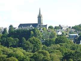
A general view of Poullaouen | ||
| ||
 Poullaouen | ||
|
Location within Brittany region  Poullaouen | ||
| Coordinates: 48°20′27″N 3°38′29″W / 48.3408°N 3.6414°WCoordinates: 48°20′27″N 3°38′29″W / 48.3408°N 3.6414°W | ||
| Country | France | |
| Region | Brittany | |
| Department | Finistère | |
| Arrondissement | Châteaulin | |
| Canton | Carhaix-Plouguer | |
| Intercommunality | Poher | |
| Government | ||
| • Mayor (2014–2020) | Didier Goubil | |
| Area1 | 71.36 km2 (27.55 sq mi) | |
| Population (2008)2 | 1,390 | |
| • Density | 19/km2 (50/sq mi) | |
| Time zone | CET (UTC+1) | |
| • Summer (DST) | CEST (UTC+2) | |
| INSEE/Postal code | 29227 / 29246 | |
| Elevation | 69–218 m (226–715 ft) | |
|
1 French Land Register data, which excludes lakes, ponds, glaciers > 1 km² (0.386 sq mi or 247 acres) and river estuaries. 2 Population without double counting: residents of multiple communes (e.g., students and military personnel) only counted once. | ||
.svg.png)
Poullaouen (Breton: Poullaouen) is a commune in the Finistère department of Brittany in north-western France.
Population
Inhabitants of Poullaouen are called in French Poullaouenais.
| Year | 1793 | 1800 | 1806 | 1821 | 1831 | 1836 | 1841 | 1846 | 1851 | 1856 |
|---|---|---|---|---|---|---|---|---|---|---|
| Population | 3421 | 3611 | 3355 | 3142 | 3544 | 3685 | 3700 | 3733 | 3723 | 3662 |
| Year | 1861 | 1866 | 1872 | 1876 | 1881 | 1886 | 1891 | 1896 | 1901 | 1906 |
|---|---|---|---|---|---|---|---|---|---|---|
| Population | 3720 | 3380 | 3158 | 3176 | 2966 | 3172 | 3220 | 3232 | 3353 | 3468 |
| Year | 1911 | 1921 | 1926 | 1931 | 1936 | 1946 | 1954 | 1962 | 1968 | 1975 |
|---|---|---|---|---|---|---|---|---|---|---|
| Population | 3640 | 3635 | 3640 | 3434 | 3316 | 3016 | 2586 | 2327 | 2075 | 1793 |
| Year | 1982 | 1990 | 1999 | 2008 |
|---|---|---|---|---|
| Population | 1731 | 1574 | 1498 | 1390 |
See also
References
- Mayors of Finistère Association (French)
External links
| Wikimedia Commons has media related to Poullaouen. |
This article is issued from Wikipedia - version of the 2/11/2016. The text is available under the Creative Commons Attribution/Share Alike but additional terms may apply for the media files.