Saint-Thois
| Saint-Thois Santoz | |
|---|---|
|
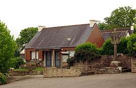
The town hall in Saint-Thois | |
 Saint-Thois | |
|
Location within Brittany region  Saint-Thois | |
| Coordinates: 48°09′57″N 3°53′00″W / 48.1658°N 3.8833°WCoordinates: 48°09′57″N 3°53′00″W / 48.1658°N 3.8833°W | |
| Country | France |
| Region | Brittany |
| Department | Finistère |
| Arrondissement | Châteaulin |
| Canton | Châteauneuf-du-Faou |
| Intercommunality | Haute Cornouaille |
| Government | |
| • Mayor (2014–2020) | Bernard Saliou |
| Area1 | 18.10 km2 (6.99 sq mi) |
| Population (2008)2 | 724 |
| • Density | 40/km2 (100/sq mi) |
| Time zone | CET (UTC+1) |
| • Summer (DST) | CEST (UTC+2) |
| INSEE/Postal code | 29267 / 29520 |
| Elevation | 28–238 m (92–781 ft) |
|
1 French Land Register data, which excludes lakes, ponds, glaciers > 1 km² (0.386 sq mi or 247 acres) and river estuaries. 2 Population without double counting: residents of multiple communes (e.g., students and military personnel) only counted once. | |
Saint-Thois (Breton: Santoz) is a commune in the Finistère department of Brittany in north-western France.
Population
Inhabitants of Saint-Thois are called in French Saint-Thoisiens.
| Year | 1793 | 1800 | 1806 | 1821 | 1831 | 1836 | 1841 | 1846 | 1851 | 1856 |
|---|---|---|---|---|---|---|---|---|---|---|
| Population | 852 | 738 | 959 | 840 | 963 | 1021 | 1039 | 1089 | 1082 | 1003 |
| Year | 1861 | 1866 | 1872 | 1876 | 1881 | 1886 | 1891 | 1896 | 1901 | 1906 |
|---|---|---|---|---|---|---|---|---|---|---|
| Population | 1010 | 1187 | 1067 | 1191 | 1200 | 1218 | 1231 | 1215 | 1262 | 1315 |
| Year | 1911 | 1921 | 1926 | 1931 | 1936 | 1946 | 1954 | 1962 | 1968 | 1975 |
|---|---|---|---|---|---|---|---|---|---|---|
| Population | 1429 | 1476 | 1385 | 1360 | 1358 | 1152 | 1011 | 910 | 821 | 760 |
| Year | 1982 | 1990 | 1999 | 2008 |
|---|---|---|---|---|
| Population | 704 | 633 | 634 | 724 |
See also
References
- Mayors of Finistère Association (French)
External links
| Wikimedia Commons has media related to Saint-Thois. |
This article is issued from Wikipedia - version of the 2/24/2015. The text is available under the Creative Commons Attribution/Share Alike but additional terms may apply for the media files.