Pont-de-Buis-lès-Quimerch
| Pont-de-Buis-lès-Quimerch Pont-ar-Veuzenn-Kimerc'h | ||
|---|---|---|
|
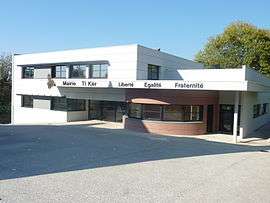
The modern town hall in Pont-de-Buis-lès-Quimerch | ||
| ||
 Pont-de-Buis-lès-Quimerch | ||
|
Location within Brittany region  Pont-de-Buis-lès-Quimerch | ||
| Coordinates: 48°15′19″N 4°05′18″W / 48.2553°N 4.0883°WCoordinates: 48°15′19″N 4°05′18″W / 48.2553°N 4.0883°W | ||
| Country | France | |
| Region | Brittany | |
| Department | Finistère | |
| Arrondissement | Châteaulin | |
| Canton | Le Faou | |
| Intercommunality | Aulne Maritime | |
| Government | ||
| • Mayor (2014–2020) | Roger Mellouët | |
| Area1 | 41.39 km2 (15.98 sq mi) | |
| Population (2008)2 | 3,768 | |
| • Density | 91/km2 (240/sq mi) | |
| Time zone | CET (UTC+1) | |
| • Summer (DST) | CEST (UTC+2) | |
| INSEE/Postal code | 29302 / 29590 | |
| Elevation | 0–278 m (0–912 ft) | |
|
1 French Land Register data, which excludes lakes, ponds, glaciers > 1 km² (0.386 sq mi or 247 acres) and river estuaries. 2 Population without double counting: residents of multiple communes (e.g., students and military personnel) only counted once. | ||
.svg.png)
Pont-de-Buis-lès-Quimerch (Breton: Pont-ar-Veuzenn-Kimerc'h) is a commune in the Finistère department of Brittany in north-western France.
Population
Inhabitants of Pont-de-Buis-lès-Quimerch are called in French Pontdebuisiens.
| Historical population | ||
|---|---|---|
| Year | Pop. | ±% |
| 1946 | 3,509 | — |
| 1954 | 3,366 | −4.1% |
| 1962 | 3,060 | −9.1% |
| 1968 | 3,999 | +30.7% |
| 1975 | 3,916 | −2.1% |
| 1982 | 3,710 | −5.3% |
| 1990 | 3,373 | −9.1% |
| 1999 | 3,385 | +0.4% |
| 2008 | 3,768 | +11.3% |
See also
References
- Mayors of Finistère Association (French)
External links
| Wikimedia Commons has media related to Pont-de-Buis-lès-Quimerch. |
This article is issued from Wikipedia - version of the 2/12/2016. The text is available under the Creative Commons Attribution/Share Alike but additional terms may apply for the media files.