Atlanta, Indiana
| Atlanta, Indiana | |
|---|---|
| Town | |
| Atlanta | |
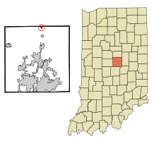 Location in the state of Indiana | |
| Coordinates: 40°12′50″N 86°1′32″W / 40.21389°N 86.02556°WCoordinates: 40°12′50″N 86°1′32″W / 40.21389°N 86.02556°W | |
| Country | United States |
| State | Indiana |
| County | Hamilton |
| Township | Jackson |
| Area[1] | |
| • Total | 0.30 sq mi (0.78 km2) |
| • Land | 0.30 sq mi (0.78 km2) |
| • Water | 0 sq mi (0 km2) |
| Elevation[2] | 863 ft (263 m) |
| Population (2010)[3] | |
| • Total | 725 |
| • Estimate (2012)[4] | 739 |
| • Density | 2,416.7/sq mi (933.1/km2) |
| Time zone | EST (UTC−5) |
| • Summer (DST) | EST (UTC−5) |
| ZIP code | 46031 |
| Area code | 765 |
| FIPS code[2][5] | 18-02602 |
| GNIS ID[2][5] | 430329 |
| Website |
www |
Atlanta is a town in Jackson Township, Hamilton County, Indiana, United States. The population was 725 at the 2010 census.
History
Atlanta had its start by the merger of the three neighboring rival towns of Spargerville, Shielville, and Buena Vista.[6] The earliest part of what is now Atlanta was laid out in 1834, and the town has been called Atlanta since 1885.[7] The town most likely was named after Atlanta, Georgia.[8]
Roads Hotel was listed on the National Register of Historic Places in 1987.[9]
Geography
Atlanta is located at 40°12′50″N 86°1′32″W / 40.21389°N 86.02556°W (40.213954, -86.025498).[10]
According to the 2010 census, Atlanta has a total area of 0.3 square miles (0.78 km2), all land.[1]
The town is noted throughout the area for the Atlanta New Earth Festival, held on the fourth weekend of September annually since 1973.
Demographics
| Historical population | |||
|---|---|---|---|
| Census | Pop. | %± | |
| 1900 | 1,000 | — | |
| 1910 | 876 | −12.4% | |
| 1920 | 678 | −22.6% | |
| 1930 | 551 | −18.7% | |
| 1940 | 479 | −13.1% | |
| 1950 | 613 | 28.0% | |
| 1960 | 602 | −1.8% | |
| 1970 | 620 | 3.0% | |
| 1980 | 657 | 6.0% | |
| 1990 | 703 | 7.0% | |
| 2000 | 761 | 8.3% | |
| 2010 | 725 | −4.7% | |
| Est. 2015 | 735 | [11] | 1.4% |
2010 census
As of the 2010 census,[3] there were 725 people, 265 households, and 203 families residing in the town. The population density was 2,416.7 inhabitants per square mile (933.1/km2). There were 302 housing units at an average density of 1,006.7 per square mile (388.7/km2). The racial makeup of the town was 97.8% White, 0.6% African American, 1.4% from other races, and 0.3% from two or more races. Hispanic or Latino of any race were 1.9% of the population.
There were 265 households of which 39.2% had children under the age of 18 living with them, 55.8% were married couples living together, 13.2% had a female householder with no husband present, 7.5% had a male householder with no wife present, and 23.4% were non-families. 17.0% of all households were made up of individuals and 8.4% had someone living alone who was 65 years of age or older. The average household size was 2.69 and the average family size was 3.03.
The median age in the town was 36.1 years. 27% of residents were under the age of 18; 7% were between the ages of 18 and 24; 27.4% were from 25 to 44; 28.4% were from 45 to 64; and 10.1% were 65 years of age or older. The gender makeup of the town was 49.0% male and 51.0% female.
2000 census
As of the 2000 census,[13] there were 761 people, 261 households, and 205 families residing in the town. The population density was 2,533.9 people per square mile (979.4/km²). There were 283 housing units at an average density of 942.3 per square mile (364.2/km²). The racial makeup of the town was 96.85% White, 0.66% Native American, 0.26% Asian, 1.45% from other races, and 0.79% from two or more races. Hispanic or Latino of any race were 2.10% of the population.
There were 261 households out of which 44.8% had children under the age of 18 living with them, 62.1% were married couples living together, 10.3% had a female householder with no husband present, and 21.1% were non-families. 16.5% of all households were made up of individuals and 6.1% had someone living alone who was 65 years of age or older. The average household size was 2.90 and the average family size was 3.20.
In the town the population was spread out with 32.1% under the age of 18, 7.4% from 18 to 24, 33.9% from 25 to 44, 19.7% from 45 to 64, and 7.0% who were 65 years of age or older. The median age was 34 years. For every 100 females there were 97.2 males. For every 100 females age 18 and over, there were 92.2 males.
The median income for a household in the town was $43,036, and the median income for a family was $47,159. Males had a median income of $33,438 versus $22,011 for females. The per capita income for the town was $16,342. About 5.5% of families and 7.0% of the population were below the poverty line, including 5.9% of those under age 18 and 10.9% of those age 65 or over.
References
- 1 2 "G001 - Geographic Identifiers - 2010 Census Summary File 1". United States Census Bureau. Retrieved 2015-07-13.
- 1 2 3 "Feature ID 430329". Geographic Names Information System. United States Geological Survey. Retrieved June 30, 2014.
- 1 2 "American FactFinder". United States Census Bureau. Retrieved 2012-12-11.
- ↑ "Population Estimates". United States Census Bureau. Archived from the original on June 17, 2013. Retrieved 2013-06-25.
- 1 2 "FIPS55 Data: Indiana". FIPS55 Data. United States Geological Survey. February 23, 2006. Archived from the original on June 18, 2006. Retrieved June 30, 2014. External link in
|work=(help) - ↑ Haines, John F. (1915). History of Hamilton County, Indiana: Her People, Industries And Institutions, Volume 1. B.F. Bowen & Co. p. 233.
- ↑ "Town History". Town of Atlanta, Indiana. Retrieved May 31, 2014.
- ↑ Baker, Ronald L. (October 1995). From Needmore to Prosperity: Hoosier Place Names in Folklore and History. Indiana University Press. p. 55. ISBN 978-0-253-32866-3.
...apparently for the city in Georgia.
- ↑ National Park Service (2010-07-09). "National Register Information System". National Register of Historic Places. National Park Service.
- ↑ "US Gazetteer files: 2010, 2000, and 1990". United States Census Bureau. 2011-02-12. Retrieved 2011-04-23.
- ↑ "Annual Estimates of the Resident Population for Incorporated Places: April 1, 2010 to July 1, 2015". Retrieved July 2, 2016.
- ↑ "Census of Population and Housing". Census.gov. Archived from the original on May 11, 2015. Retrieved June 4, 2015.
- ↑ "American FactFinder". United States Census Bureau. Archived from the original on September 11, 2013. Retrieved 2008-01-31.
External links
Municipalities and communities of Hamilton County, Indiana, United States | ||
|---|---|---|
| Cities | ||
| Towns | ||
| Townships | ||
| Unincorporated communities |
| |
| Footnotes | ‡This populated place also has portions in an adjacent county or counties | |