Spring Lake, Indiana
| Spring Lake, Indiana | |
|---|---|
| Town | |
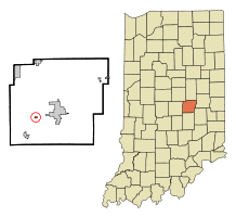 Location of Spring Lake in the state of Indiana | |
| Coordinates: 39°46′37″N 85°51′16″W / 39.77694°N 85.85444°WCoordinates: 39°46′37″N 85°51′16″W / 39.77694°N 85.85444°W | |
| Country | United States |
| State | Indiana |
| County | Hancock |
| Township | Sugar Creek |
| Area[1] | |
| • Total | 0.16 sq mi (0.41 km2) |
| • Land | 0.15 sq mi (0.39 km2) |
| • Water | 0.01 sq mi (0.03 km2) |
| Elevation | 850 ft (259 m) |
| Population (2010)[2] | |
| • Total | 218 |
| • Estimate (2012[3]) | 219 |
| • Density | 1,453.3/sq mi (561.1/km2) |
| Time zone | Eastern (EST) (UTC-5) |
| • Summer (DST) | EDT (UTC-4) |
| FIPS code | 18-72296[4] |
| GNIS feature ID | 0443991[5] |
Spring Lake is a town in Sugar Creek Township, Hancock County, Indiana, along Sugar Creek. The population was 218 at the 2010 census.
History
Spring Lake is centered on an artificial lake of the same name, which was completed in about 1885.[6] Spring Lake was laid out as a town in 1912.[7]
Geography
Spring Lake is located at 39°46′37″N 85°51′16″W / 39.77694°N 85.85444°W (39.776823, -85.854347).[8]
According to the 2010 census, Spring Lake has a total area of 0.161 square miles (0.42 km2), of which 0.15 square miles (0.39 km2) (or 93.17%) is land and 0.011 square miles (0.03 km2) (or 6.83%) is water.[1]
Demographics
| Historical population | |||
|---|---|---|---|
| Census | Pop. | %± | |
| 1930 | 69 | — | |
| 1940 | 111 | 60.9% | |
| 1950 | 156 | 40.5% | |
| 1960 | 206 | 32.1% | |
| 1970 | 263 | 27.7% | |
| 1980 | 236 | −10.3% | |
| 1990 | 216 | −8.5% | |
| 2000 | 262 | 21.3% | |
| 2010 | 218 | −16.8% | |
| Est. 2015 | 217 | [9] | −0.5% |
2010 census
As of the census[2] of 2010, there were 218 people, 95 households, and 67 families residing in the town. The population density was 1,453.3 inhabitants per square mile (561.1/km2). There were 98 housing units at an average density of 653.3 per square mile (252.2/km2). The racial makeup of the town was 95.9% White, 0.5% African American, 0.5% Native American, 0.5% from other races, and 2.8% from two or more races. Hispanic or Latino of any race were 0.9% of the population.
There were 95 households of which 24.2% had children under the age of 18 living with them, 56.8% were married couples living together, 7.4% had a female householder with no husband present, 6.3% had a male householder with no wife present, and 29.5% were non-families. 25.3% of all households were made up of individuals and 9.5% had someone living alone who was 65 years of age or older. The average household size was 2.29 and the average family size was 2.73.
The median age in the town was 47 years. 16.5% of residents were under the age of 18; 7.5% were between the ages of 18 and 24; 22% were from 25 to 44; 33.4% were from 45 to 64; and 20.6% were 65 years of age or older. The gender makeup of the town was 52.8% male and 47.2% female.
2000 census
As of the census[4] of 2000, there were 262 people, 107 households, and 87 families residing in the town. The population density was 1,697.2 people per square mile (674.4/km²). There were 108 housing units at an average density of 699.6 per square mile (278.0/km²). The racial makeup of the town was 99.62% White, and 0.38% from two or more races. Hispanic or Latino of any race were 1.15% of the population.
There were 107 households out of which 23.4% had children under the age of 18 living with them, 70.1% were married couples living together, 6.5% had a female householder with no husband present, and 17.8% were non-families. 17.8% of all households were made up of individuals and 6.5% had someone living alone who was 65 years of age or older. The average household size was 2.45 and the average family size was 2.72.
In the town the population was spread out with 19.5% under the age of 18, 7.3% from 18 to 24, 25.2% from 25 to 44, 32.1% from 45 to 64, and 16.0% who were 65 years of age or older. The median age was 44 years. For every 100 females there were 109.6 males. For every 100 females age 18 and over, there were 113.1 males.
The median income for a household in the town was $52,222, and the median income for a family was $56,250. Males had a median income of $40,750 versus $26,458 for females. The per capita income for the town was $24,468. About 3.3% of families and 2.7% of the population were below the poverty line, including 8.8% of those under the age of eighteen and none of those sixty five or over.
References
- 1 2 "G001 - Geographic Identifiers - 2010 Census Summary File 1". United States Census Bureau. Retrieved 2015-07-25.
- 1 2 "American FactFinder". United States Census Bureau. Retrieved 2012-12-11.
- ↑ "Population Estimates". United States Census Bureau. Retrieved 2013-06-25.
- 1 2 "American FactFinder". United States Census Bureau. Retrieved 2008-01-31.
- ↑ "US Board on Geographic Names". United States Geological Survey. 2007-10-25. Retrieved 2008-01-31.
- ↑ Richman, George J. (1916). History of Hancock County, Indiana: Its People, Industries and Institutions. Wm. Mitchell Printing Company. p. 763.
- ↑ Baker, Ronald L. (October 1995). From Needmore to Prosperity: Hoosier Place Names in Folklore and History. Indiana University Press. p. 310. ISBN 978-0-253-32866-3.
The town was platted in 1912.
- ↑ "US Gazetteer files: 2010, 2000, and 1990". United States Census Bureau. 2011-02-12. Retrieved 2011-04-23.
- ↑ "Annual Estimates of the Resident Population for Incorporated Places: April 1, 2010 to July 1, 2015". Retrieved July 2, 2016.
- ↑ "Census of Population and Housing". Census.gov. Retrieved June 4, 2015.
Municipalities and communities of Hancock County, Indiana, United States | ||
|---|---|---|
| City | ||
| Towns | ||
| Townships | ||
| Unincorporated communities |
| |
| Footnotes | ‡This populated place also has portions in an adjacent county or counties | |