Fillmore, Indiana
| Fillmore, Indiana | |
|---|---|
| Town | |
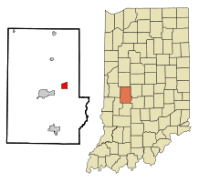 Location in the state of Indiana | |
| Coordinates: 39°40′19″N 86°45′13″W / 39.67194°N 86.75361°WCoordinates: 39°40′19″N 86°45′13″W / 39.67194°N 86.75361°W | |
| Country | United States |
| State | Indiana |
| County | Putnam |
| Township | Marion |
| Area[1] | |
| • Total | 1.95 sq mi (5.05 km2) |
| • Land | 1.95 sq mi (5.05 km2) |
| • Water | 0 sq mi (0 km2) |
| Elevation | 846 ft (258 m) |
| Population (2010)[2] | |
| • Total | 533 |
| • Estimate (2012[3]) | 530 |
| • Density | 273.3/sq mi (105.5/km2) |
| Time zone | EST (UTC-5) |
| • Summer (DST) | EST (UTC-5) |
| ZIP code | 46128 |
| Area code(s) | 765 |
| FIPS code | 18-23188[4] |
| GNIS feature ID | 0434479[5] |
| Website | http://www.fillmoreindiana.com |
Fillmore is a town in Marion Township, Putnam County, Indiana, United States. The population was 533 at the 2010 census.
The town is part of the South Putnam Community Schools school district.
Geography
Fillmore is located at 39°40′19″N 86°45′13″W / 39.671859°N 86.753742°W.[6]
According to the 2010 census, Fillmore has a total area of 1.95 square miles (5.05 km2), all land.[1]
Fillmore lies between east-west highways US Route 36 and US Route 40 and east of north-south highway US Route 231.
Demographics
| Historical population | |||
|---|---|---|---|
| Census | Pop. | %± | |
| 1880 | 180 | — | |
| 1990 | 497 | — | |
| 2000 | 545 | 9.7% | |
| 2010 | 533 | −2.2% | |
| Est. 2015 | 526 | [7] | −1.3% |
2010 census
As of the census[2] of 2010, there were 533 people, 194 households, and 142 families residing in the town. The population density was 273.3 inhabitants per square mile (105.5/km2). There were 225 housing units at an average density of 115.4 per square mile (44.6/km2). The racial makeup of the town was 97.0% White, 0.6% African American, 0.2% Native American, 0.6% Asian, 0.6% from other races, and 1.1% from two or more races. Hispanic or Latino of any race were 5.3% of the population.
There were 194 households of which 42.3% had children under the age of 18 living with them, 55.7% were married couples living together, 11.9% had a female householder with no husband present, 5.7% had a male householder with no wife present, and 26.8% were non-families. 22.2% of all households were made up of individuals and 7.7% had someone living alone who was 65 years of age or older. The average household size was 2.75 and the average family size was 3.23.
The median age in the town was 35.9 years. 27.6% of residents were under the age of 18; 9.2% were between the ages of 18 and 24; 26.1% were from 25 to 44; 26.9% were from 45 to 64; and 10.3% were 65 years of age or older. The gender makeup of the town was 48.6% male and 51.4% female.
2000 census
As of the census[4] of 2000, there were 545 people, 196 households, and 156 families residing in the town. The population density was 286.4 people per square mile (110.8/km²). There were 224 housing units at an average density of 117.7 per square mile (45.5/km²). The racial makeup of the town was 98.17% White, 0.18% African American, 1.28% Native American, 0.18% Asian, and 0.18% from two or more races. Hispanic or Latino of any race were 1.47% of the population.
There were 196 households out of which 44.4% had children under the age of 18 living with them, 66.3% were married couples living together, 7.1% had a female householder with no husband present, and 20.4% were non-families. 18.4% of all households were made up of individuals and 11.2% had someone living alone who was 65 years of age or older. The average household size was 2.78 and the average family size was 3.14.
In the town the population was spread out with 32.3% under the age of 18, 6.8% from 18 to 24, 30.6% from 25 to 44, 18.5% from 45 to 64, and 11.7% who were 65 years of age or older. The median age was 32 years. For every 100 females there were 94.6 males. For every 100 females age 18 and over, there were 105.0 males.
The median income for a household in the town was $38,269, and the median income for a family was $40,568. Males had a median income of $27,404 versus $21,875 for females. The per capita income for the town was $13,514. About 5.2% of families and 8.0% of the population were below the poverty line, including 11.2% of those under age 18 and 3.4% of those age 65 or over.
Industry
Fillmore is home to Magic Circle Corp., the manufacturers of Dixie Chopper-brand lawn mowers.
References
- 1 2 "G001 - Geographic Identifiers - 2010 Census Summary File 1". United States Census Bureau. Retrieved 2015-07-16.
- 1 2 "American FactFinder". United States Census Bureau. Retrieved 2012-12-11.
- ↑ "Population Estimates". United States Census Bureau. Archived from the original on June 17, 2013. Retrieved 2013-06-25.
- 1 2 "American FactFinder". United States Census Bureau. Archived from the original on September 11, 2013. Retrieved 2008-01-31.
- ↑ "US Board on Geographic Names". United States Geological Survey. 2007-10-25. Retrieved 2008-01-31.
- ↑ "US Gazetteer files: 2010, 2000, and 1990". United States Census Bureau. 2011-02-12. Retrieved 2011-04-23.
- ↑ "Annual Estimates of the Resident Population for Incorporated Places: April 1, 2010 to July 1, 2015". Retrieved July 2, 2016.
- ↑ "Census of Population and Housing". Census.gov. Archived from the original on May 11, 2015. Retrieved June 4, 2015.
External links
Municipalities and communities of Putnam County, Indiana, United States | ||
|---|---|---|
| City | ||
| Towns | ||
| Townships | ||
| CDPs | ||
| Other unincorporated communities |
| |
| Footnotes | ‡This populated place also has portions in an adjacent county or counties | |