Cicero, Indiana
| Cicero, Indiana | |
|---|---|
| Town | |
| Cicero | |
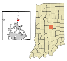 Location in the state of Indiana | |
| Coordinates: 40°7′39″N 86°1′6″W / 40.12750°N 86.01833°WCoordinates: 40°7′39″N 86°1′6″W / 40.12750°N 86.01833°W | |
| Country | United States |
| State | Indiana |
| County | Hamilton |
| Township | Jackson |
| Area[1] | |
| • Total | 2.12 sq mi (5.49 km2) |
| • Land | 1.71 sq mi (4.43 km2) |
| • Water | 0.41 sq mi (1.06 km2) |
| Elevation | 833 ft (254 m) |
| Population (2010)[2] | |
| • Total | 4,812 |
| • Estimate (2012[3]) | 4,873 |
| • Density | 2,814.0/sq mi (1,086.5/km2) |
| Time zone | EST (UTC-5) |
| • Summer (DST) | EST (UTC-5) |
| ZIP code | 46034 |
| Area code(s) | 317 |
| FIPS code | 18-12628[4] |
| GNIS feature ID | 0432518[5] |
| Website | http://www.ciceroin.org |
Cicero is a town in Jackson Township, Hamilton County, Indiana, United States, north of Indianapolis. The population was 4,812 at the 2010 census.
Cicero is notable for welcoming teenaged AIDS activist Ryan White to its community in 1987.[6] White is buried in Cicero.
History
Cicero was founded in 1835.[7] The town took its named from Cicero Creek.[8] The first post office in Jackson Township was established at Cicero in 1839.[9]
Geography
Cicero is located on the northeast shore of Morse Reservoir, at 40°7′39″N 86°1′6″W / 40.12750°N 86.01833°W (40.127568, -86.018375).[10]
According to the 2010 census, Cicero has a total area of 2.12 square miles (5.49 km2), of which 1.71 square miles (4.43 km2) (or 80.66%) is land and 0.41 square miles (1.06 km2) (or 19.34%) is water.[1]
Demographics
| Historical population | |||
|---|---|---|---|
| Census | Pop. | %± | |
| 1860 | 278 | — | |
| 1870 | 422 | 51.8% | |
| 1880 | 715 | 69.4% | |
| 1890 | 631 | −11.7% | |
| 1900 | 1,603 | 154.0% | |
| 1910 | 990 | −38.2% | |
| 1920 | 906 | −8.5% | |
| 1930 | 933 | 3.0% | |
| 1940 | 943 | 1.1% | |
| 1950 | 1,021 | 8.3% | |
| 1960 | 1,284 | 25.8% | |
| 1970 | 1,378 | 7.3% | |
| 1980 | 2,557 | 85.6% | |
| 1990 | 3,268 | 27.8% | |
| 2000 | 4,303 | 31.7% | |
| 2010 | 4,812 | 11.8% | |
| Est. 2015 | 4,891 | [11] | 1.6% |
Cicero is largely a lakeside community.
2010 census
As of the census[2] of 2010, there were 4,812 people, 1,952 households, and 1,381 families residing in the town. The population density was 2,814.0 inhabitants per square mile (1,086.5/km2). There were 2,167 housing units at an average density of 1,267.3 per square mile (489.3/km2). The racial makeup of the town was 96.8% White, 0.6% African American, 0.6% Native American, 0.5% Asian, 0.4% from other races, and 1.1% from two or more races. Hispanic or Latino of any race were 1.5% of the population.
There were 1,952 households of which 34.8% had children under the age of 18 living with them, 53.6% were married couples living together, 11.3% had a female householder with no husband present, 5.8% had a male householder with no wife present, and 29.3% were non-families. 24.5% of all households were made up of individuals and 8.2% had someone living alone who was 65 years of age or older. The average household size was 2.47 and the average family size was 2.89.
The median age in the town was 39.8 years. 25.2% of residents were under the age of 18; 6.6% were between the ages of 18 and 24; 25.6% were from 25 to 44; 31% were from 45 to 64; and 11.6% were 65 years of age or older. The gender makeup of the town was 49.2% male and 50.8% female.
2000 census
As of the census[4] of 2000, there were 4,303 people, 1,716 households, and 1,257 families residing in the town. The population density was 2,877.8 people per square mile (1,107.6/km²). There were 1,811 housing units at an average density of 1,211.2 per square mile (466.2/km²). The racial makeup of the town was 97.89% White, 0.19% African American, 0.30% Native American, 0.28% Asian, 0.02% Pacific Islander, 0.63% from other races, and 0.70% from two or more races. Hispanic or Latino of any race were 1.12% of the population.
There were 1,716 households out of which 36.0% had children living with them, 59.2% were married couples living together, 10.0% had a female householder with no husband present, and 26.7% were non-families. 21.4% of all households were made up of individuals and 6.5% had someone living alone who was 65 years of age or older. The average household size was 2.51 and the average family size was 2.92.
In the town the population was spread out with 26.4% under the age of 18, 8.2% from 18 to 24, 32.3% from 25 to 44, 24.6% from 45 to 64, and 8.5% who were 65 years of age or older. The median age was 36 years. For every 100 females there were 96.2 males. For every 100 females age 18 and over, there were 96.0 males.
The median income for a household in the town was $54,561, and the median income for a family was $60,559. Males had a median income of $39,131 versus $29,574 for females. The per capita income for the town was $23,169. About 0.7% of families and 1.7% of the population were below the poverty line, including none of those under age 18 and 2.8% of those age 65 or over.
School systems
Cicero is served by Hamilton Heights School Corporation, Indiana Academy[13] and Cicero Seventh-day Adventist Elementary School.[14]
Media
The plot of the episode entitled "The Kids Are All Right" from the TV series Supernatural took place in the town of Cicero, Indiana.
Cicero Seventh-day Adventist Church[15] is the home of the Hope for Life television ministry, with Pastors Vic Van Schaik and Aaron Clark.[16]
References
- 1 2 "G001 - Geographic Identifiers - 2010 Census Summary File 1". United States Census Bureau. Retrieved 2015-07-14.
- 1 2 "American FactFinder". United States Census Bureau. Retrieved 2012-12-11.
- ↑ "Population Estimates". United States Census Bureau. Archived from the original on 2013-06-17. Retrieved 2013-06-25.
- 1 2 "American FactFinder". United States Census Bureau. Archived from the original on 2013-09-11. Retrieved 2008-01-31.
- ↑ "US Board on Geographic Names". United States Geological Survey. 2007-10-25. Retrieved 2008-01-31.
- ↑ Pohlen, Jerome (1 June 2008). Progressive Nation: A Travel Guide with 400+ Left Turns and Inspiring Landmarks. Chicago Review Press. p. 248. ISBN 978-1-56976-484-8.
- ↑ "Hamilton County History Timeline". Carmel Clay Historical Society. Retrieved 31 May 2014.
- ↑ Exploring Indiana Highways: Trip Trivia. Exploring America's Highway. 2007. p. 265. ISBN 978-0-9744358-3-1.
- ↑ Shirts, Augustus Finch (1901). A History of the Formation, Settlement and Development of Hamilton County, Indiana: From the Year 1818 to the Close of the Civil War. p. 202.
- ↑ "US Gazetteer files: 2010, 2000, and 1990". United States Census Bureau. 2011-02-12. Retrieved 2011-04-23.
- ↑ "Annual Estimates of the Resident Population for Incorporated Places: April 1, 2010 to July 1, 2015". Retrieved July 2, 2016.
- ↑ "Census of Population and Housing". Census.gov. Archived from the original on May 11, 2015. Retrieved June 4, 2015.
- ↑
- ↑
- ↑
- ↑ Hope for Life Media Ministry
External links
Municipalities and communities of Hamilton County, Indiana, United States | ||
|---|---|---|
| Cities | ||
| Towns | ||
| Townships | ||
| Unincorporated communities |
| |
| Footnotes | ‡This populated place also has portions in an adjacent county or counties | |